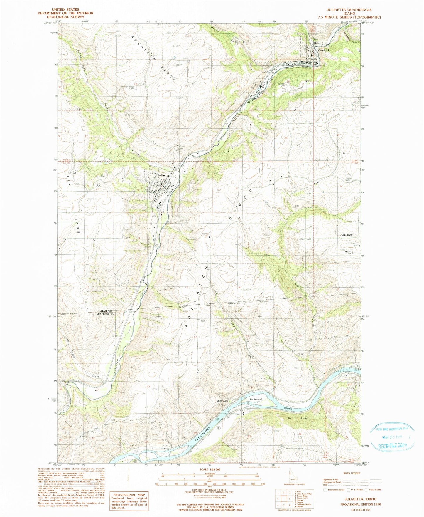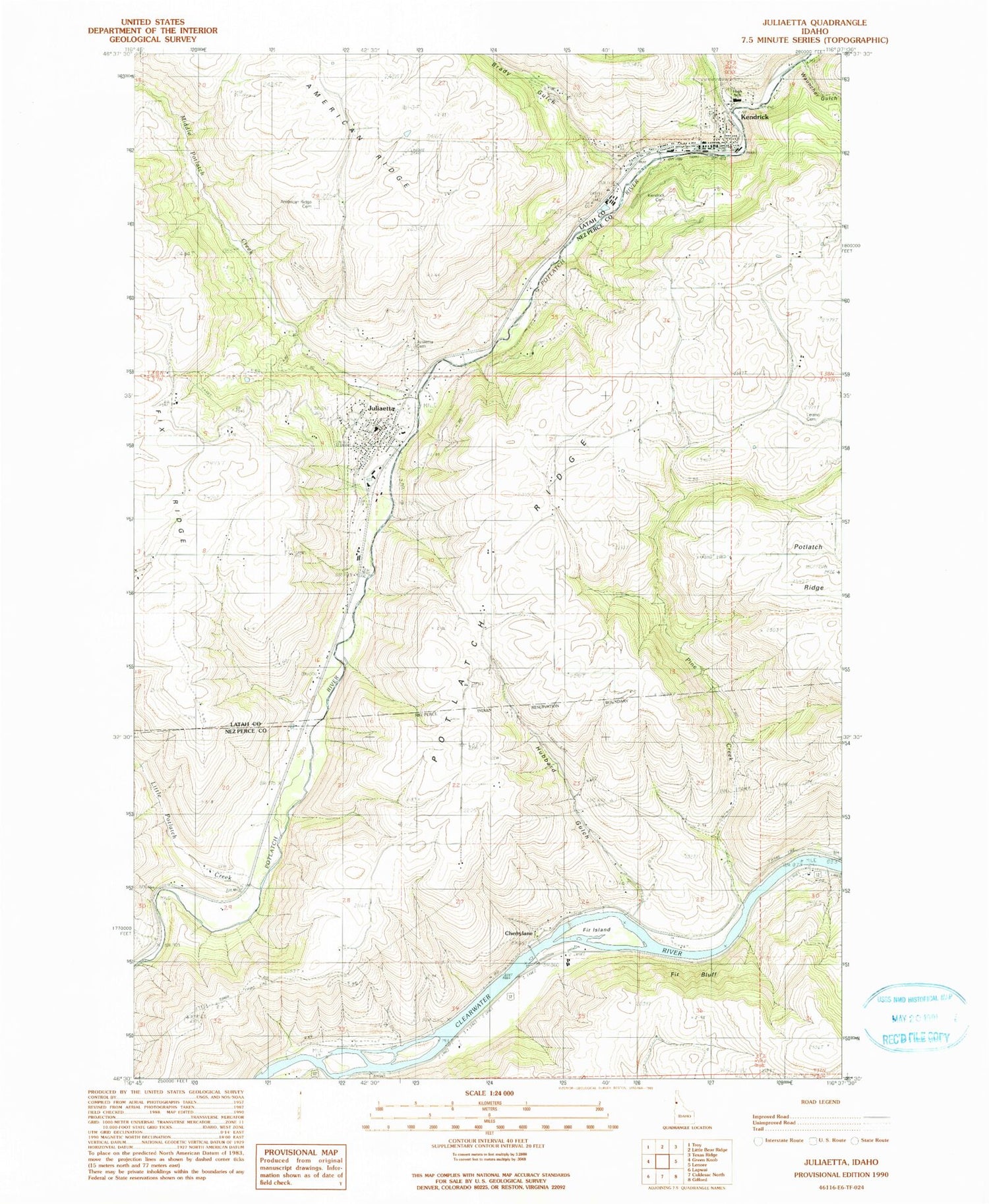
MyTopo
Classic USGS Juliaetta Idaho 7.5'x7.5' Topo Map
Couldn't load pickup availability
Historical USGS topographic quad map of Juliaetta in the state of Idaho. Map scale may vary for some years, but is generally around 1:24,000. Print size is approximately 24" x 27"
This quadrangle is in the following counties: Latah, Nez Perce.
The map contains contour lines, roads, rivers, towns, and lakes. Printed on high-quality waterproof paper with UV fade-resistant inks, and shipped rolled.
Contains the following named places: American Ridge Cemetery, Big Bear Creek, Brady Gulch, Cherrylane, Cherrylane Station, City of Juliaetta, City of Kendrick, Fir Bluff, Fir Bluff Station, Fir Island, Hubbard Gulch, J K Ambulance, Juliaetta, Juliaetta Cemetery, Juliaetta Elementary School, Juliaetta Post Office, Juliaetta Volunteer Fire Department, Kendrick, Kendrick Cemetery, Kendrick Junior - Senior High School, Kendrick Post Office, Kendrick Volunteer Fire Department, Leland Cemetery, Little Potlatch Creek, Middle Potlatch Creek, Orchard Homes, Pine Creek, Wauncher Gulch, ZIP Code: 83535