MyTopo
Classic USGS Jumpertown Mississippi 7.5'x7.5' Topo Map
Couldn't load pickup availability
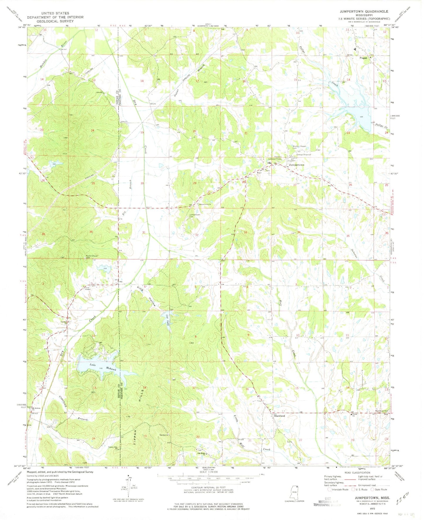
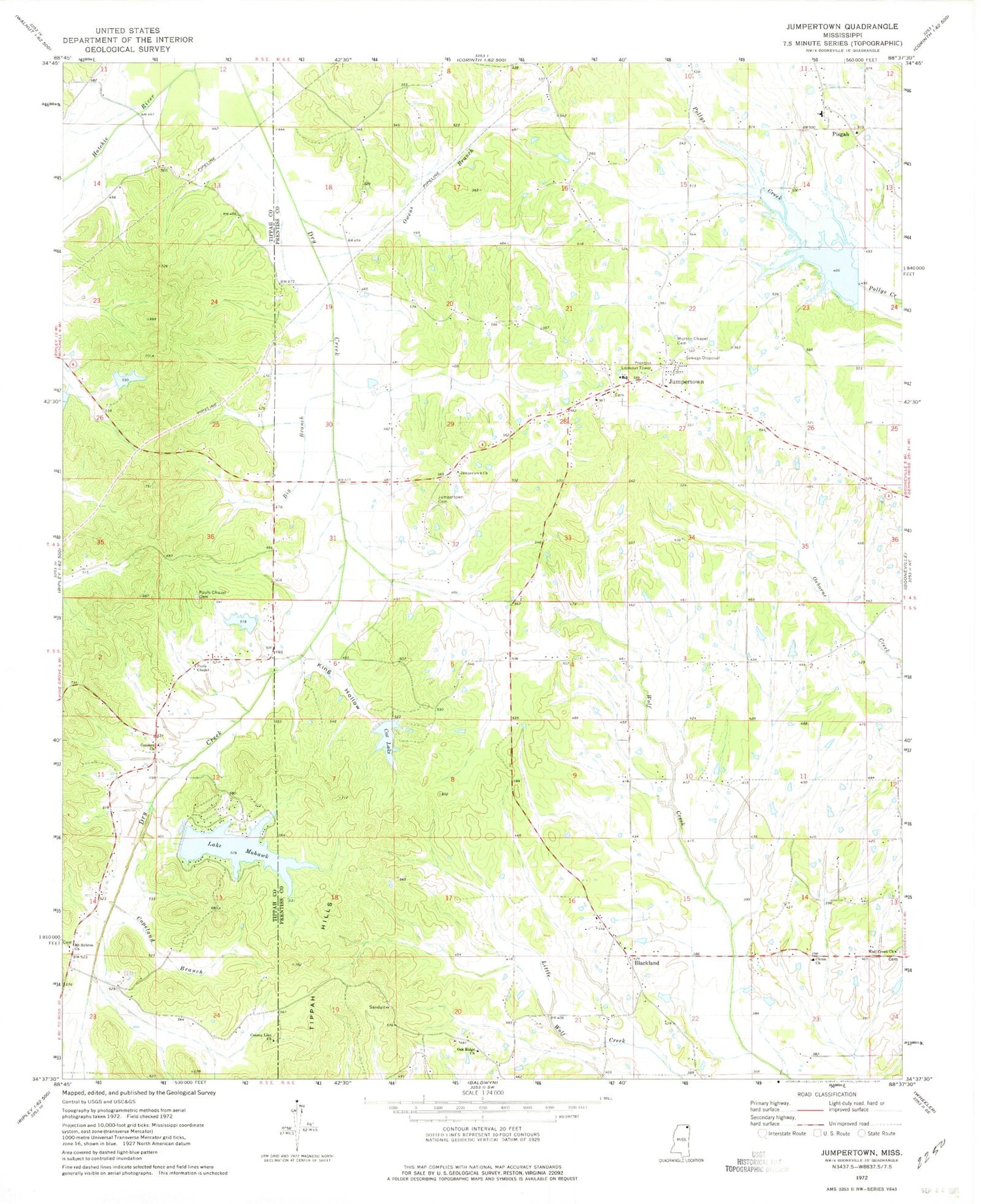
Historical USGS topographic quad map of Jumpertown in the state of Mississippi. Map scale may vary for some years, but is generally around 1:24,000. Print size is approximately 24" x 27"
This quadrangle is in the following counties: Prentiss, Tippah.
The map contains contour lines, roads, rivers, towns, and lakes. Printed on high-quality waterproof paper with UV fade-resistant inks, and shipped rolled.
Contains the following named places: Big Branch, Blackland, Blackland Cemetery, Blackland Elementary School, Blackland Methodist Church, Blackland Volunteer Fire Department, Christ Church, Church of the Lord Jesus Christ, Concord Cemetery, Concord Church, Concord School, Copeland Branch, Cornelius Lake Dam, County Line Cemetery, County Line Church, Cox Lake, Crossroads Church, D Carmichael lake Dam, Dalton School, Doyle Cox Lake Dam, Dry Creek, Dry Creek Volunteer Fire Department, Dry Run, Goodluck School, Guin Branch, Jumper School, Jumpertown, Jumpertown Attendance Center, Jumpertown Cemetery, Jumpertown Church, Jumpertown Church of Christ, Jumpertown Church of Christ Cemetery, Jumpertown Consolidated School, Jumpertown Volunteer Fire Department, King Hollow, Lake Mohawk, Lake Mohawk Dam, Liberty Cumberland Presbyterian Church, Morton Chapel, Morton Chapel Cemetery, Mount Hebron Church, Oak Ridge Church, Owens Branch, Pauls Chapel, Pauls Chapel Cemetery, Pisgah, Pisgah Cemetery, Pisgah Church, Pisgah Community Volunteer Fire Department, Pisgah School, Prentiss Lookout Tower, Ruticle School, Supervisor District 2, Town of Jumpertown, Tuscumbia Structure 38 Dam, Walnut Grove School, Wolf Creek Cemetery, Wolf Creek Church