MyTopo
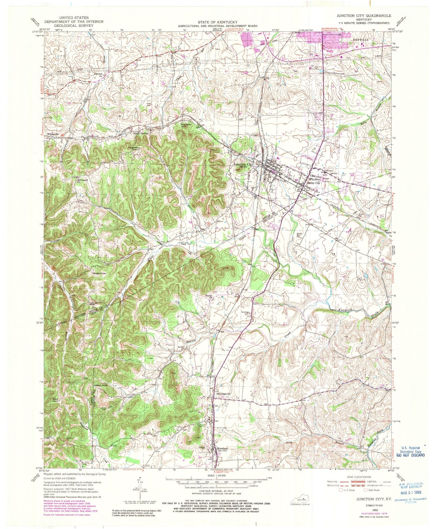
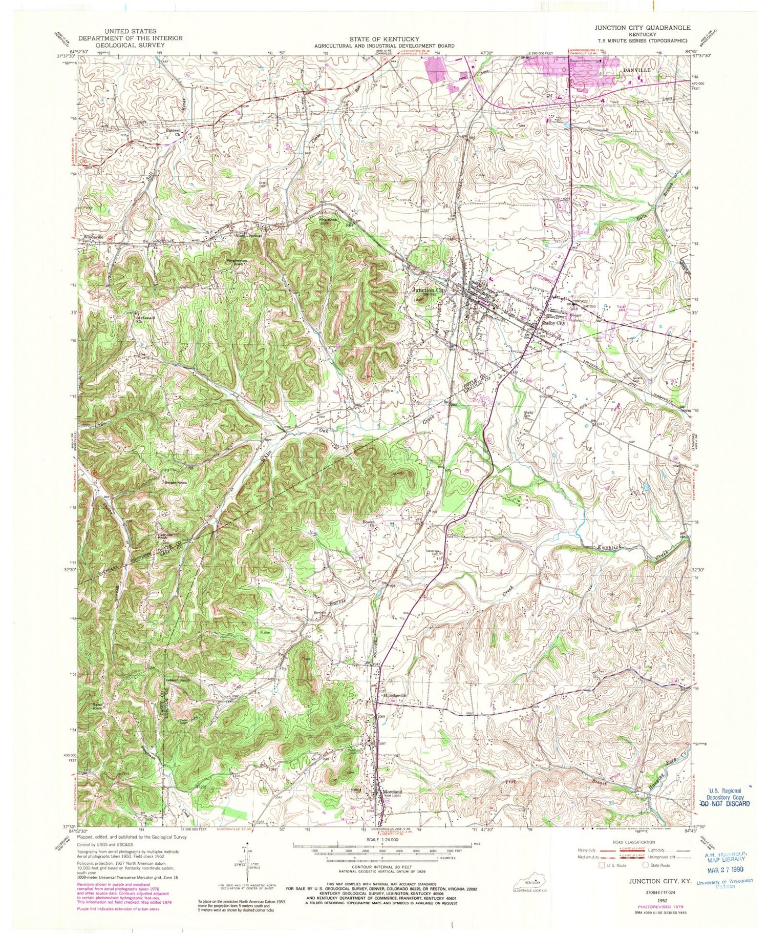
Classic USGS Junction City Kentucky 7.5'x7.5' Topo Map
Couldn't load pickup availability
Historical USGS topographic quad map of Junction City in the state of Kentucky. Map scale may vary for some years, but is generally around 1:24,000. Print size is approximately 24" x 27"
This quadrangle is in the following counties: Boyle, Casey, Lincoln.
The map contains contour lines, roads, rivers, towns, and lakes. Printed on high-quality waterproof paper with UV fade-resistant inks, and shipped rolled.
Contains the following named places: Alum Springs, Alum Springs Post Office, Alum Springs Railroad Station, Benedict Cemetery, Berger Knob, Bowen Church, Boyle County, Boyle County Emergency Medical Services, Boyle County Fire Department Station 4, Boyle Knob, Caldwell Church, Caldwell School, Catholic Knob, City of Junction City, Danville Fire Department Station 2, Frog Branch, Germantown School, Gibson Knob, Givans Cemetery, Givens Depot, Gray Cemetery, Harris Creek, Isaac Shelby State Shrine, Junction City, Junction City Police Department, Junction City Post Office, Junction City Volunteer Fire Department, Knob Lick, Lincoln County Fire Department Station 3, McDonald Church, Milledgeville, Milledgeville Post Office, Milledgeville Railroad Station, Moreland, Moreland Post Office, Moreland Railroad Station, New Austria Church, Persimmon Grove, Persimmon Knob, Peytons Mill, Peytons Well, Pine Knob, Pruitt Cemetery, Saint Francis of Assisi Catholic Church, Saint Joseph Church, Saint Joseph School, Sand Knob, Sand Knob Lookout Tower, Sandidge Cemetery, Shelby Cemetery, Shelby City, Shelby City Post Office, Shelby City Railroad Station, Stuart Powell Field, Thorn Hill School, Travelers Rest Post Office, WDFB-AM (Junction City), West Lincoln County Emergency Medical Services, White Oak Creek, ZIP Code: 40440