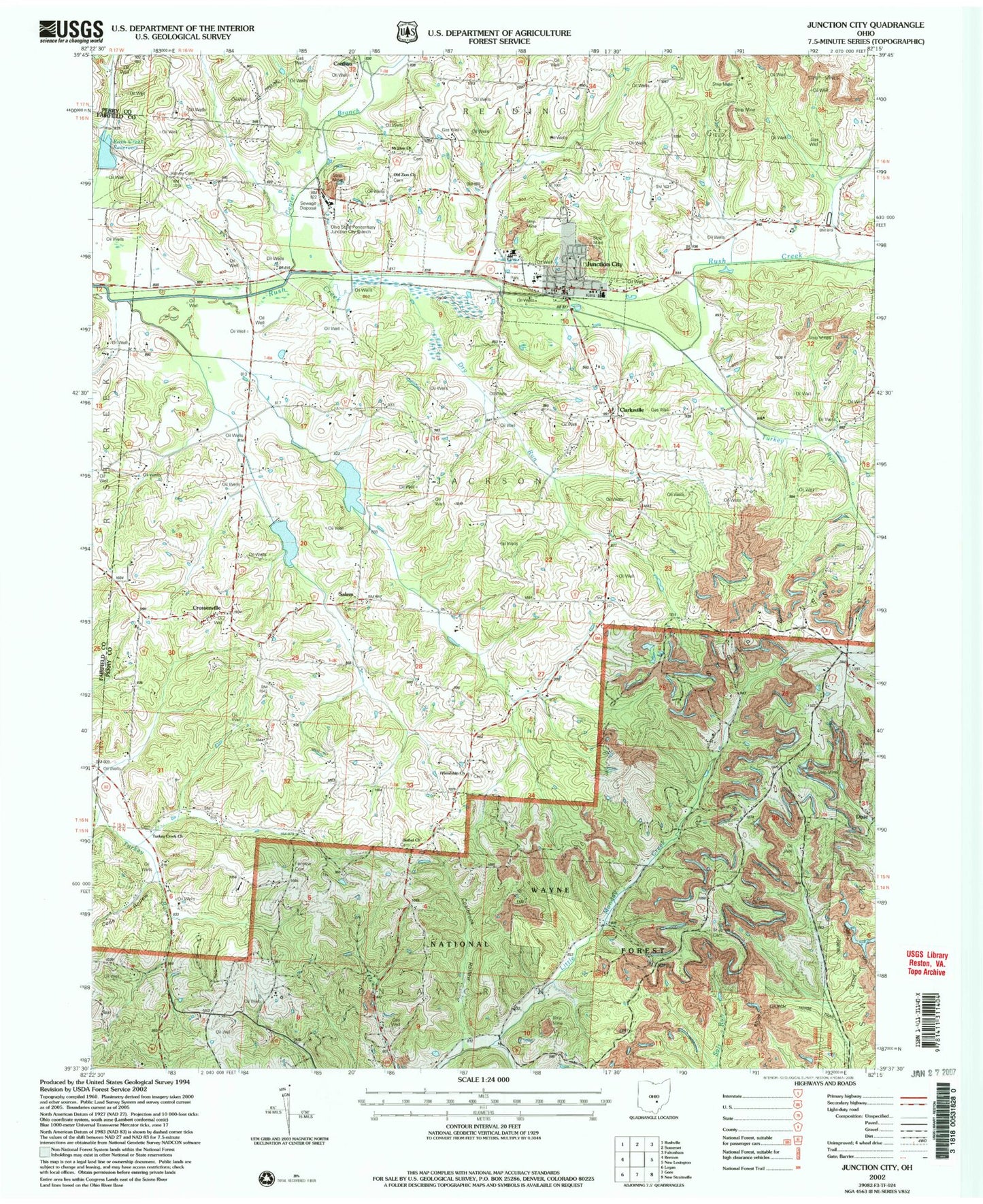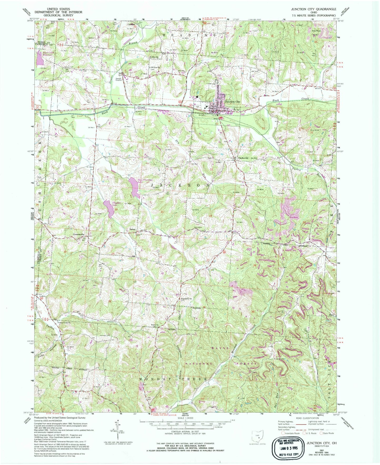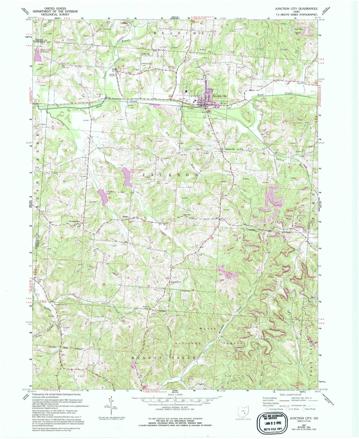
MyTopo
Classic USGS Junction City Ohio 7.5'x7.5' Topo Map
Couldn't load pickup availability
Historical USGS topographic quad map of Junction City in the state of Ohio. Map scale may vary for some years, but is generally around 1:24,000. Print size is approximately 24" x 27"
This quadrangle is in the following counties: Fairfield, Hocking, Perry.
The map contains contour lines, roads, rivers, towns, and lakes. Printed on high-quality waterproof paper with UV fade-resistant inks, and shipped rolled.
Contains the following named places: Asbury, Asbury Post Office, Bethel Cemetery, Bethel Church, Brehm Run, Carthon, Carthon Post Office, Center Branch Rush Creek, Clark Run, Clarksville, Coalbrook Creek, Coalbrook Hollow, Coon Hollow, Crossenville, Crossenville Post Office, Dry Run, Fairview Cemetery, Fairview United Brethren Church, Five Points, Flagdale Lake, Friendship Church, Friendship Methodist Episcopal Cemetery, Harvey Cemetery, Harvey Chapel, Junction City, Junction City Elementary School, Junction City Park, Junction City Post Office, Junction City Volunteer Fire Department, Lideys Run, Mount Zion United Brethren In Christ Cemetery, Mount Zion United Brethren in Christ Church, New Lebanon Evangelical Lutheran Cemetery, New Lebanon Evangelical Lutheran Church, Ohio State Penitentiary Junction City Branch, Old Zion United Brethren Cemetery, Old Zion United Brethren Church, Pigeonroost School, Pine View Tree Farm, Rush Creek Conservation District Structure 5a Dam, Rush Creek Conservation District Structure Reservoir, Rush Creek School, Saint Johns Cemetery, Saint Patricks Cemetery, Saint Patricks Church, Salem, Salem Run, Township of Jackson, Turkey Run, Turkey Run Mennonite Church, Twin Churches Lake, Village of Junction City, ZIP Code: 43748