MyTopo
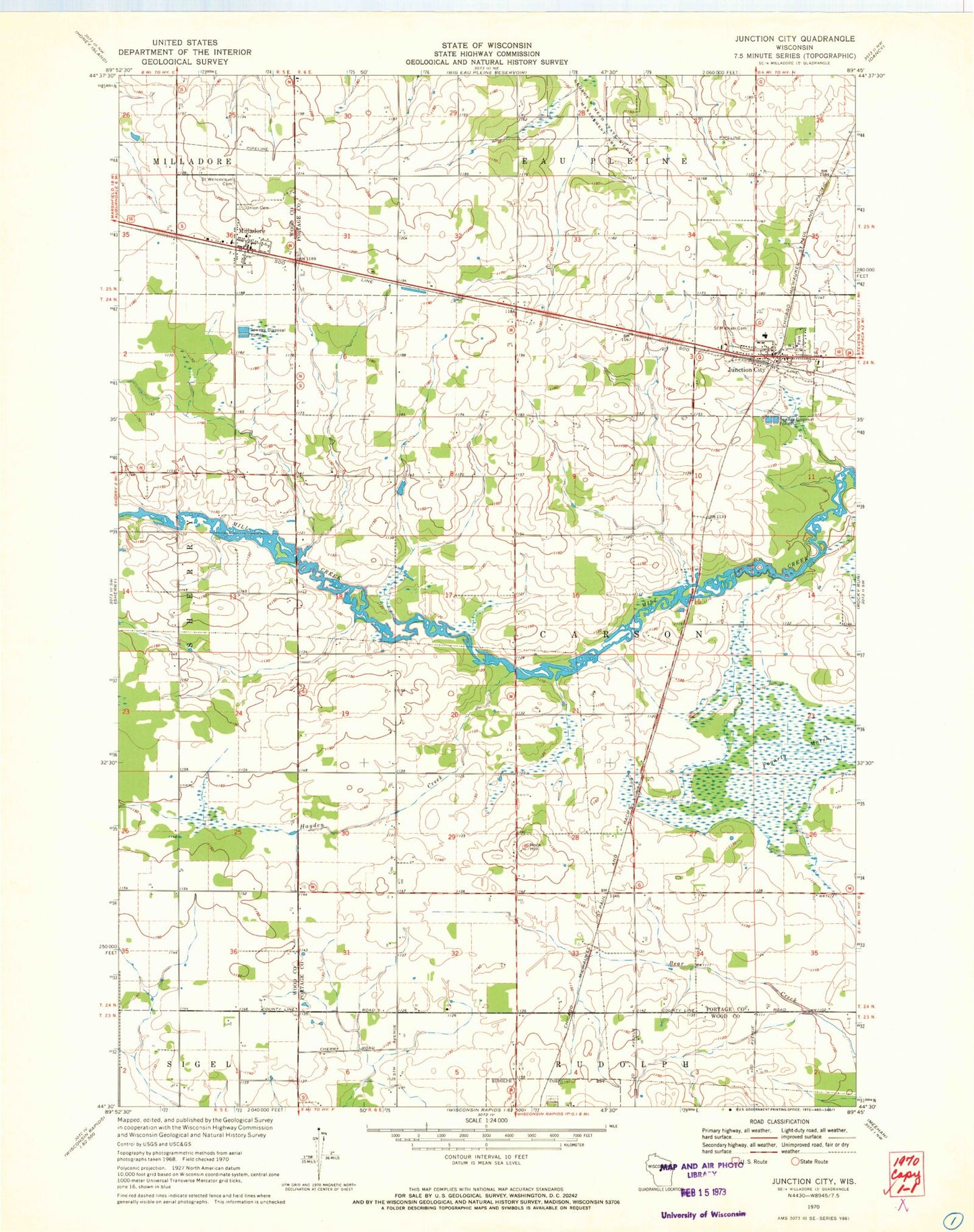
Classic USGS Junction City Wisconsin 7.5'x7.5' Topo Map
Couldn't load pickup availability
Historical USGS topographic quad map of Junction City in the state of Wisconsin. Map scale may vary for some years, but is generally around 1:24,000. Print size is approximately 24" x 27"
This quadrangle is in the following counties: Portage, Wood.
The map contains contour lines, roads, rivers, towns, and lakes. Printed on high-quality waterproof paper with UV fade-resistant inks, and shipped rolled.
Contains the following named places: Fogarty Marsh, Hayden Creek, Junction City, Junction City Post Office, Junction City Wastewater Treatment Plant, Kennedy Elementary School, Lone Elm School, Lone Maple School, Mill Creek School, Milladore, Rock Hill, Rudolph Volunteer Fire Department Station 5, Saint Michael's Cemetery, Saint Wenceslaus Cemetery, Sunrise Valley School, Union Cemetery, Victory School, Village of Junction City, Village of Milladore, ZIP Code: 54443