MyTopo
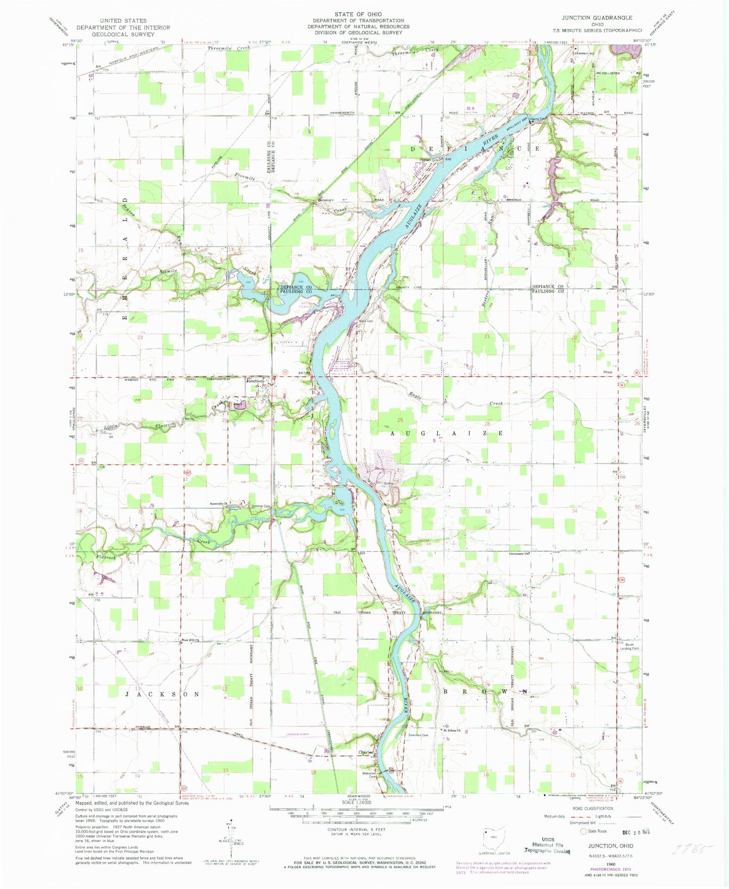
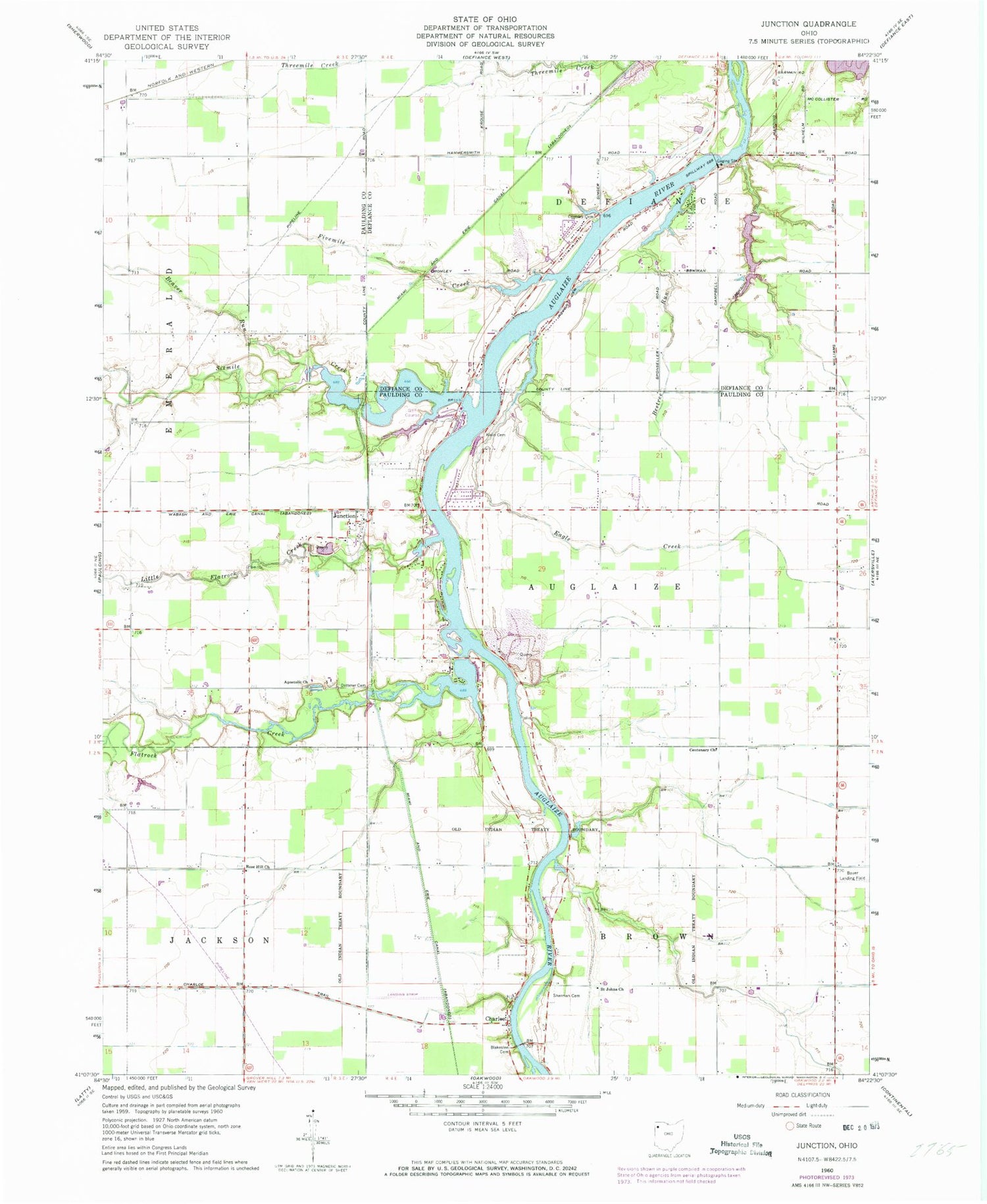
Classic USGS Junction Ohio 7.5'x7.5' Topo Map
Couldn't load pickup availability
Historical USGS topographic quad map of Junction in the state of Ohio. Map scale may vary for some years, but is generally around 1:24,000. Print size is approximately 24" x 27"
This quadrangle is in the following counties: Defiance, Paulding.
The map contains contour lines, roads, rivers, towns, and lakes. Printed on high-quality waterproof paper with UV fade-resistant inks, and shipped rolled.
Contains the following named places: Apostolic Church, Apple Creek Farm, Au Glaize Golf Course, Auglaize Quarry, Auglaize Township Fire Department, Auglaize Township Hall, Beaver Run, Beetree Run, Blakeslee Cemetery, Blue Creek, Camp Lakota Boy Scout Lake, Centenary Church, Charloe, Charloe Airport, Charloe Community Park, Charloe Post Office, Cherry Grove Farm, Clay Bank Farm, Cooper Farms Hatchery, Cromley Cemetery, Defiance County Sanitary Landfill, Defiance Reservoir, Dotterer Cemetery, Dwight Ordway Orchards, Eagle Creek, Fivemile Creek, Flatrock Creek, Indian Hollow Farm, Jackson Ditch, Junction, Junction Cemetery, Junction Post Office, Kohart Lake, Kohart Lake Dam, Little Flatrock Creek, Molasses Gap, Potter and Klein Cemetery, Renollet, Rose Hill Church, Saint Johns Church, Saint Marys Cemetery, Sherman Cemetery, Sixmile Creek, Strable Landing Strip, Toledo Edison Power Dam, Township of Auglaize, Township of Defiance, WZOM-FM (Defiance)