MyTopo
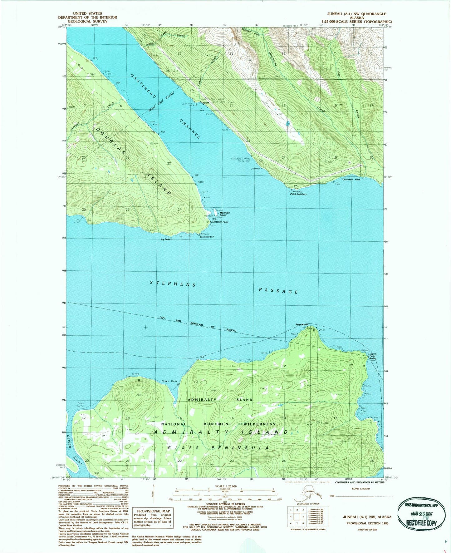
Classic USGS Juneau A-1 NW Alaska 7.5'x7.5' Topo Map
Couldn't load pickup availability
Historical USGS topographic quad map of Juneau A-1 NW in the state of Alaska. Map scale may vary for some years, but is generally around 1:24,000. Print size is approximately 24" x 27"
This quadrangle is in the following counties: Hoonah-Angoon (CA), Juneau.
The map contains contour lines, roads, rivers, towns, and lakes. Printed on high-quality waterproof paper with UV fade-resistant inks, and shipped rolled.
Contains the following named places: Arden Point, Cherokee Flats, Cove Point, Dupont, Dupont Creek, False Arden, Gastineau City, Goldstein Gulch, Green Cove, Grindstone Creek, Grindstone Falls, Icy Point, Kuteha Indian Burial Grounds, Little Sheep Creek, Marmion Island, Nevada Creek, Point Salisbury, Rhine Creek, Sikanasankian, South Rhine Peak, Southeast End, Tantallon Point