MyTopo
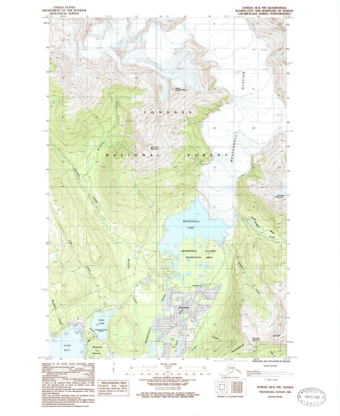
Classic USGS Juneau B-2 NW Alaska 7.5'x7.5' Topo Map
Couldn't load pickup availability
Historical USGS topographic quad map of Juneau B-2 NW in the state of Alaska. Typical map scale is 1:24,000, but may vary for certain years, if available. Print size: 24" x 27"
This quadrangle is in the following counties: Juneau.
The map contains contour lines, roads, rivers, towns, and lakes. Printed on high-quality waterproof paper with UV fade-resistant inks, and shipped rolled.
Contains the following named places: Auke Bay, Auke Creek, Auke Lake, Auke Nu Creek, Bay Creek, Dredge Lake, Lake Creek, Lower Basin, McGinnis Mountain, West Glacier Trail, Mendenhall Lake, Mendenhaven, Montana Creek, Nugget Creek, Nugget Creek Trail, Spaulding Point, Steep Creek, Stroller White Mountain, Thunder Mountain, Tolch Rock, Waydelich Creek, McGinnis Creek, Mendenhall Valley, Mendenhall Glacier Recreation Area, University of Alaska Southeast, Nugget Creek Dam, Nugget Creek, Arastra Creek, Capital City Fire and Rescue Auke Bay Station, Lower Montana Creek Mine, Alaskan Memorial Park, Auke Bay Post Office, Tlaxsatanjin