
MyTopo
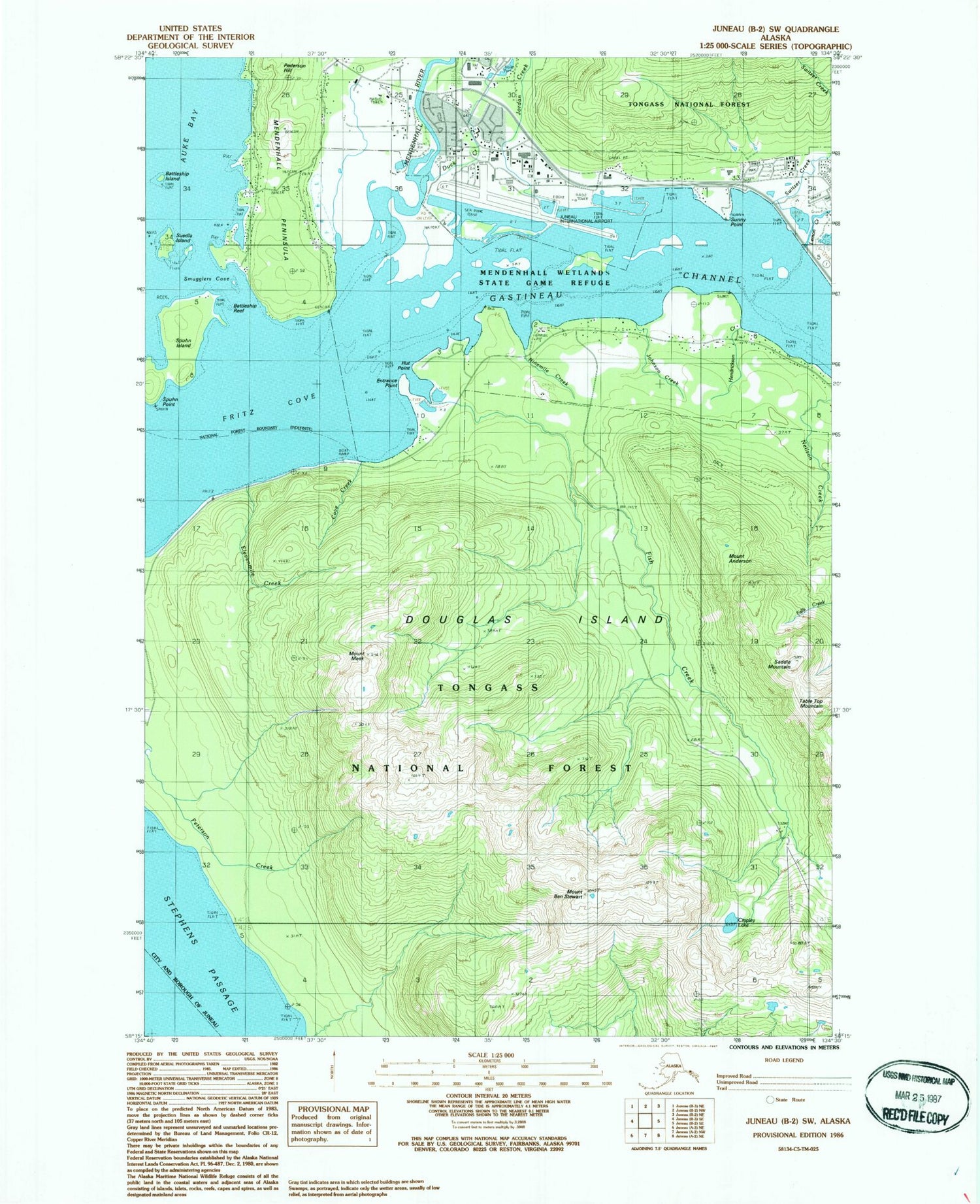
Classic USGS Juneau B-2 SW Alaska 7.5'x7.5' Topo Map
Couldn't load pickup availability
Historical USGS topographic quad map of Juneau B-2 SW in the state of Alaska. Typical map scale is 1:24,000, but may vary for certain years, if available. Print size: 24" x 27"
This quadrangle is in the following counties: Juneau.
The map contains contour lines, roads, rivers, towns, and lakes. Printed on high-quality waterproof paper with UV fade-resistant inks, and shipped rolled.
Contains the following named places: Mount Anderson, Battleship Island, Battleship Reef, Cove Creek, Cropley Lake, Douglas Island, Duck Creek, Elevenmile Creek, Entrance Point, Fish Creek, Fritz Cove, Hendrickson Creek, Hut Point, Johnson Creek, Jordan Creek, Lemon Creek, Mount Meek, Mendenhall Peninsula, Mendenhall River, Ninemile Creek, Pederson Hill, Saddle Mountain, Smugglers Cove, Spuhn Island, Spuhn Point, Suedla Island, Sunny Point, Switzer Creek, Table Top Mountain, Mendenhall Valley, Brotherhood Bridge, Mendenhall Wetlands State Game Refuge, Mount Ben Stewart, KDEV-FM (Juneau), Juneau International Airport, Mendenhall Bar, Fish Creek (historical), Capital City Fire and Rescue Glacier / Airport Station, Capital City Fire and Rescue Training Station, Family Practice Physicians, Juneau Medical Clinic, Juneau Urgent Care and Family Medical Clinic, Airlift Northwest, Guardian Flight Juneau, Mendenhall Post Office, Juneau Police Department, United States Customs and Border Protection Port of Entry Juneau, Alaska State Troopers Juneau


