MyTopo
Classic USGS Juneberry Ridge Minnesota 7.5'x7.5' Topo Map
Regular price
$16.95
Regular price
Sale price
$16.95
Unit price
per
Couldn't load pickup availability
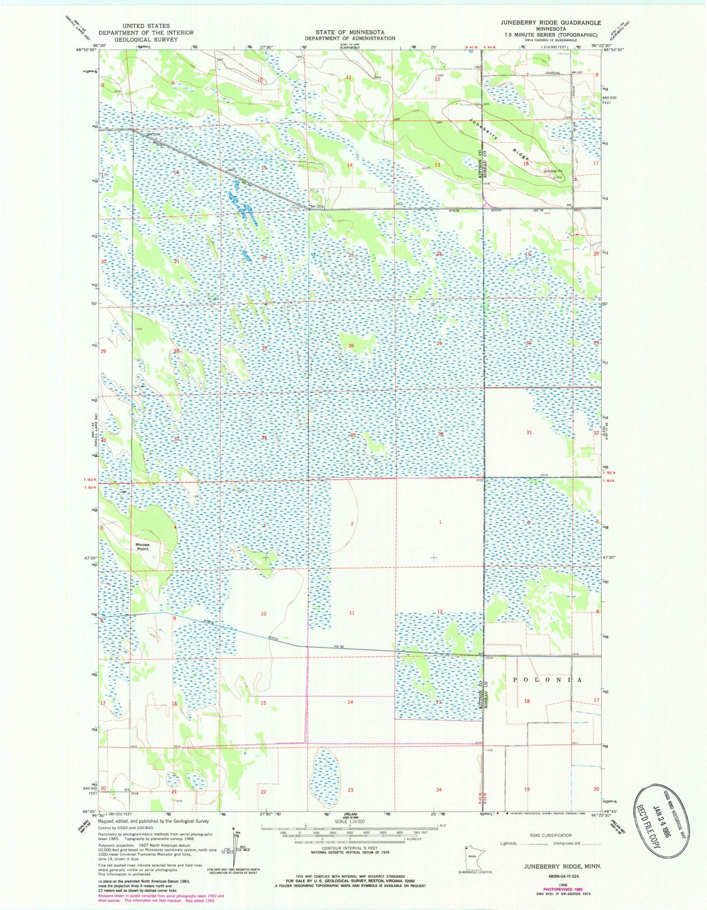
Historical USGS topographic quad map of Juneberry Ridge in the state of Minnesota. Map scale may vary for some years, but is generally around 1:24,000. Print size is approximately 24" x 27"
This quadrangle is in the following counties: Kittson, Roseau.
The map contains contour lines, roads, rivers, towns, and lakes. Printed on high-quality waterproof paper with UV fade-resistant inks, and shipped rolled.
Contains the following named places: Juneberry Post Office, Juneberry Ridge, Moose Point, School Number 28, State Ditch Number Fifty, State Ditch Number Seventytwo, Unorganized Territory of East Kittson, Unorganized Territory of Klondike, Unorganized Territory of Peatland