
MyTopo
Classic USGS Junior West Virginia 7.5'x7.5' Topo Map
Couldn't load pickup availability
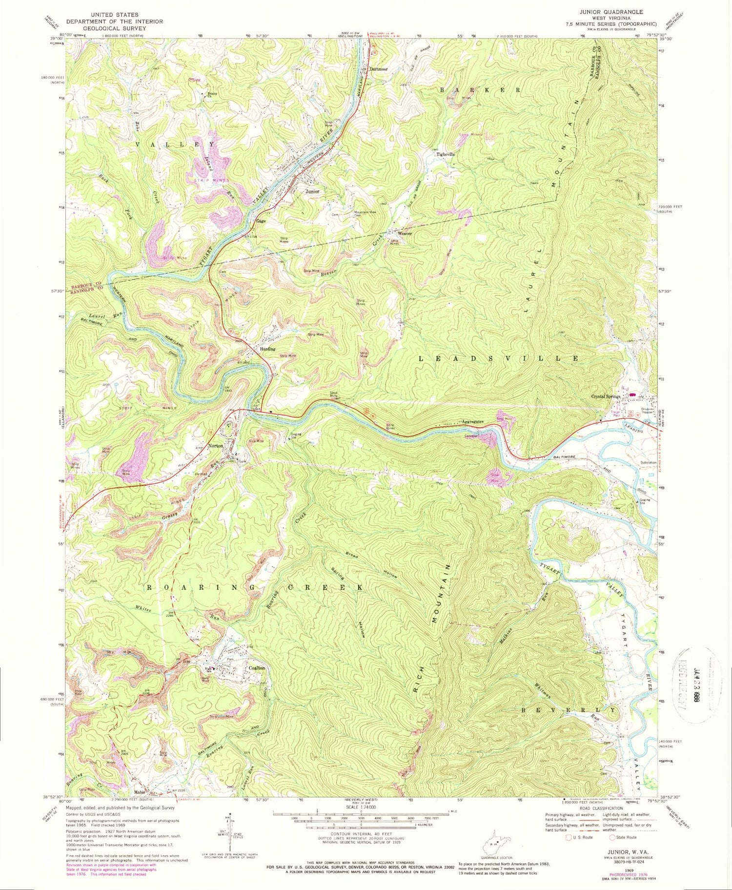
Historical USGS topographic quad map of Junior in the state of West Virginia. Map scale may vary for some years, but is generally around 1:24,000. Print size is approximately 24" x 27"
This quadrangle is in the following counties: Barbour, Randolph.
The map contains contour lines, roads, rivers, towns, and lakes. Printed on high-quality waterproof paper with UV fade-resistant inks, and shipped rolled.
Contains the following named places: Aggregates, Back Fork, Beaver Creek, Bethel United Methodist Church, Big Laurel Run, Broad Hollow, Bruxton, Coalton, Coalton Elementary School, Coalton Post Office, Coalton Volunteer Fire Department, Coffman Methodist Episcopal Church, Crystal Springs, Crystal Springs Census Designated Place, Dartmoor, Dartmoor Full Gospel Church, Denver Lee Shomer Spring, Findley, Fisher, Flatbush Fork, Gage, Georgetown School, Goff School, Grassy Fork, Grassy Run, Gum Road Bridge, Harding, Island Run, Jeff Scotts, Junior, Junior Church of the Brethren, Junior Elelmentary School, Junior Police Department, Junior Post Office, Junior Volunteer Fire Department, Kaufman Church, Laurel, Laurel Hills School, Laurel Run, Leading Creek, Leiter, Little Laurel Run, Mabie, Mabie Post Office, Mathias Run, Michael A Mikey Hart Bridge, Mountain View Cemetery, Norton, Norton Bridge, Norton Census Designated Place, Norton Post Office, Rich Mountain School, Roaring Creek, Roaring Creek Junction, Skidmore, Spring Hollow, Stonecoal School, Tigheville, Town of Junior, Town of Junior Spring, Town of Womelsdorf, Trinity Church, Tygart Valley Regional Jail, Tyre School, Weaver, West Junior, Whites Run, Whitman Run, Zebs Creek, ZIP Codes: 26275, 26285


