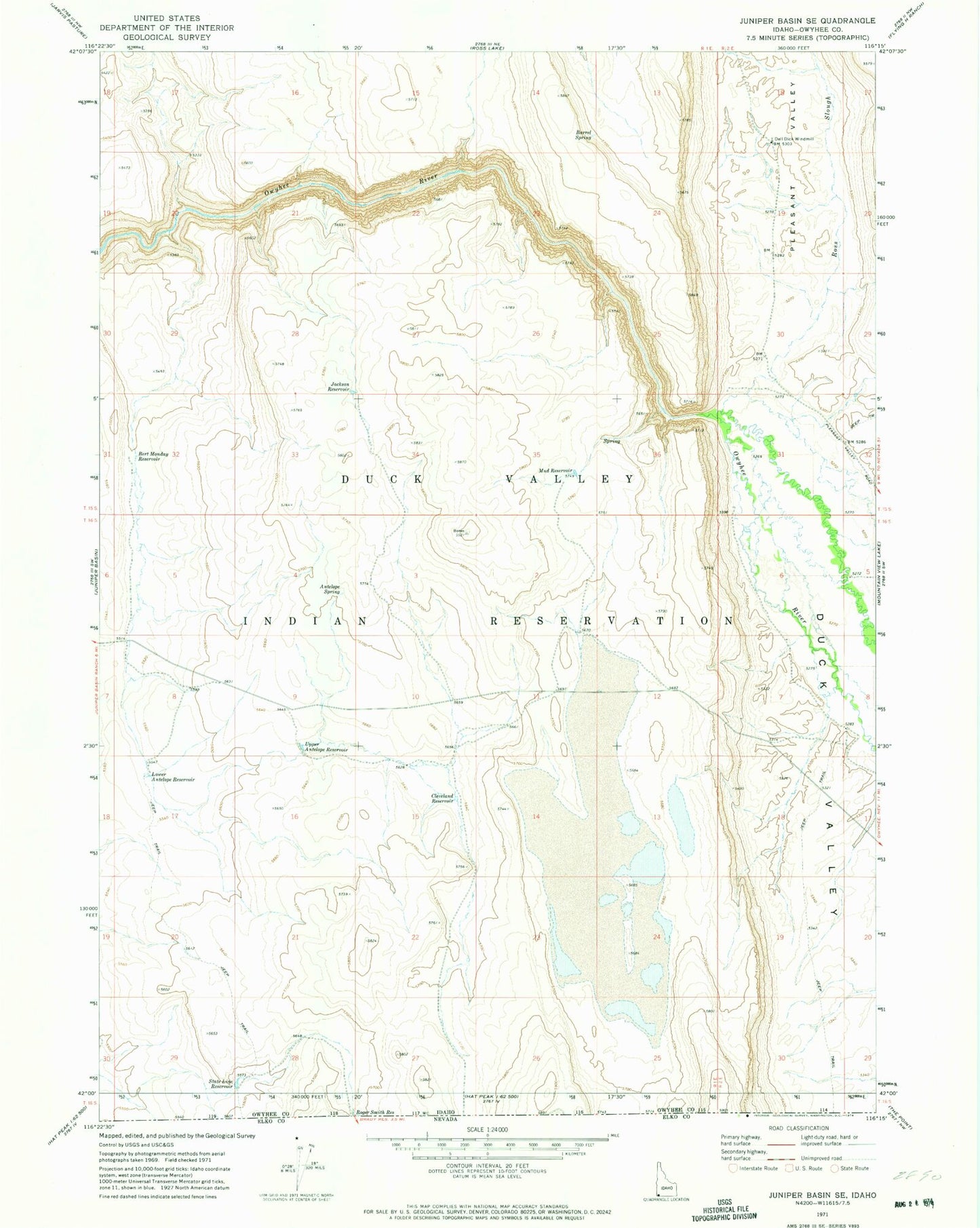
MyTopo
Classic USGS Juniper Basin SE Idaho 7.5'x7.5' Topo Map
Regular price
$16.95
Regular price
Sale price
$16.95
Unit price
per
Couldn't load pickup availability
Historical USGS topographic quad map of Juniper Basin SE in the state of Idaho. Map scale may vary for some years, but is generally around 1:24,000. Print size is approximately 24" x 27"
This quadrangle is in the following counties: Owyhee.
The map contains contour lines, roads, rivers, towns, and lakes. Printed on high-quality waterproof paper with UV fade-resistant inks, and shipped rolled.
Contains the following named places: Antelope Spring, Bert Monday Reservoir, Cleveland Reservoir, Dell Dick Windmill, Jackson Reservoir, Lower Antelope Reservoir, Mud Reservoir, Pleasant Valley, Ross Slough, State Line Reservoir, Upper Antelope Reservoir