MyTopo
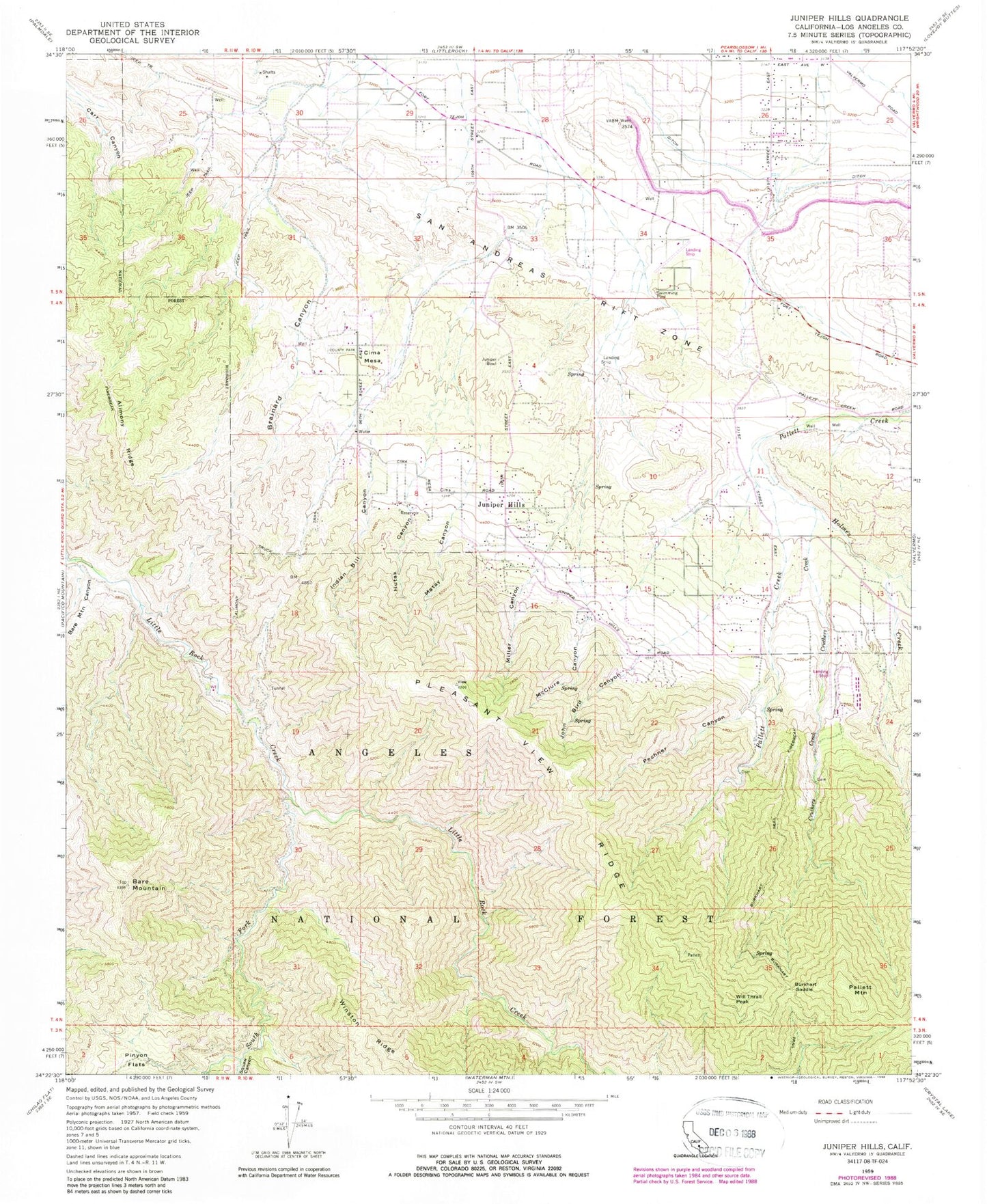
Classic USGS Juniper Hills California 7.5'x7.5' Topo Map
Couldn't load pickup availability
Historical USGS topographic quad map of Juniper Hills in the state of California. Typical map scale is 1:24,000, but may vary for certain years, if available. Print size: 24" x 27"
This quadrangle is in the following counties: Los Angeles.
The map contains contour lines, roads, rivers, towns, and lakes. Printed on high-quality waterproof paper with UV fade-resistant inks, and shipped rolled.
Contains the following named places: Alimony Ridge, Bare Mountain, Bare Mountain Canyon, Brainard Canyon, Burkhart Saddle, Burkhart Trail, Cruthers Creek, Fort Tejon Siphon, Holmes Creek, Hutak Canyon, Indian Bill Canyon, John Bird Canyon, Juniper Bowl, Juniper Hills, Little Cedars Campground, Matay Canyon, McClure Canyon, Miller Canyon, Pechner Canyon, Pinyon Flats, South Fork Little Rock Creek, Squaw Canyon, Sycamore Campground, Watkins Creek, Will Thrall Peak, Little Sycamore Campground, Clima Mesa, Pallett Mountain, Aldrich Ranch (historical), Burkhart Ranch, Cobbleita Ranch, East Ranch, Longview, Moss Spring, Saunders Ranch, Stanton Ranch, Juniper Hills Park, South Antelope Valley Division, Pleasant View Ridge Wilderness