MyTopo
Classic USGS Juniper Lake Oregon 7.5'x7.5' Topo Map
Regular price
$16.95
Regular price
Sale price
$16.95
Unit price
per
Couldn't load pickup availability
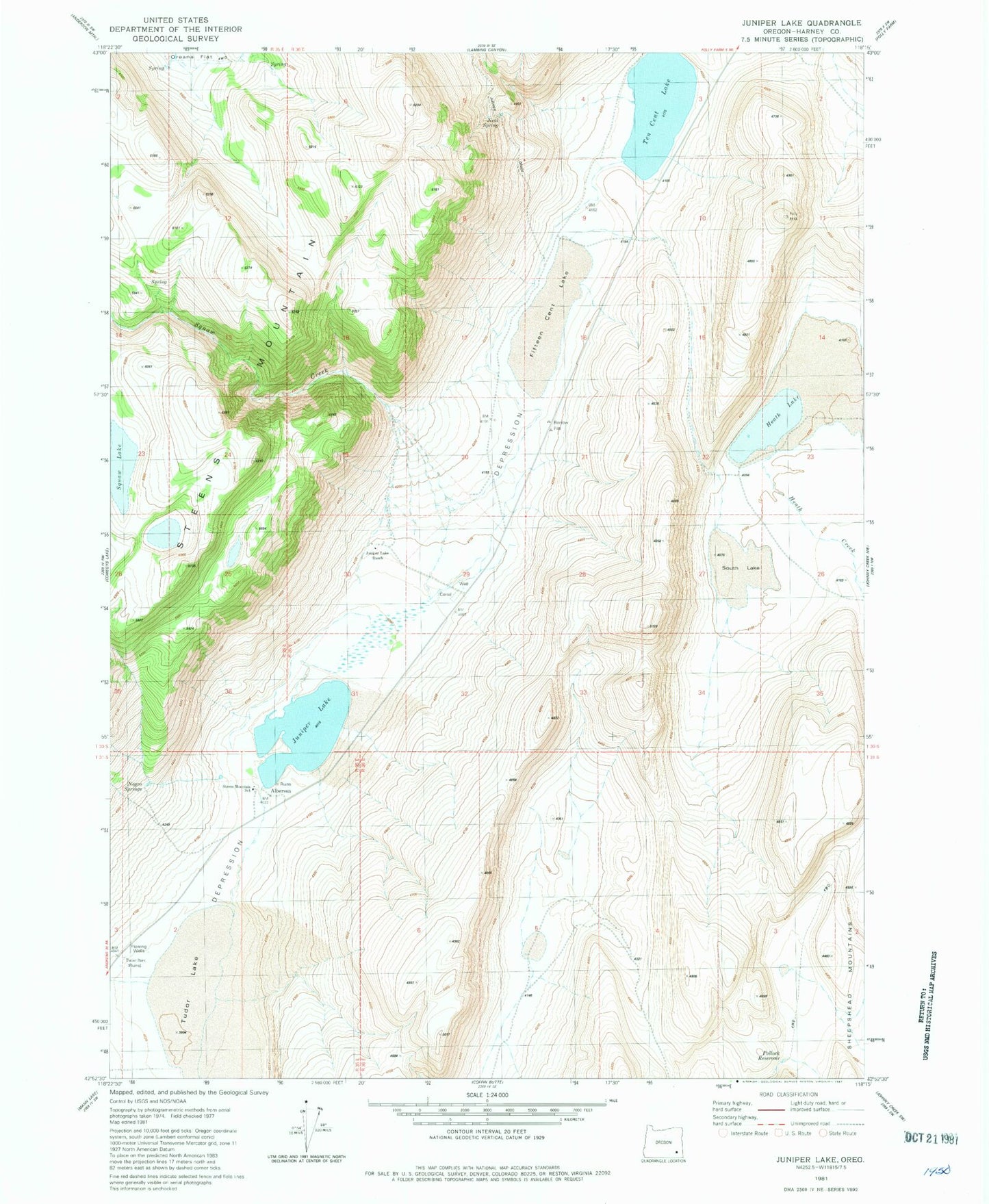
Historical USGS topographic quad map of Juniper Lake in the state of Oregon. Map scale may vary for some years, but is generally around 1:24,000. Print size is approximately 24" x 27"
This quadrangle is in the following counties: Harney.
The map contains contour lines, roads, rivers, towns, and lakes. Printed on high-quality waterproof paper with UV fade-resistant inks, and shipped rolled.
Contains the following named places: Alberson, Alberson Post Office, Anderson Ranch, Ede huudi Creek, Fifteen Cent Lake, Heath Lake, Juniper Grade, Juniper Lake, Juniper Lake Ranch, Neal Spring, Negro Springs, Pollock Reservoir, Puhi-Pane Na-De Lake, South Lake, Steens Mountain School, Ten Cent Lake, Tudor Lake