MyTopo
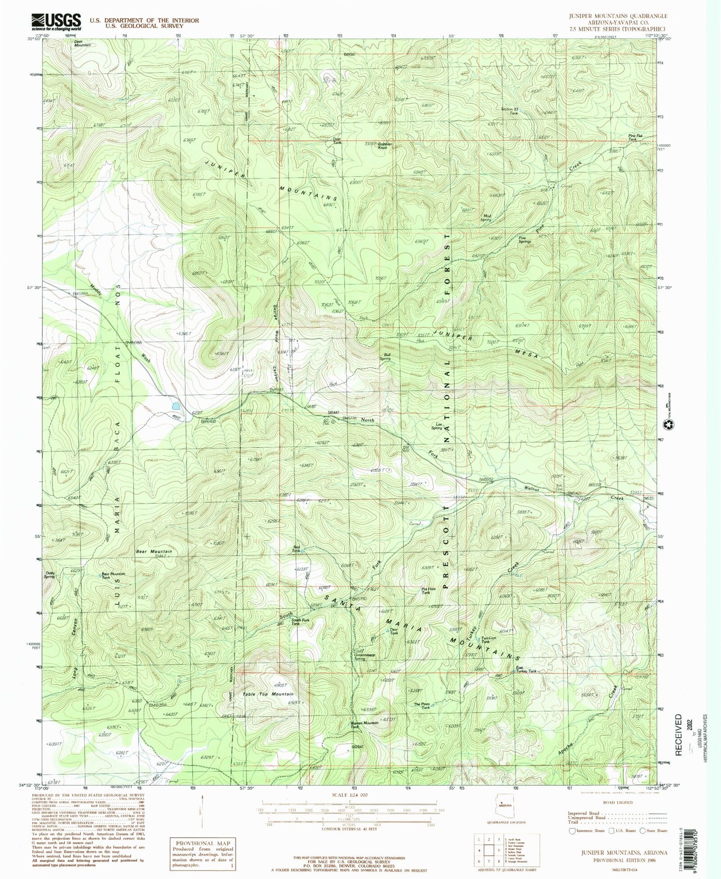
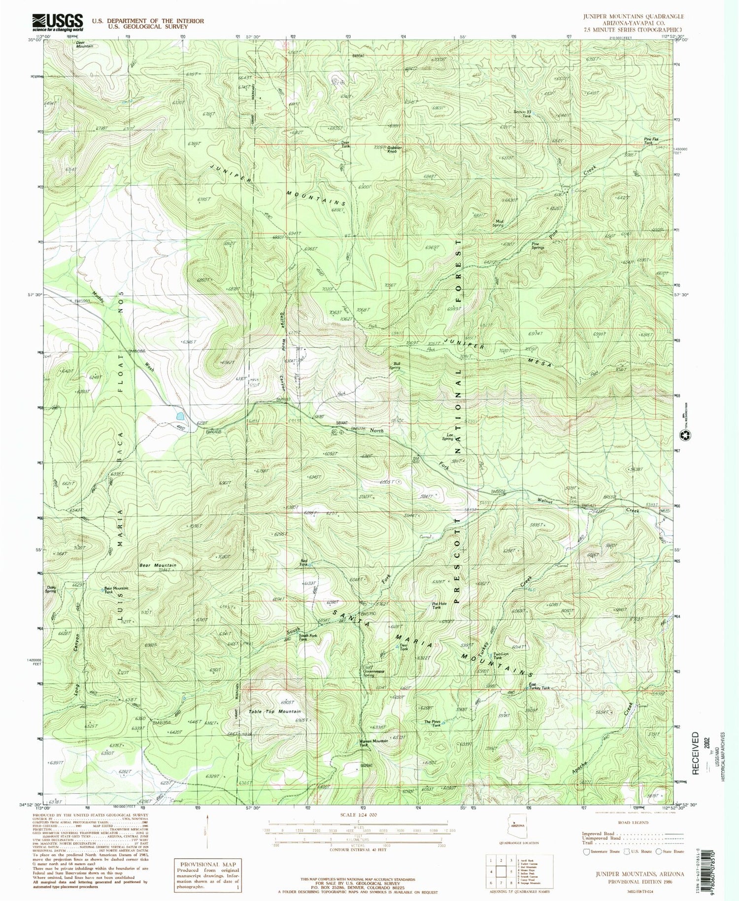
Classic USGS Juniper Mountains Arizona 7.5'x7.5' Topo Map
Couldn't load pickup availability
Historical USGS topographic quad map of Juniper Mountains in the state of Arizona. Map scale may vary for some years, but is generally around 1:24,000. Print size is approximately 24" x 27"
This quadrangle is in the following counties: Yavapai.
The map contains contour lines, roads, rivers, towns, and lakes. Printed on high-quality waterproof paper with UV fade-resistant inks, and shipped rolled.
Contains the following named places: Apache Creek Seep, Apache Creek Wilderness, Ash Spring, Bear Mountain, Bear Mountain Tank, Bull Spring, Dairy Spring, Datry Spring, Deer Tank, East Turkey Tank, George Wood Canyon, Gobbler Knob, Government Spring, Hunt Ranch, Juniper Catchment, Juniper Mesa, Juniper Mesa Wilderness, Juniper Trick Tank, Lee Spring, Little Old Spring, Mud Spring, North Fork Walnut Creek, Pine Flat Tank, Pine Spring, Pine Springs, Pot Hole Tank, Red Tank, Section Thirtythree Tank, Seep Tank, South Fork Tank, South Fork Walnut Creek, Table Top Mountain, The Pines Tank, Trick Tank, Turkey Creek, Turkey Creek Well, Two Lion Tank, Warren Mountain Tank