MyTopo
Classic USGS Juno Tennessee 7.5'x7.5' Topo Map
Couldn't load pickup availability
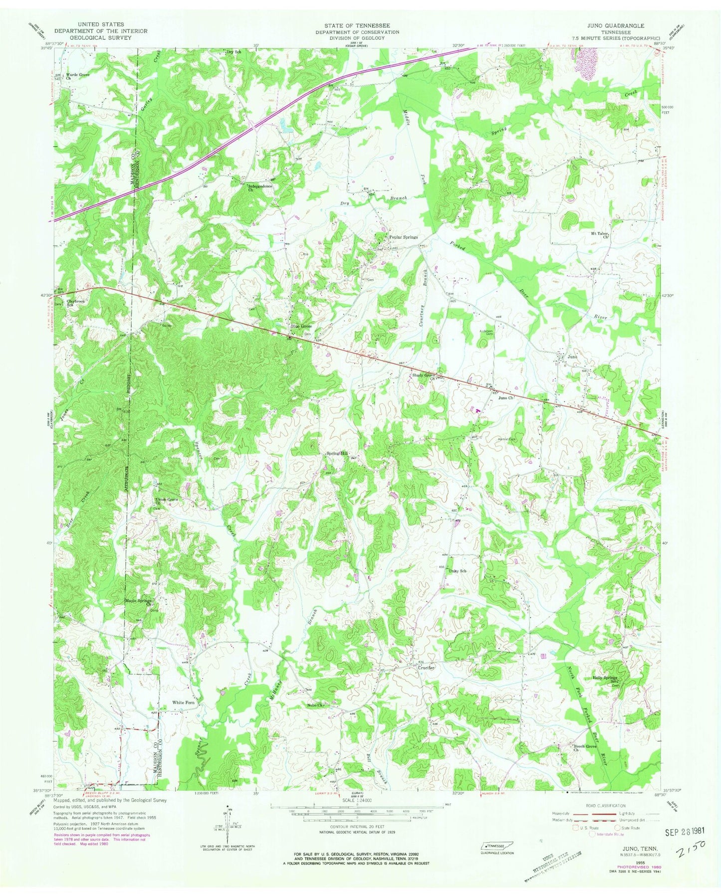
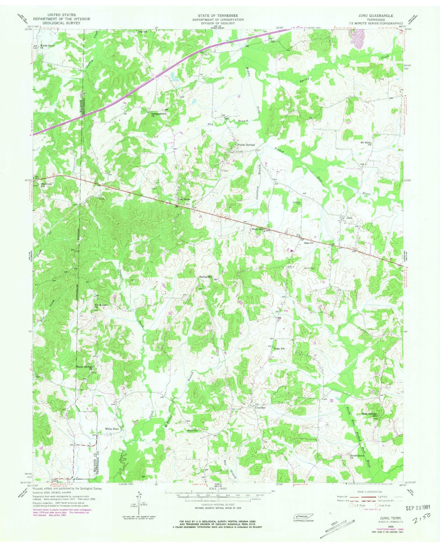
Historical USGS topographic quad map of Juno in the state of Tennessee. Map scale may vary for some years, but is generally around 1:24,000. Print size is approximately 24" x 27"
This quadrangle is in the following counties: Henderson, Madison.
The map contains contour lines, roads, rivers, towns, and lakes. Printed on high-quality waterproof paper with UV fade-resistant inks, and shipped rolled.
Contains the following named places: Anderson Cemetery, Atkins, Atkins Post Office, Beech Grove Church, Blue Goose, Claybrook School, Commissioner District 2, Cool Springs Church, Courtney Branch, Crucifer, Dry Branch, Dry School, Hamlet Cemetery, Henderson County Fire Department Station 1, Holly Springs Cemetery, Holly Springs Methodist Church, Holly Springs School, Independence, Independence Cemetery, Independence Church, Juno, Juno Church, Juno Post Office, Juno School, Maple Spring School, Maple Springs Church, McHaney Branch, Meals Creek, Mount Tabor Church, Nebo Church, Poplar Springs, Poplar Springs Methodist Church, Poplar Springs School, Providence School, Shady Grove Church, Spring Creek, Spring Hill, Union Grove Cemetery, Union Grove Church, Unity School, Wards Grove Church, Westover Elementary School, White Fern, WLJT-TV (Lexington)