
MyTopo
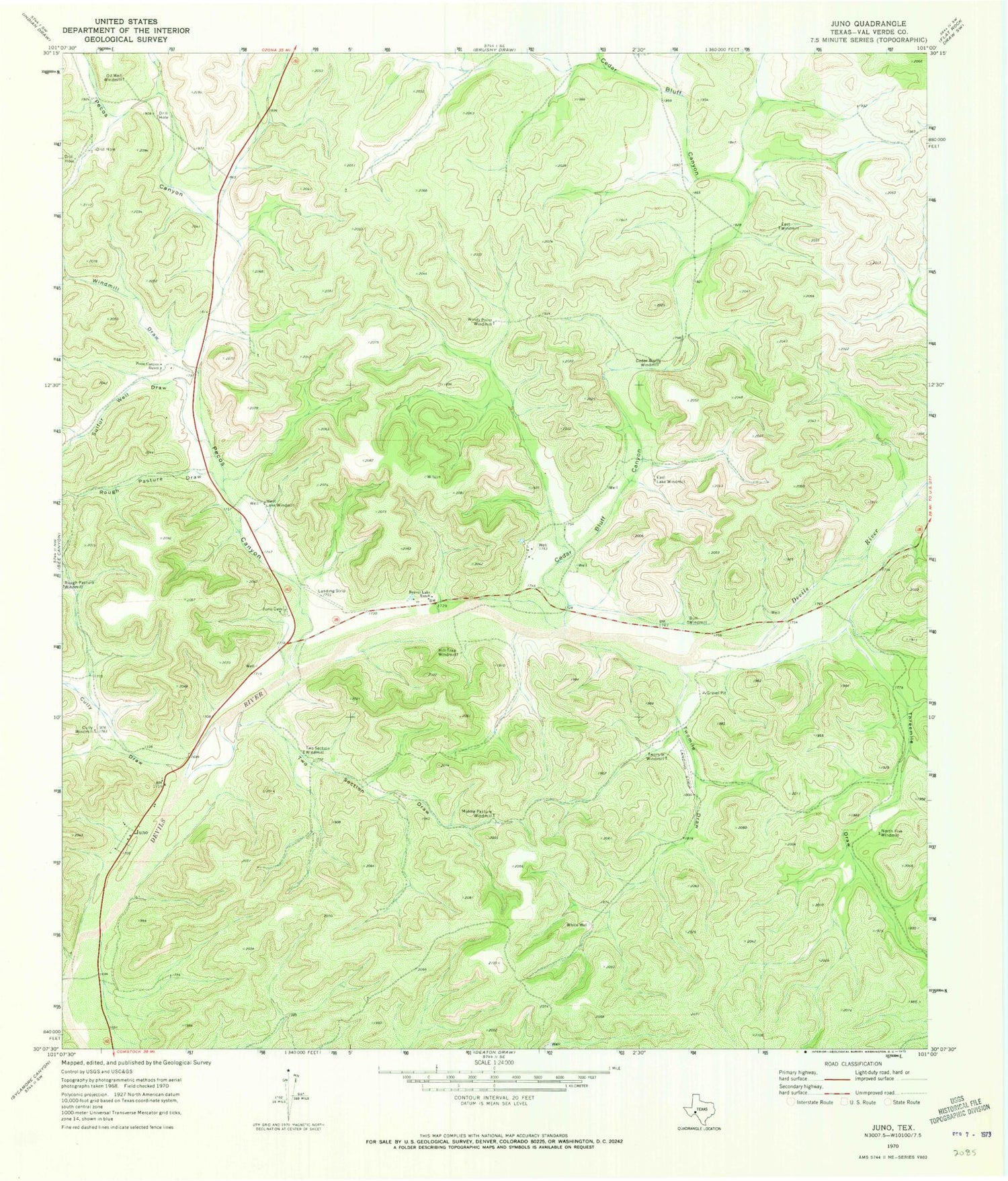
Classic USGS Juno Texas 7.5'x7.5' Topo Map
Couldn't load pickup availability
Historical USGS topographic quad map of Juno in the state of Texas. Map scale may vary for some years, but is generally around 1:24,000. Print size is approximately 24" x 27"
This quadrangle is in the following counties: Val Verde.
The map contains contour lines, roads, rivers, towns, and lakes. Printed on high-quality waterproof paper with UV fade-resistant inks, and shipped rolled.
Contains the following named places: Beaver Lake Ranch, Bull Windmill, Cedar Bluff Canyon, Cedar Bluff Windmill, Cully Draw, Cully Windmill, East Lake Windmill, East Windmill, Hill Trap Windmill, Juno, Juno Cemetery, Middle Pasture Windmill, North Five Windmill, Oil Well Windmill, Pecos Canyon, Pecos Canyon Ranch, Rough Pasture Draw, Sulfur Well Draw, Threemile Draw, Two Section Draw, Two Section Windmill, Twomile Draw, Twomile Windmill, West Lake Windmill, White Well, Windmill Draw, Windy Point Windmill


