
MyTopo
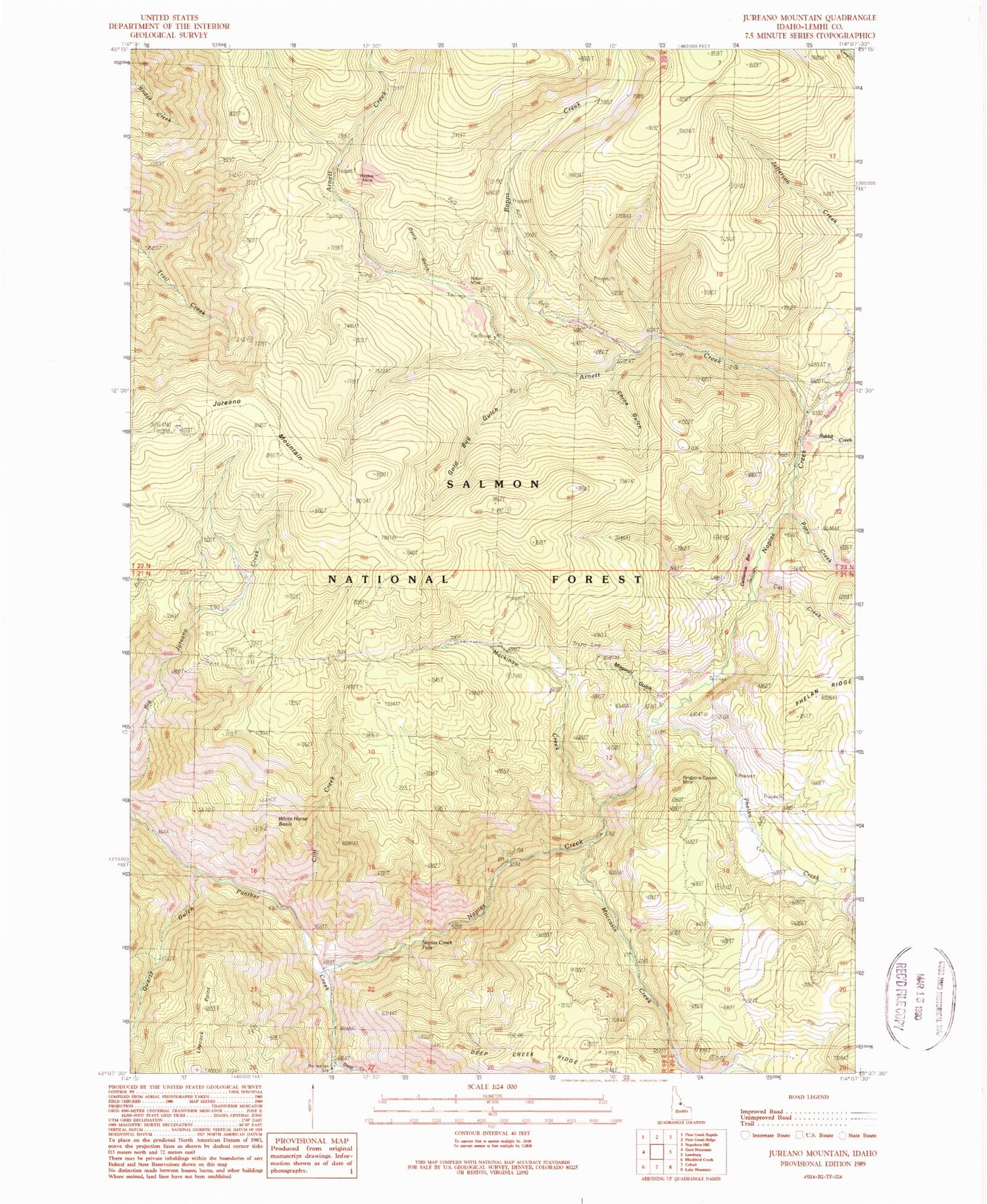
Classic USGS Jureano Mountain Idaho 7.5'x7.5' Topo Map
Couldn't load pickup availability
Historical USGS topographic quad map of Jureano Mountain in the state of Idaho. Map scale may vary for some years, but is generally around 1:24,000. Print size is approximately 24" x 27"
This quadrangle is in the following counties: Lemhi.
The map contains contour lines, roads, rivers, towns, and lakes. Printed on high-quality waterproof paper with UV fade-resistant inks, and shipped rolled.
Contains the following named places: Arnett Creek, California Bar, Cat Creek, China Gulch, Cliff Creek, Davis Gulch, Deep Creek, Deep Creek Recreation Site, Gold Bug Gulch, Haidee Mine, Italian Mine, Jureano Mountain, Jureano Placer Diggings, Leacock Point, Leacock Ranch, Mackinaw Creek, Missouri Gulch, Moccasin Creek, Napias Creek, Napias Creek Falls, Phelan Creek, Pony Creek, Quartz Gulch, Rabbit Creek, Rapps Creek, Ringbone Cayuse Mine, South Fork Phelan Creek, White Horse Basin


