
MyTopo
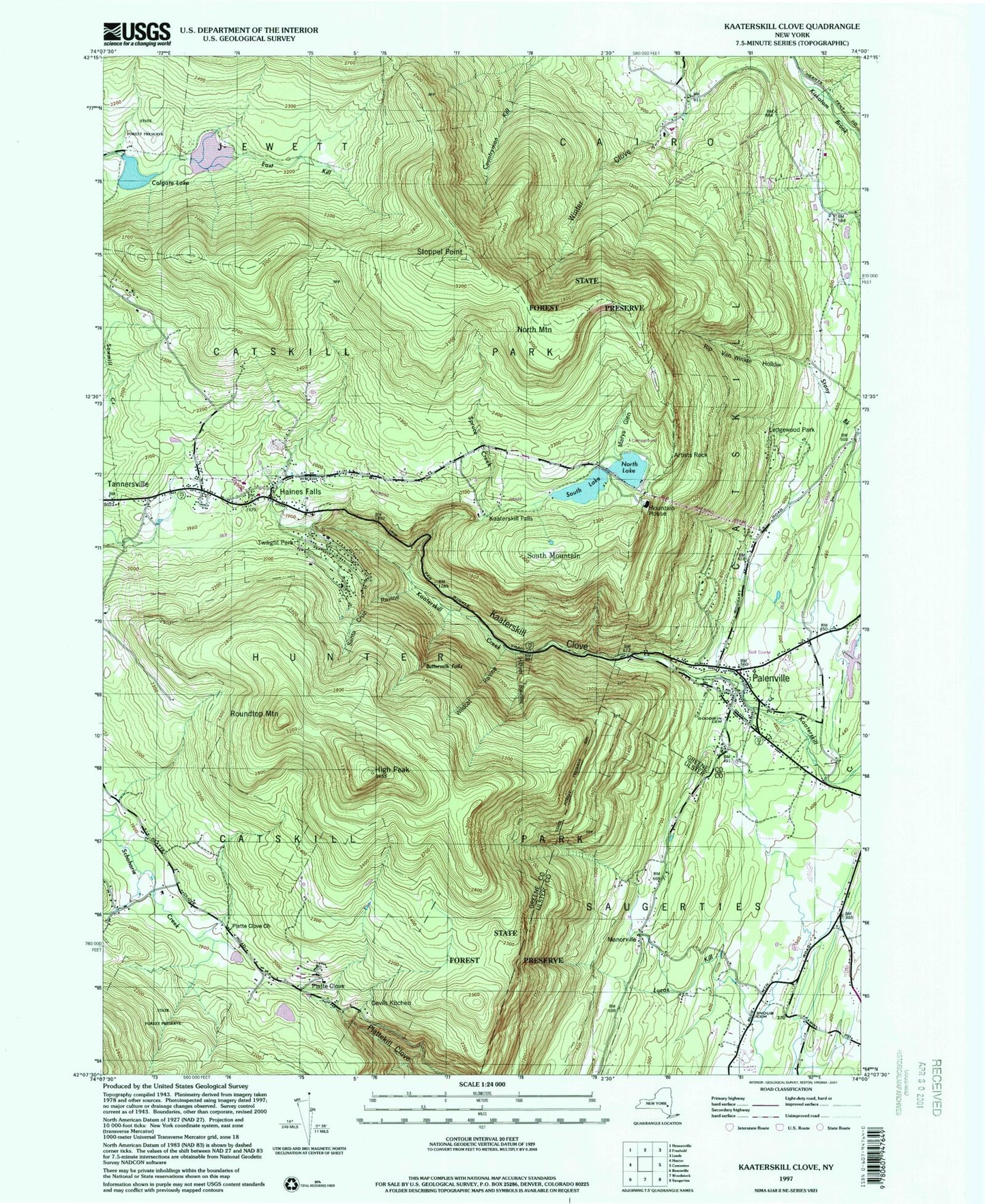
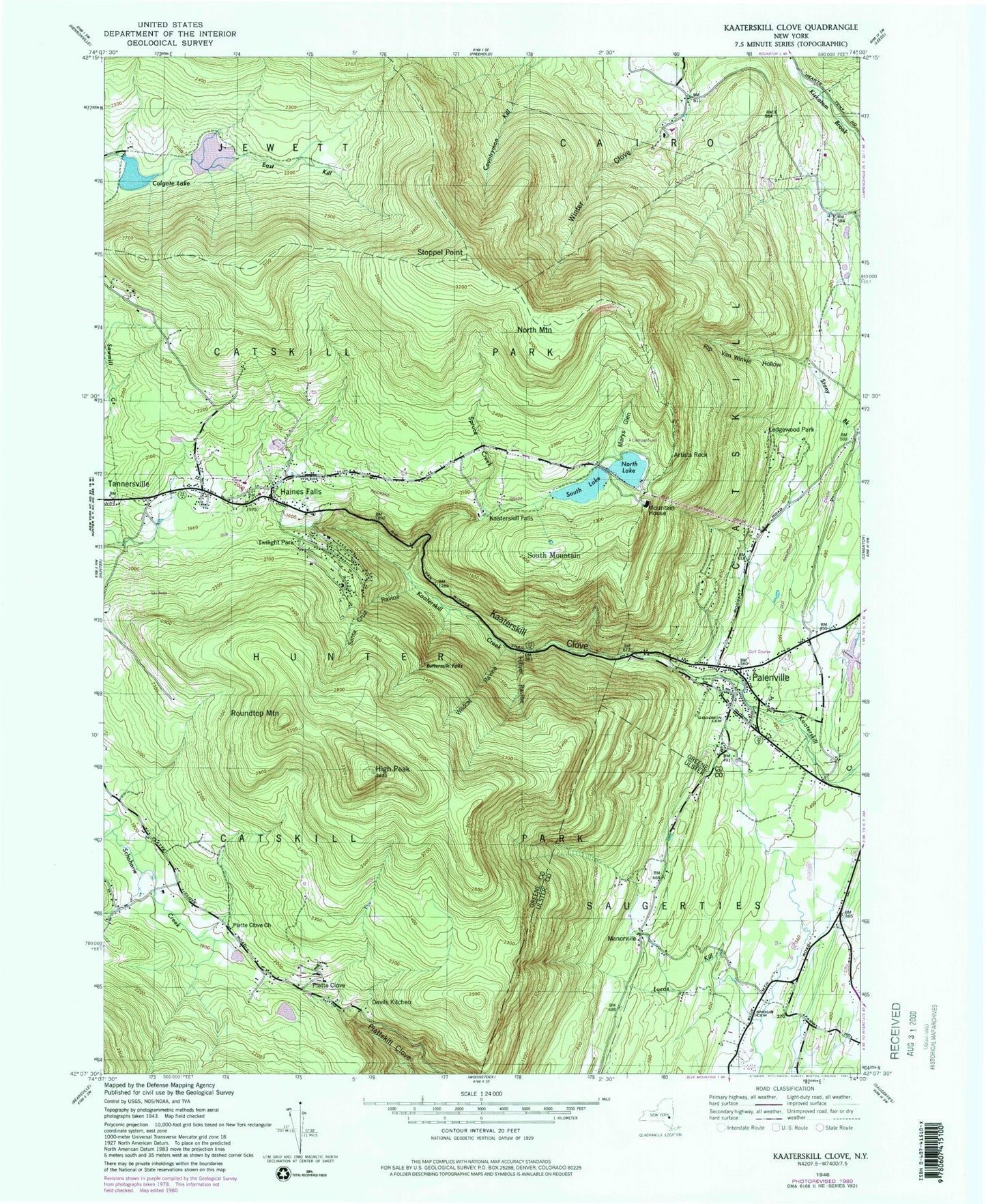
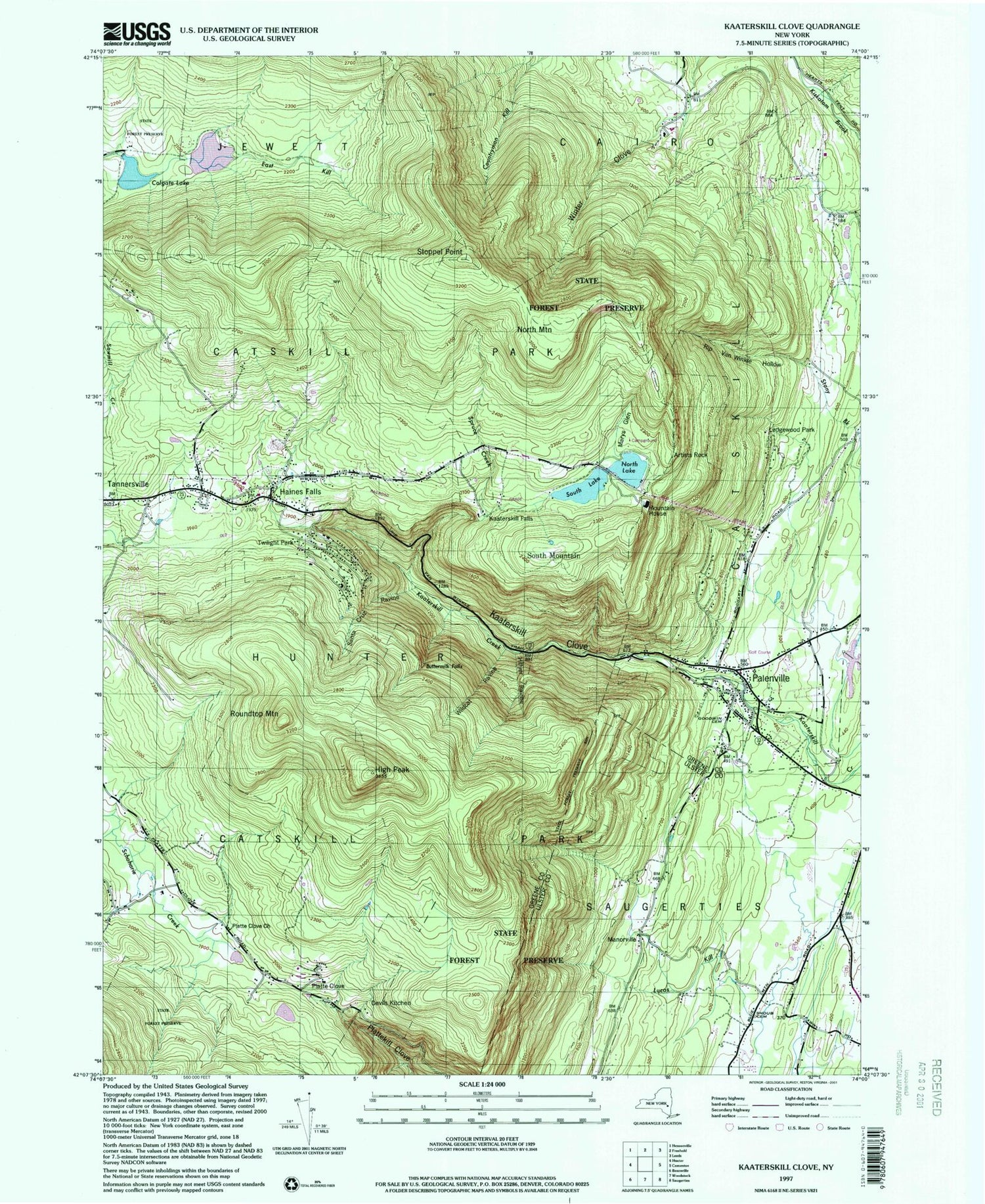
Classic USGS Kaaterskill Clove New York 7.5'x7.5' Topo Map
Couldn't load pickup availability
Historical USGS topographic quad map of Kaaterskill Clove in the state of New York. Typical map scale is 1:24,000, but may vary for certain years, if available. Print size: 24" x 27"
This quadrangle is in the following counties: Greene, Ulster.
The map contains contour lines, roads, rivers, towns, and lakes. Printed on high-quality waterproof paper with UV fade-resistant inks, and shipped rolled.
Contains the following named places: Artists Rock, Buttermilk Falls, Colgate Lake, Devils Kitchen, Goodwin Cemetery, Haines Falls, High Peak, Hillyer Ravine, Kaaterskill Clove, Kaaterskill Falls, Ledgewood Park, Manorville, Marys Glen, Mountain House, North Lake, North Mountain, Palenville, Platte Clove, Platte Clove Church, Rip Van Winkle Hollow, Roaring Kill, Roundtop Mountain, Santa Cruz Ravine, Shoub Cemetery, South Lake, South Mountain, Spruce Creek, Stoppel Point, Twilight Park, Wildcat Ravine, School Number 2 (historical), Palenville Census Designated Place, Haines Falls Cemetery, Palenville Village Cemetery, All Angels Episcopal Church, Immaculate Conception Church, Sacred Heart Church, Catskill Public Library Palenville Branch, Haines Falls Free Library, Haines Falls Post Office, Palenville Post Office, Saxton Sandstone Quarry, Hunter Ambulance Service, Palenville Fire Department, Haines Falls Volunteer Fire Company, Palenville Fire District, Saxton Katsbaan Volunteer Fire Company Saxton Station, Haines Falls Census Designated Place