
MyTopo
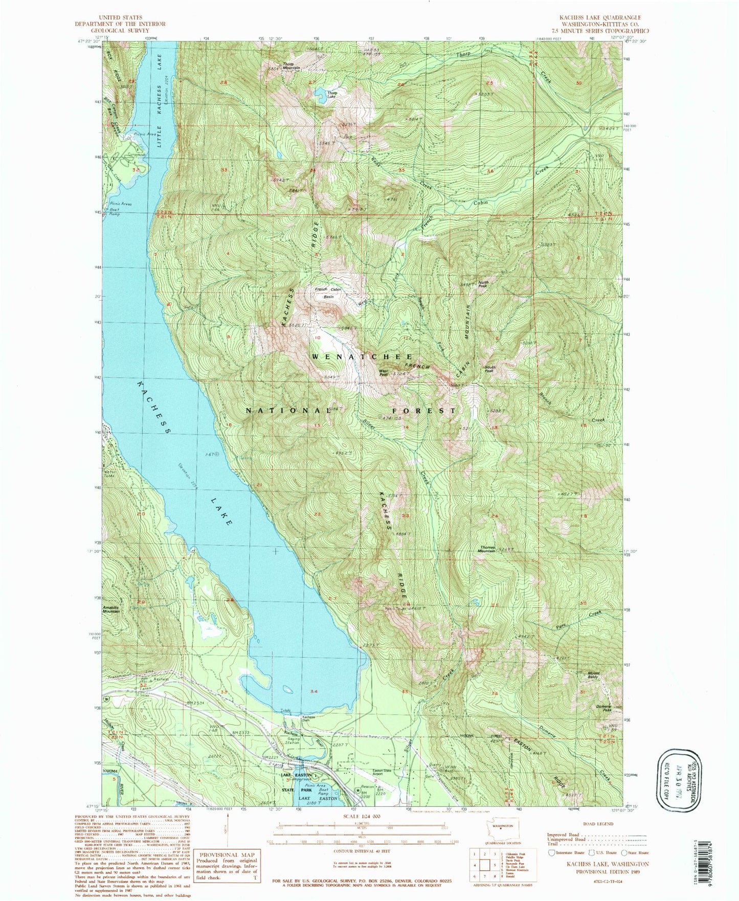
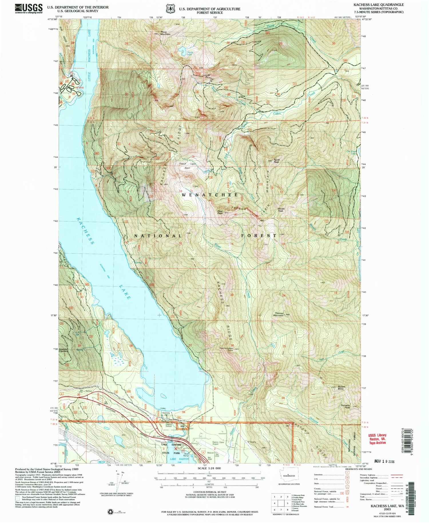
Classic USGS Kachess Lake Washington 7.5'x7.5' Topo Map
Couldn't load pickup availability
Historical USGS topographic quad map of Kachess Lake in the state of Washington. Map scale may vary for some years, but is generally around 1:24,000. Print size is approximately 24" x 27"
This quadrangle is in the following counties: Kittitas.
The map contains contour lines, roads, rivers, towns, and lakes. Printed on high-quality waterproof paper with UV fade-resistant inks, and shipped rolled.
Contains the following named places: Box Canyon Creek, Branch Creek, City of Roslyn, Domerie Peak, Domerie Peak Trail, Easton Ridge, Easton Sno-Park, Easton State Airport, Forest Camp Kachess, French Cabin Basin, French Cabin Mountain, Gale Creek, Hudson Creek, Kachess Campground, Kachess Dam, Kachess Lake, Kachess Ridge, Kachess Ridge Trail, Kachess River, Kittitas County Fire District 8 Station 81, Knox Creek, Lake Easton State Park, Mount Baldy, North Peak, South Fork French Cabin Creek, South Peak, Thomas Mountain, Thorp Lake, Thorp Mountain, Thorp Mountain Lookout, West Fork French Cabin Creek, West Peak