MyTopo
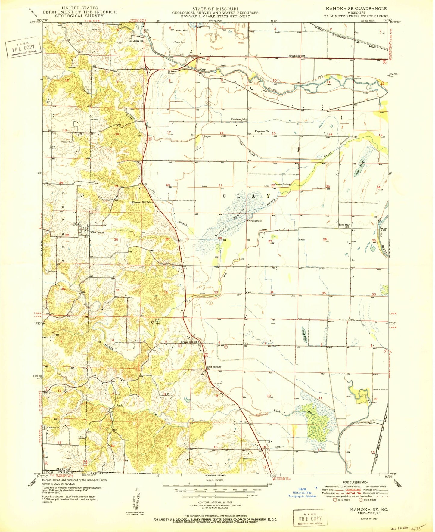
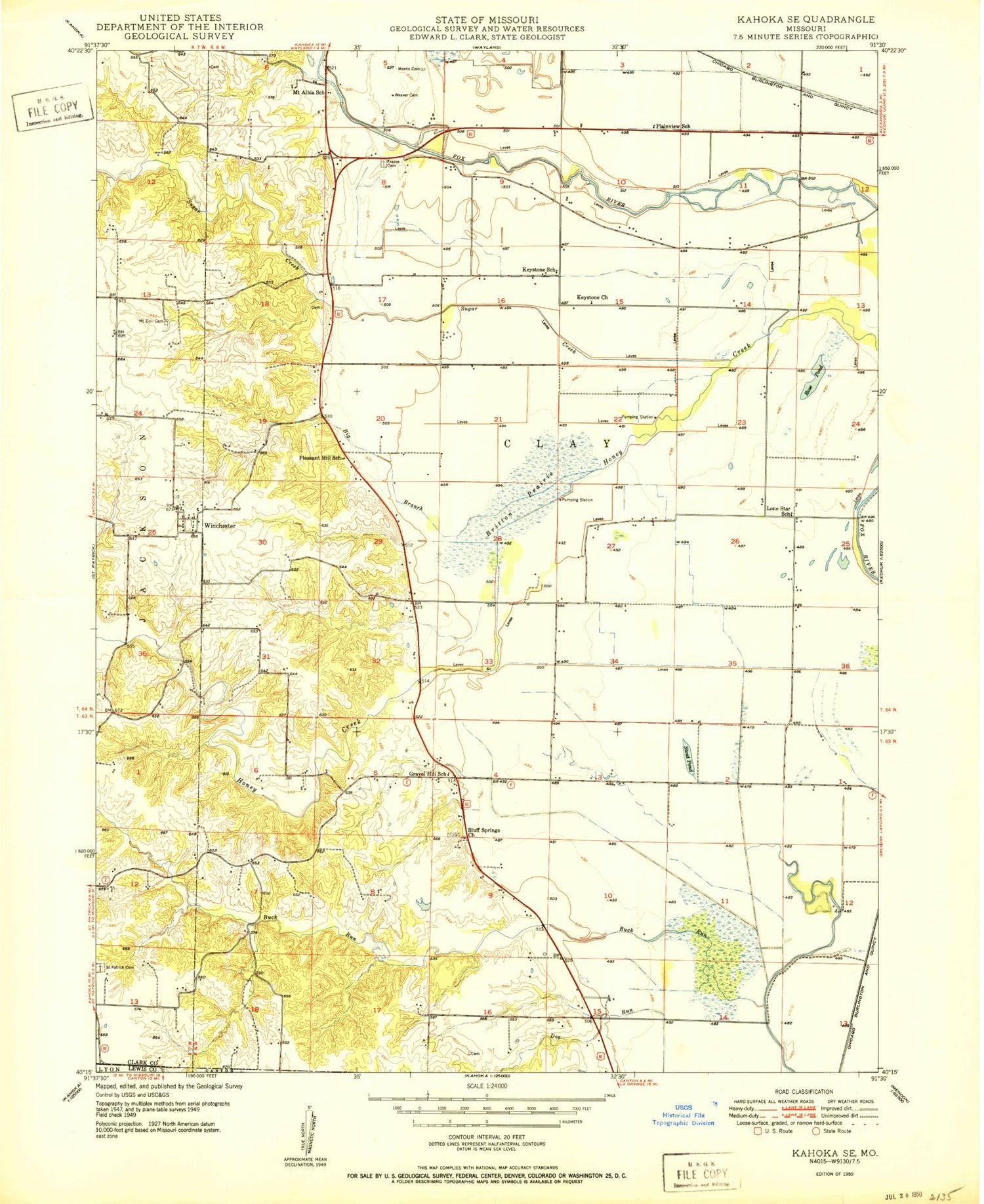
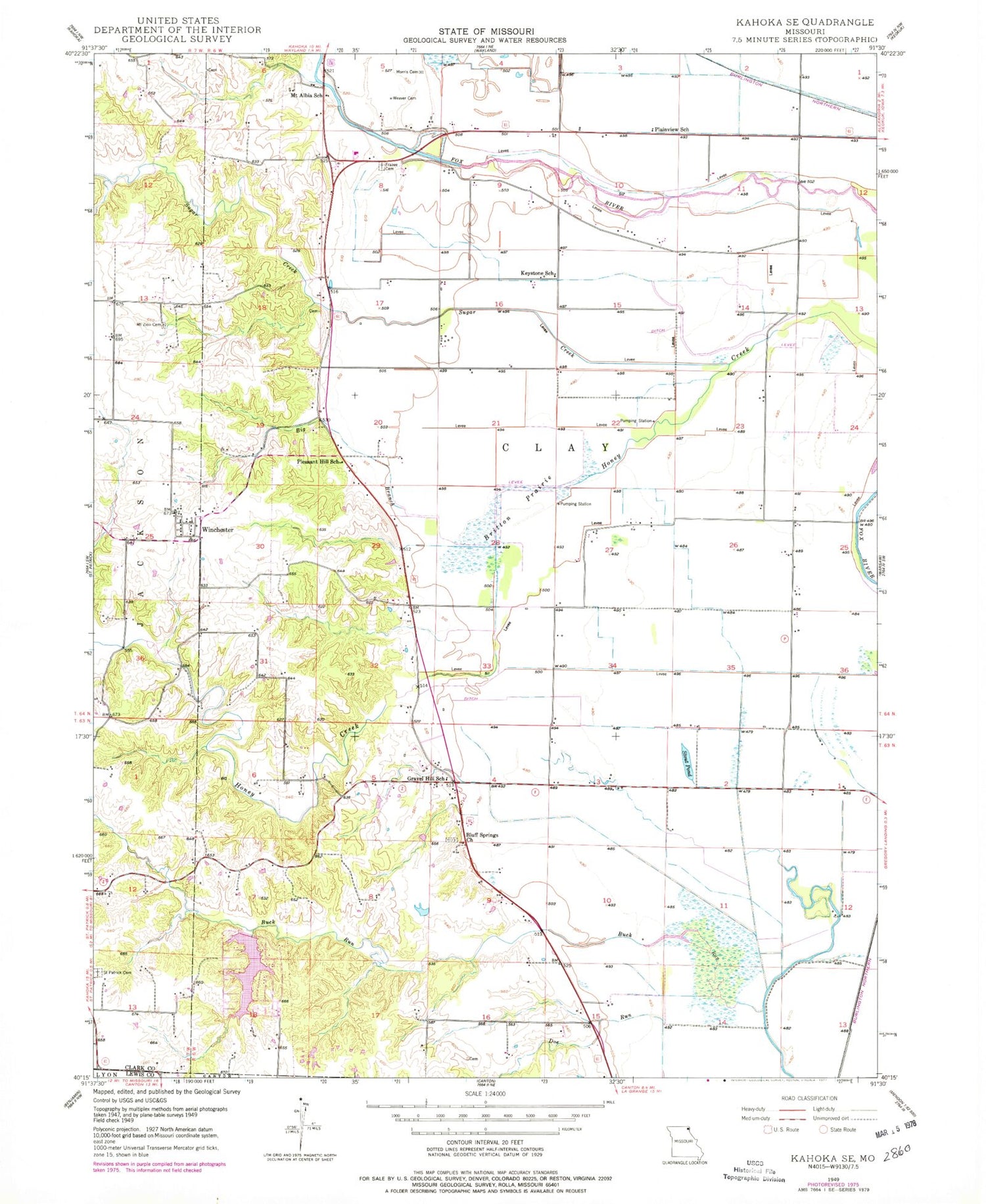
Classic USGS Kahoka SE Missouri 7.5'x7.5' Topo Map
Couldn't load pickup availability
Historical USGS topographic quad map of Kahoka SE in the state of Missouri. Map scale may vary for some years, but is generally around 1:24,000. Print size is approximately 24" x 27"
This quadrangle is in the following counties: Clark, Lewis.
The map contains contour lines, roads, rivers, towns, and lakes. Printed on high-quality waterproof paper with UV fade-resistant inks, and shipped rolled.
Contains the following named places: Big Branch, Bluff Springs Church, Britton Prairie, Buck-Doe Run Creeks Watershed 32 Dam, Buck-Doe Run Watershed Structure Number 2 Dam, Frazee Cemetery, Gravel Hill School, Keystone Church, Keystone School, Lake of the Oaks, Lake of the Oaks Dam, Lone Star School, Morris Cemetery, Mount Albia School, Mount Zion Cemetery, Plainview School, Pleasant Hill School, Rose Pond, Saint Patrick Cemetery, Stone Pond, Sugar Creek, Township of Clay, Weaver Cemetery, Winchester