
MyTopo
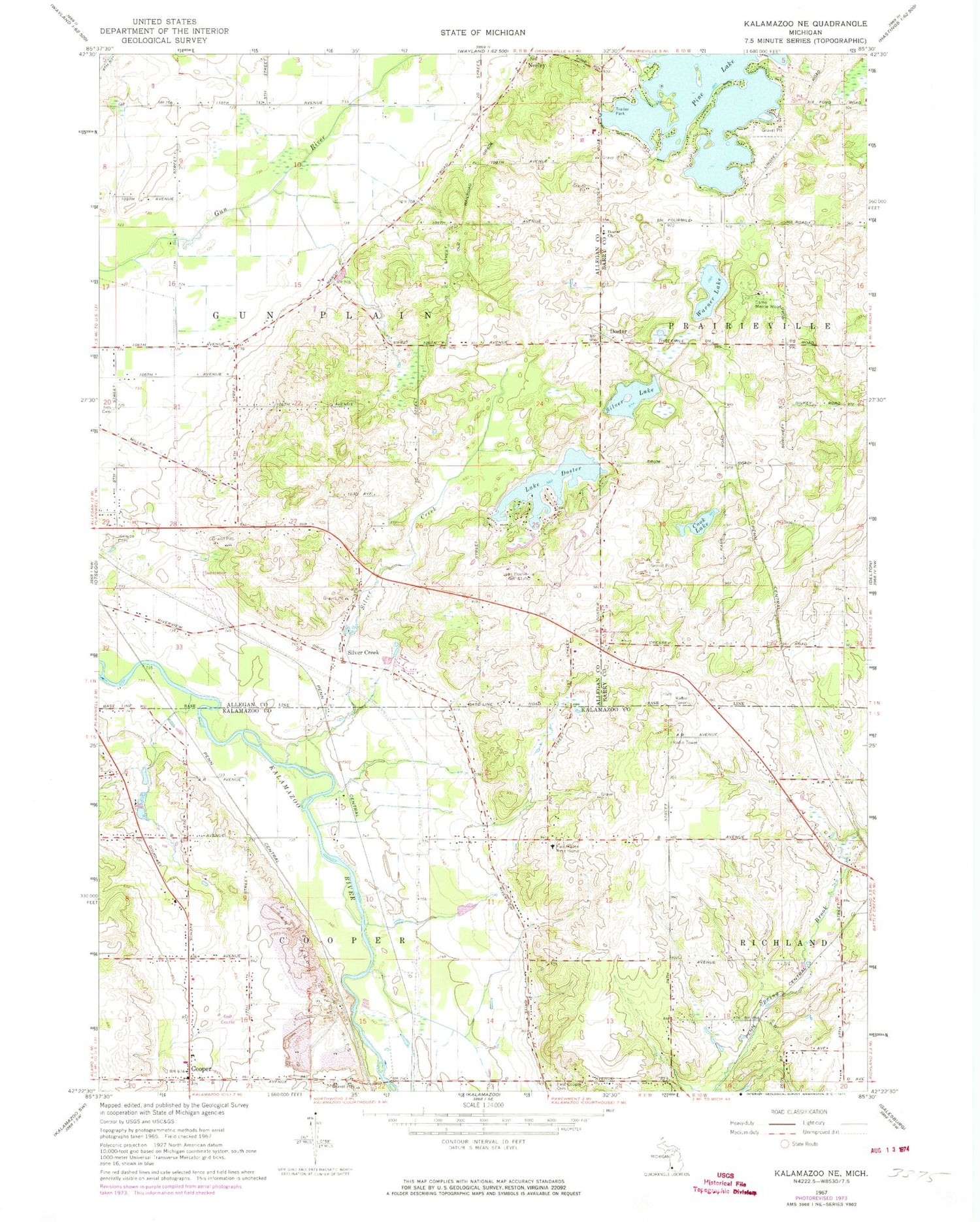
Classic USGS Kalamazoo NE Michigan 7.5'x7.5' Topo Map
Couldn't load pickup availability
Historical USGS topographic quad map of Kalamazoo NE in the state of Michigan. Map scale may vary for some years, but is generally around 1:24,000. Print size is approximately 24" x 27"
This quadrangle is in the following counties: Allegan, Barry, Kalamazoo.
The map contains contour lines, roads, rivers, towns, and lakes. Printed on high-quality waterproof paper with UV fade-resistant inks, and shipped rolled.
Contains the following named places: Camp Merrie Wood, Canaanland Church of God, Charter Township of Cooper, Cook Lake, Cooper, Cooper Post Office, Cooper Station, Cooper Township Fire Department Station 1, Doster, Doster Church, Doster Post Office, Doster Station, East Cooper Cemetery, Evergreen Park Mobile Home Park, Gun Plain Charter Township Fire Department, Gun Plains Township Cemetery, Hillside Cemetery, Ives Cemetery, Lake Doster, Lake Doster Golf Club, Lighthouse Baptist Church, Pine Lake, Plainwell Pines Nursing Center, Prairieville Township Fire Department, Silver Creek, Silver Lake, Silvercreek Post Office, Township of Gun Plain, Walker Airport, Warner Lake, WMUK-FM (Kalamazoo), ZIP Code: 49080


