MyTopo
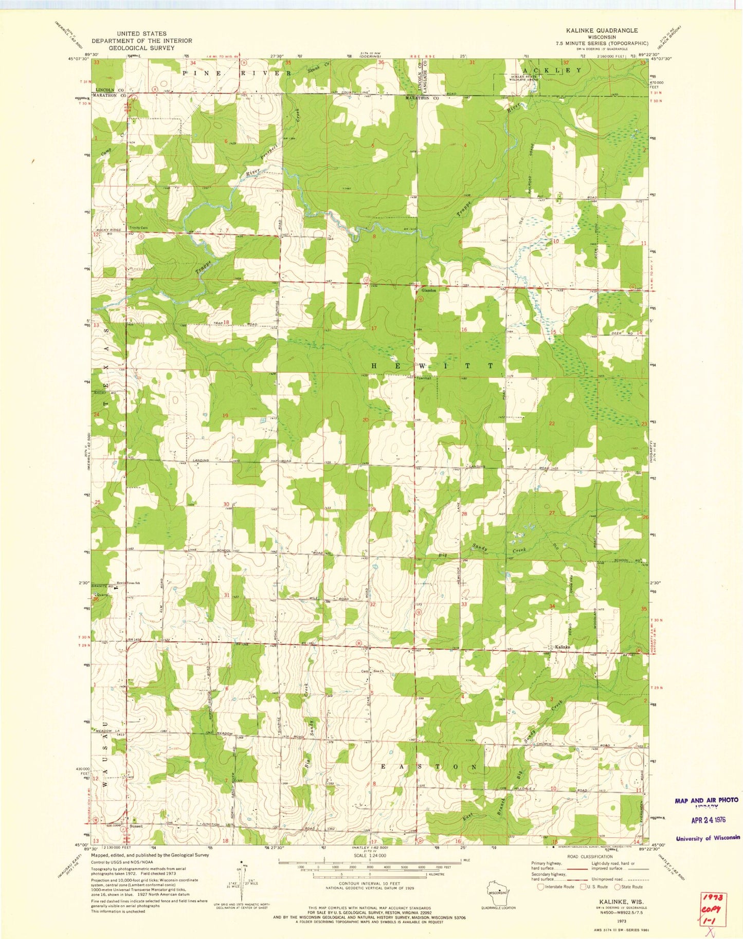
Classic USGS Kalinke Wisconsin 7.5'x7.5' Topo Map
Couldn't load pickup availability
Historical USGS topographic quad map of Kalinke in the state of Wisconsin. Map scale may vary for some years, but is generally around 1:24,000. Print size is approximately 24" x 27"
This quadrangle is in the following counties: Langlade, Lincoln, Marathon.
The map contains contour lines, roads, rivers, towns, and lakes. Printed on high-quality waterproof paper with UV fade-resistant inks, and shipped rolled.
Contains the following named places: Blue Ridge Dairy, Calvary Cemetery, Deffner Farms, Farrell School, Glandon, Hewitt - Texas Elementary School, Hewitt Townhall, Hewitt Township Volunteer Fire Department, Kalinke, Knight Sky Airport, Little Nienow Flowage, McMynn School, Motl 1 G12 121 Dam, Prospect Creek, Skunk Creek, Spring Hill Farm, Sunrise School, Sunset, Town of Hewitt, Trappe River School, Trinity Church, WYCO-FM (Wausau), Zion Cemetery, Zion Church