MyTopo
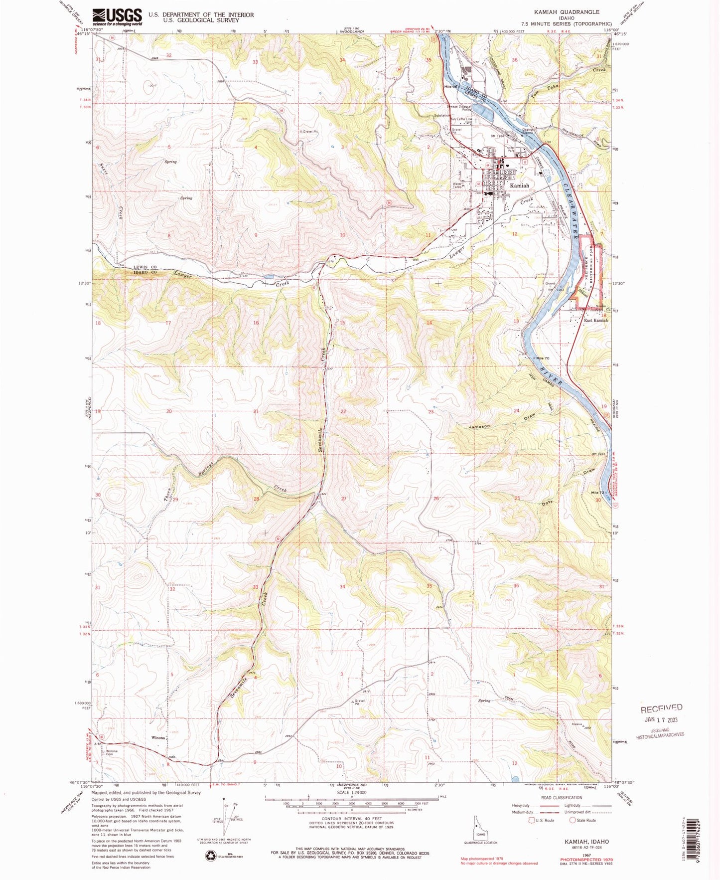
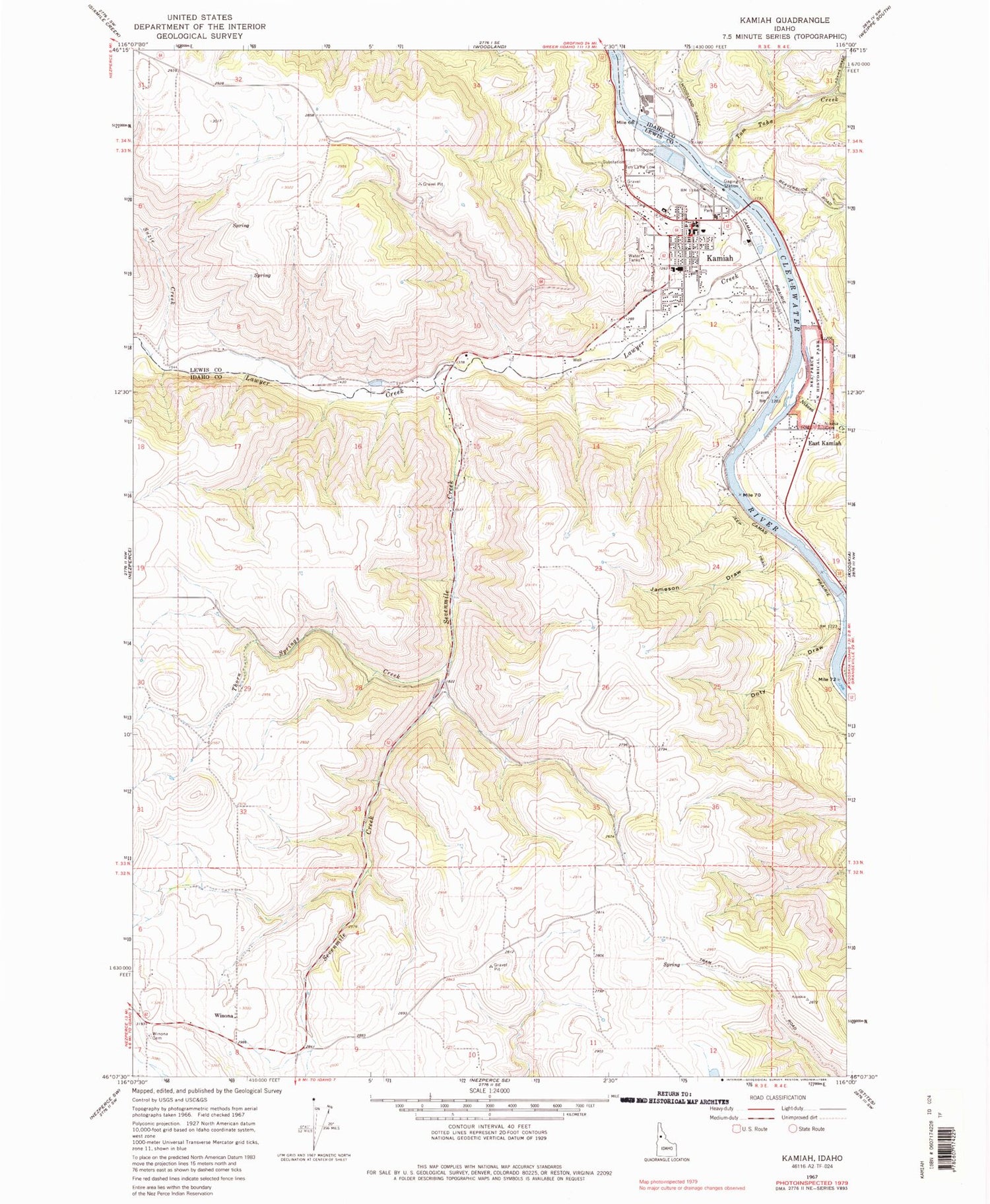
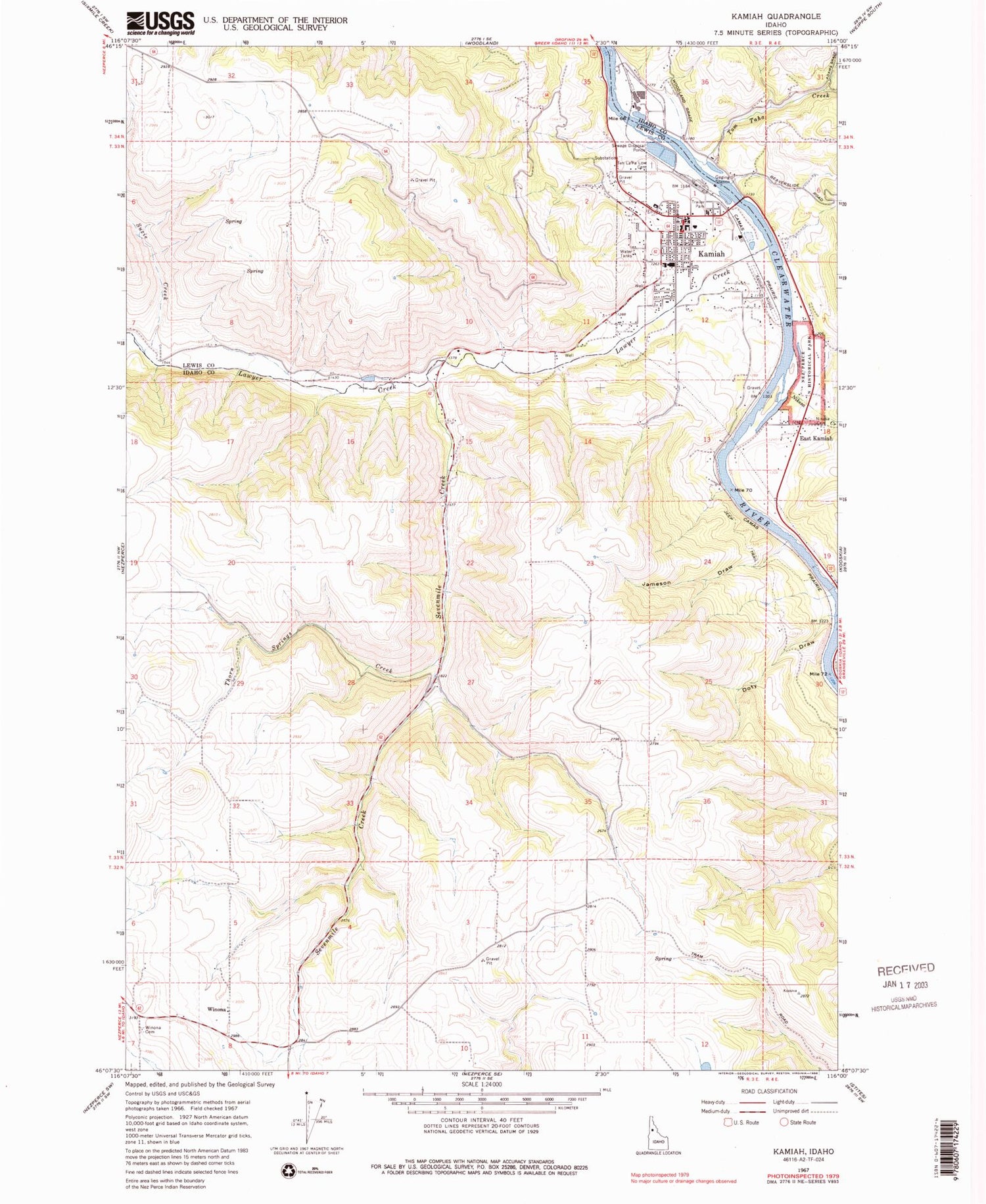
Classic USGS Kamiah Idaho 7.5'x7.5' Topo Map
Couldn't load pickup availability
Historical USGS topographic quad map of Kamiah in the state of Idaho. Map scale may vary for some years, but is generally around 1:24,000. Print size is approximately 24" x 27"
This quadrangle is in the following counties: Idaho, Lewis.
The map contains contour lines, roads, rivers, towns, and lakes. Printed on high-quality waterproof paper with UV fade-resistant inks, and shipped rolled.
Contains the following named places: Church Canyon, City of Kamiah, Doty Draw, East Kamiah, Heart of the Monster Point of Interest, Jameson Draw, Kamiah, Kamiah Division, Kamiah Elementary School, Kamiah High School, Kamiah Holding Ponds, Kamiah Municipal Airport, Kamiah Police Department, Kamiah Post Office, Kamiah Volunteer Fire Department, Lawyer Creek, Long Camp and ASA Smith Mission, Nikesa Cemetery, Nikesa Creek, Pierce Ranger Station, Riverfront Park, Sevenmile Creek, Suzie Creek, Teh LaPa Low Cemetery, Thorn Springs Creek, Tom Taha Creek, Winona, Winona Cemetery, ZIP Code: 83536