MyTopo
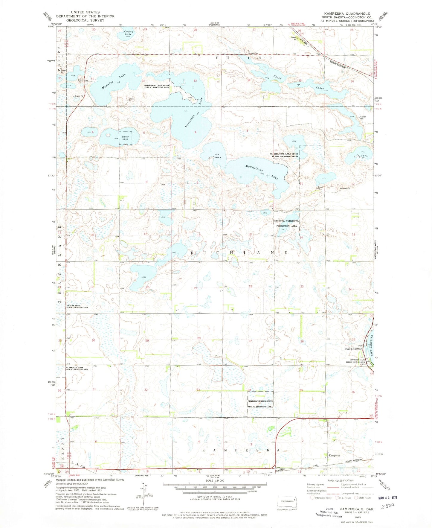
Classic USGS Kampeska South Dakota 7.5'x7.5' Topo Map
Couldn't load pickup availability
Historical USGS topographic quad map of Kampeska in the state of South Dakota. Map scale may vary for some years, but is generally around 1:24,000. Print size is approximately 24" x 27"
This quadrangle is in the following counties: Codington.
The map contains contour lines, roads, rivers, towns, and lakes. Printed on high-quality waterproof paper with UV fade-resistant inks, and shipped rolled.
Contains the following named places: Chain of Lakes, Christopherson State Public Shooting Area, Clarksean State Public Shooting Area, Hanten State Public Shooting Area, Horseshoe Lake, Horseshoe Lake State Public Shooting Area, Kampeska, Kampeska Census Designated Place, Lynwood State Public Access Area, McKillicans Lake, McKillicans Lake State Public Shooting Area, Medicine Lake, Serenity Lake, Spencer State Public Shooting Area, Township of Richland