
MyTopo
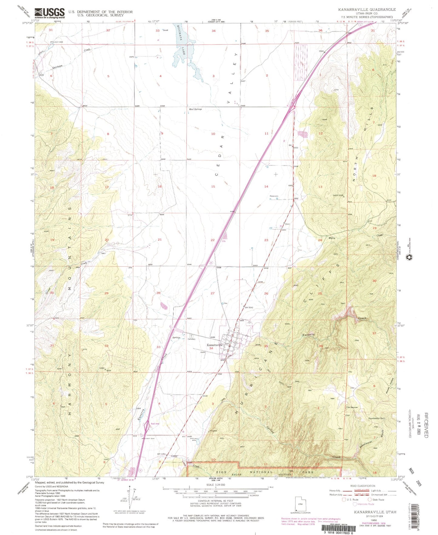
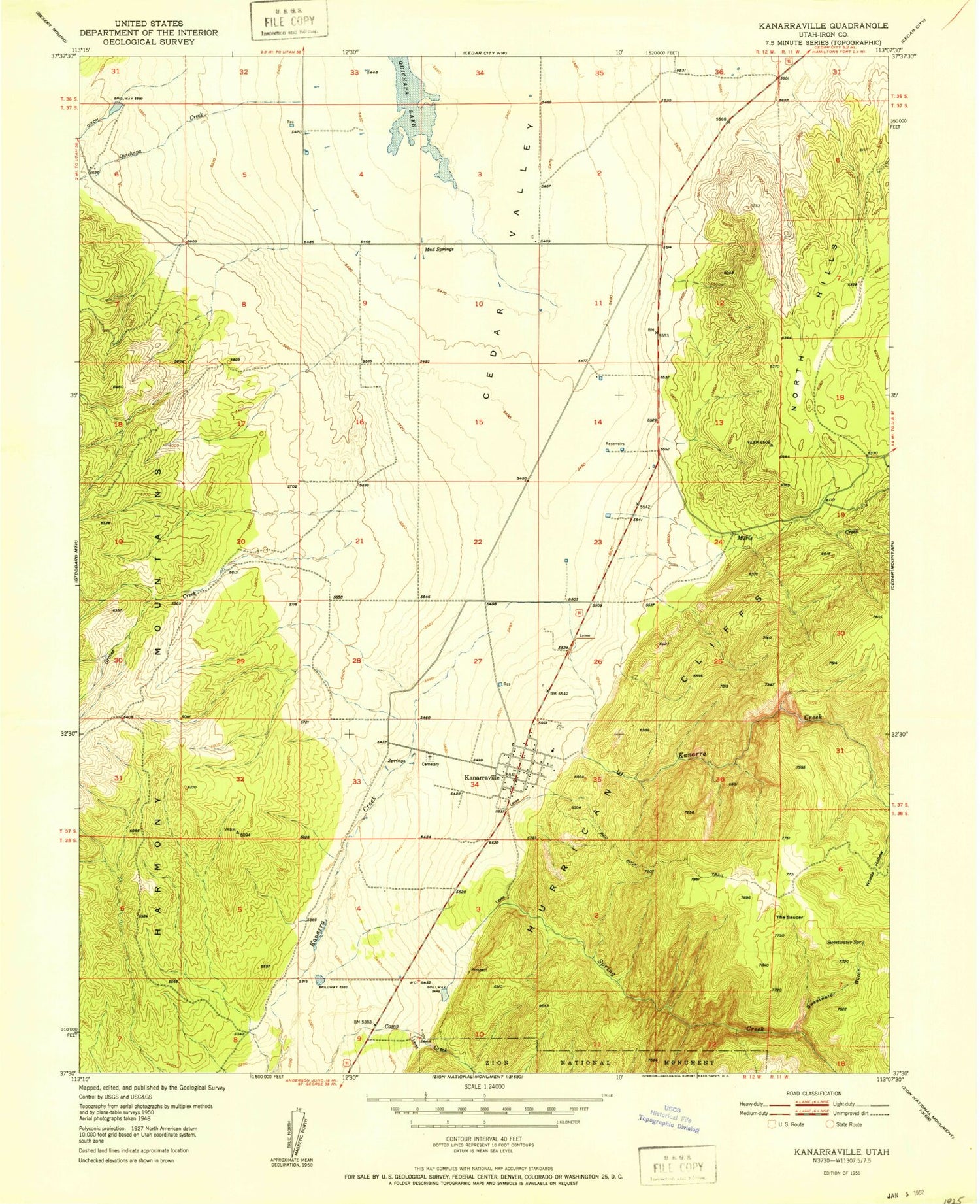
Classic USGS Kanarraville Utah 7.5'x7.5' Topo Map
Couldn't load pickup availability
Historical USGS topographic quad map of Kanarraville in the state of Utah. Map scale may vary for some years, but is generally around 1:24,000. Print size is approximately 24" x 27"
This quadrangle is in the following counties: Iron.
The map contains contour lines, roads, rivers, towns, and lakes. Printed on high-quality waterproof paper with UV fade-resistant inks, and shipped rolled.
Contains the following named places: Escalante Interpretive Site, Groves Creek, Hamiltons Fort, Harris Gubler Dam, Harris Gubler Reservoir, Kanarraville, Kanarraville Cemetery, Kanarraville Fire Department, Kanarraville Post Office, Mud Springs, Murie Creek, North Hills, Paiute Indian Reservation, Quichapa Creek, Spring Creek, Sweetwater Gulch, Sweetwater Spring, The Church of Jesus Christ of Latter Day Saints, The Saucer, Town of Kanarraville, ZIP Codes: 84720, 84742