
MyTopo
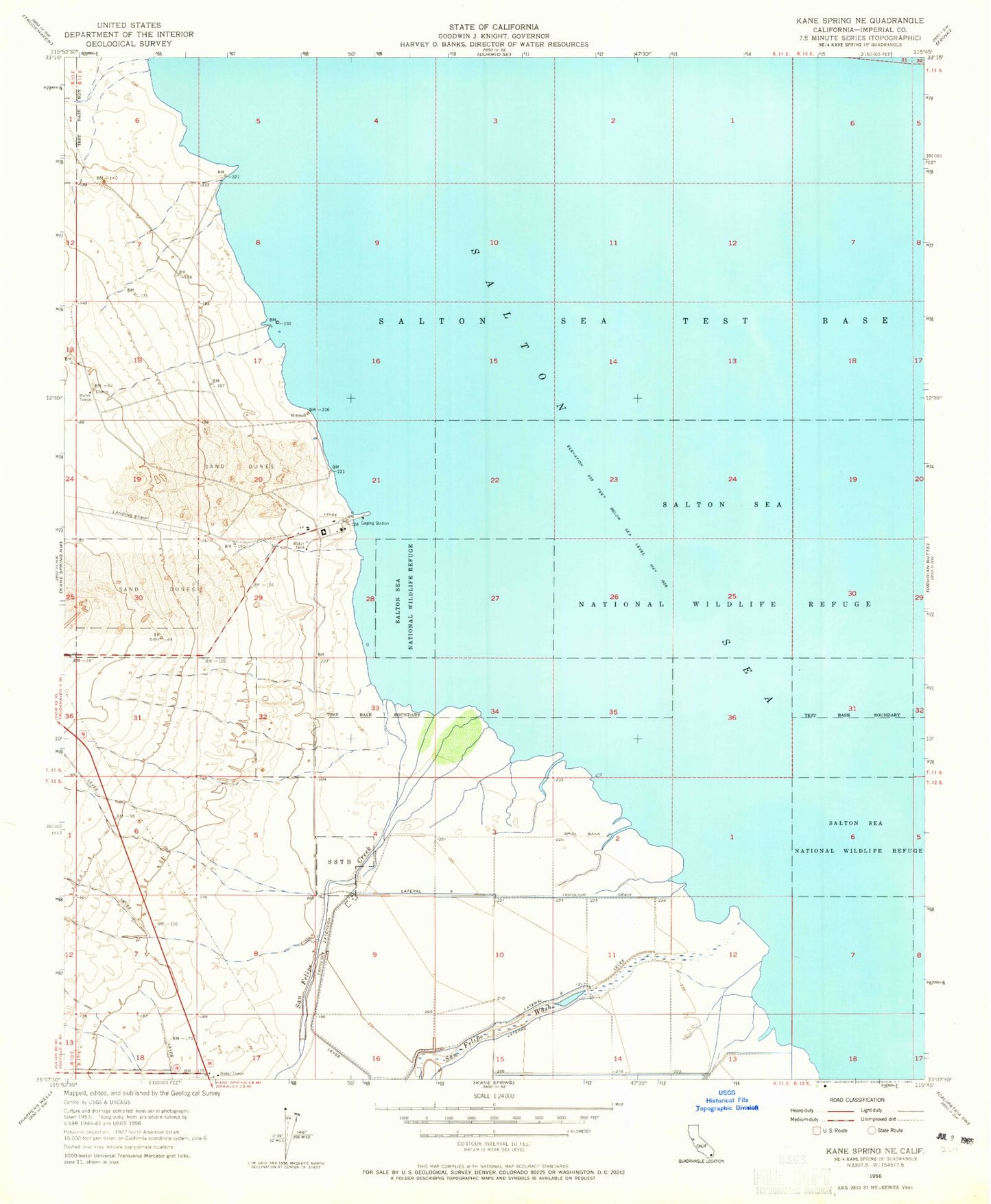
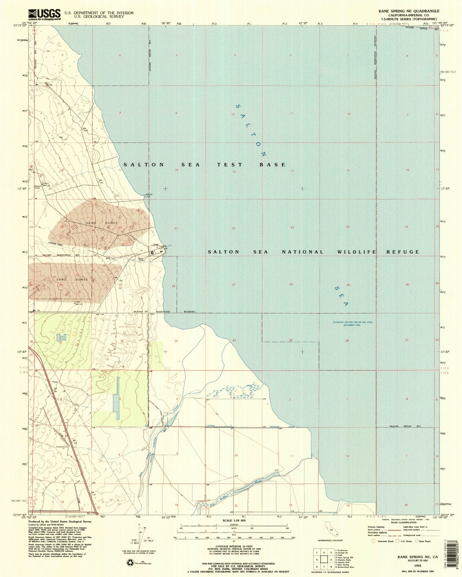
Classic USGS Kane Spring NE California 7.5'x7.5' Topo Map
Regular price
$16.95
Regular price
Sale price
$16.95
Unit price
per
Couldn't load pickup availability
Historical USGS topographic quad map of Kane Spring NE in the state of California. Map scale may vary for some years, but is generally around 1:24,000. Print size is approximately 24" x 27"
This quadrangle is in the following counties: Imperial.
The map contains contour lines, roads, rivers, towns, and lakes. Printed on high-quality waterproof paper with UV fade-resistant inks, and shipped rolled.
Contains the following named places: Lateral Eight, Lateral Nine, Lateral Seven, Naval Auxiliary Air Station Salton Sea, San Felipe Creek, San Felipe Wash, Sandy Beach, Sea View Beach, Sonny Bono Salton Sea National Wildlife Refuge, Trifolium Drain