MyTopo
Classic USGS Kane Spring California 7.5'x7.5' Topo Map
Regular price
$16.95
Regular price
Sale price
$16.95
Unit price
per
Couldn't load pickup availability
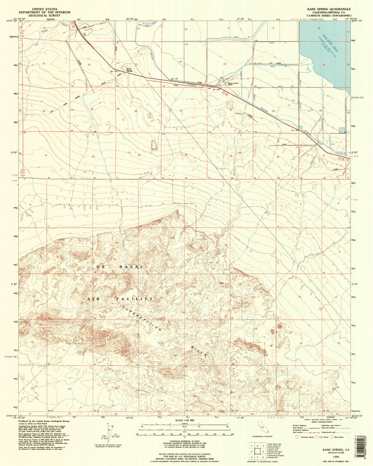
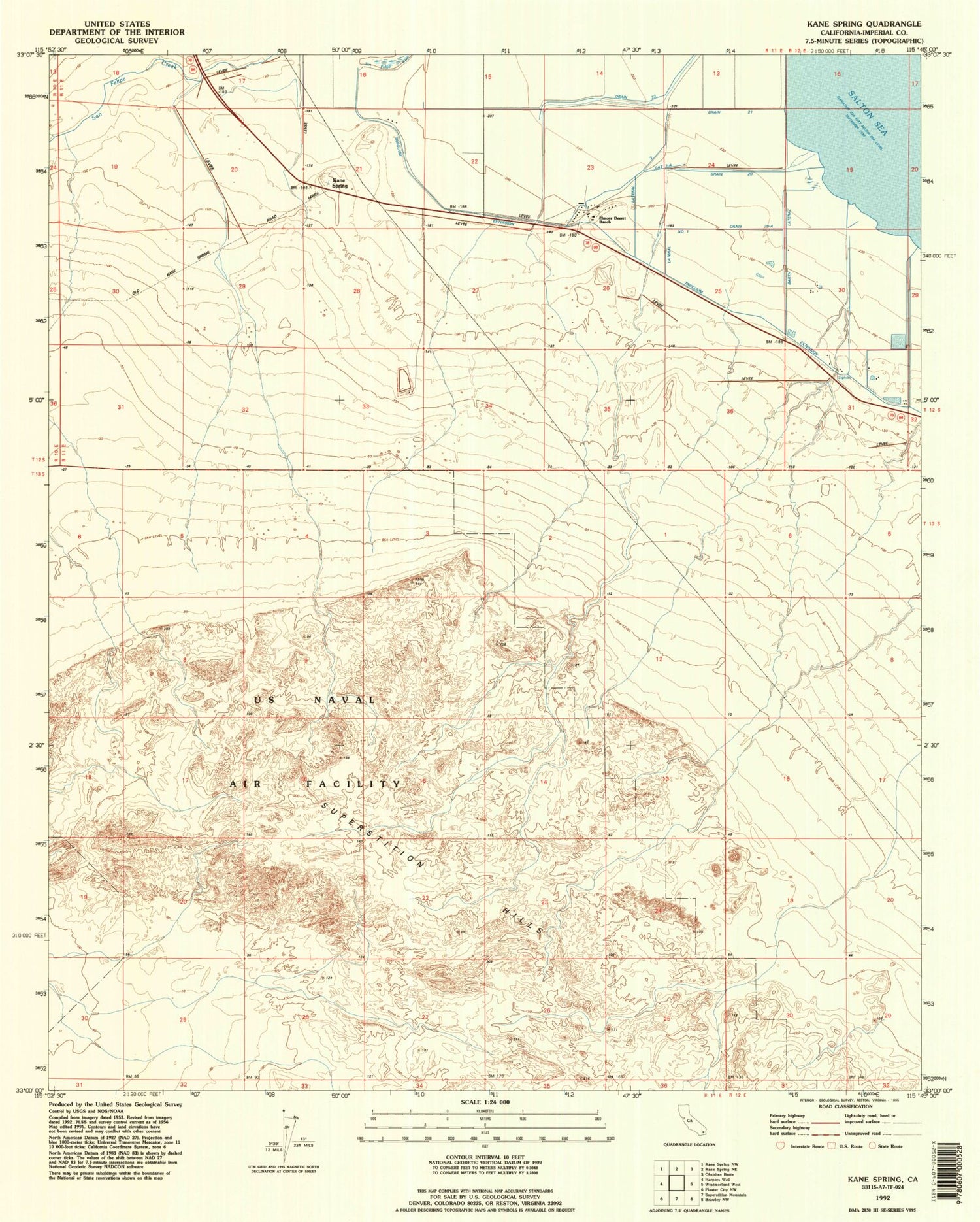
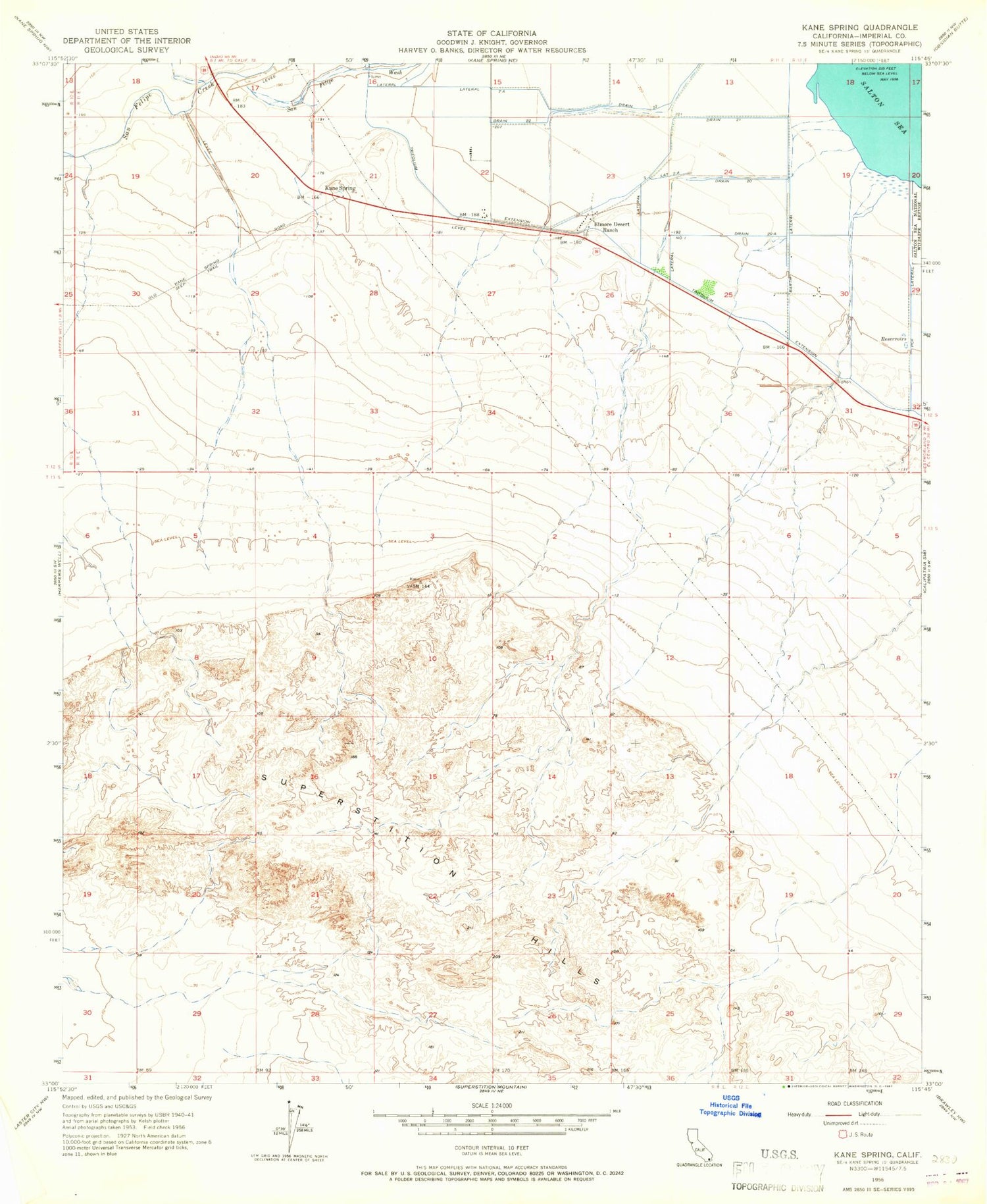
Historical USGS topographic quad map of Kane Spring in the state of California. Map scale may vary for some years, but is generally around 1:24,000. Print size is approximately 24" x 27"
This quadrangle is in the following counties: Imperial.
The map contains contour lines, roads, rivers, towns, and lakes. Printed on high-quality waterproof paper with UV fade-resistant inks, and shipped rolled.
Contains the following named places: Barth Lateral, Drain Twenty, Drain Twenty-A, Drain Twenty-One, Drain Twenty-Two, Elmore Desert Ranch, Kane Spring, Lateral Number One, Lateral Seven-A, Lateral Two, Lateral Two-A, Roosevelt School, Superstition Hills, Trifolium Extension