MyTopo
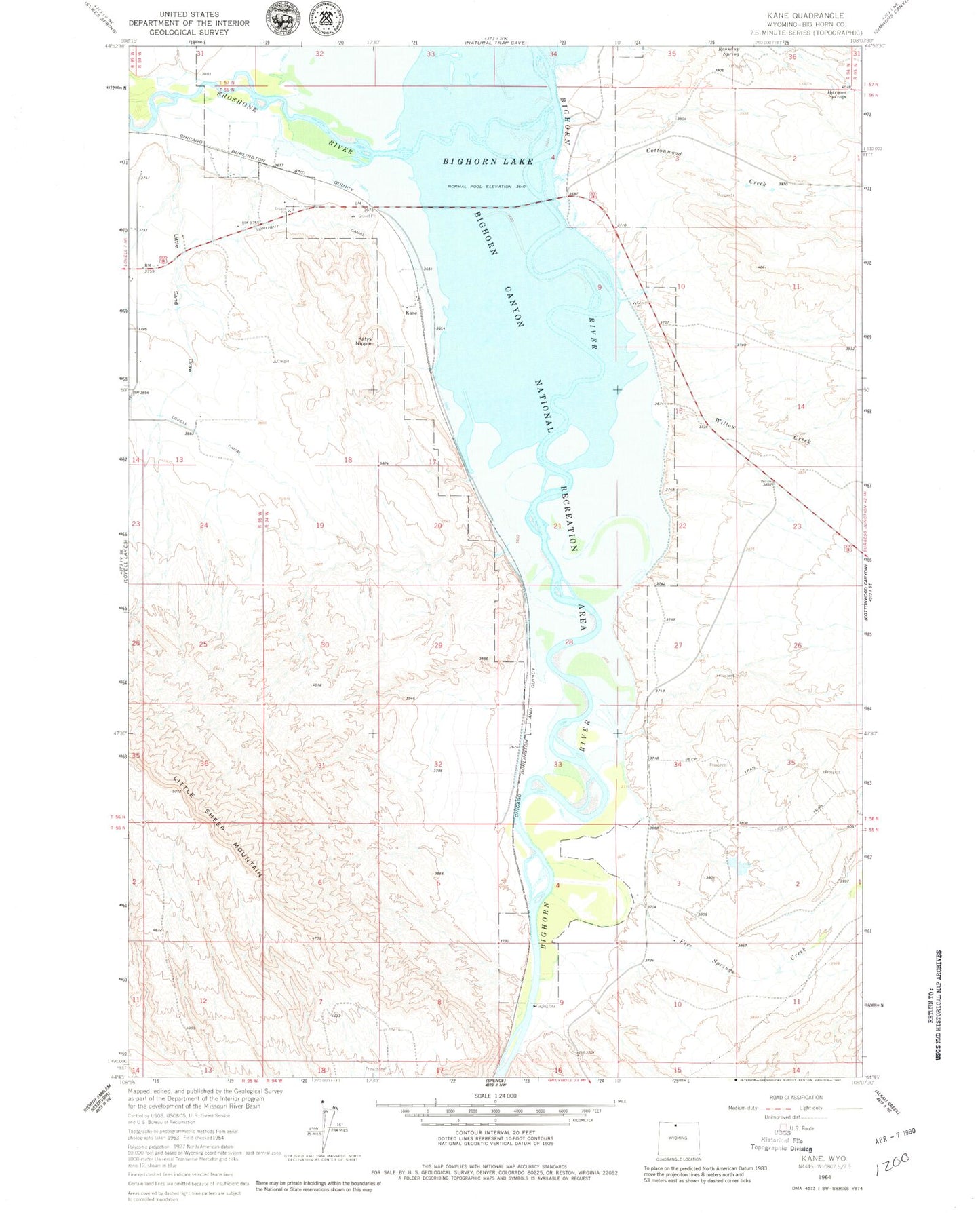
Classic USGS Kane Wyoming 7.5'x7.5' Topo Map
Couldn't load pickup availability
Historical USGS topographic quad map of Kane in the state of Wyoming. Map scale may vary for some years, but is generally around 1:24,000. Print size is approximately 24" x 27"
This quadrangle is in the following counties: Big Horn.
The map contains contour lines, roads, rivers, towns, and lakes. Printed on high-quality waterproof paper with UV fade-resistant inks, and shipped rolled.
Contains the following named places: Big Horn River Mine, Bighorn Lake, Bischoff Creek Dam, Bischoff Creek Reservoir, Bureau of Land Management Pit Mine, Cottonwood Creek, Five Springs Creek, Five Springs Number 2 Dam, Five Springs Number 2 Reservoir, Harmon Springs, Kane, Katys Nipple, Little Sand Draw, Little Sheep Mountain Anticline Number Fourteen Mine, Little Sheep Mountain Anticline Number Twenty Mine, Roundup Spring, Shoshone River, Willow Creek, ZIP Code: 82431