MyTopo
Classic USGS Kangaroo Mountain California 7.5'x7.5' Topo Map
Couldn't load pickup availability
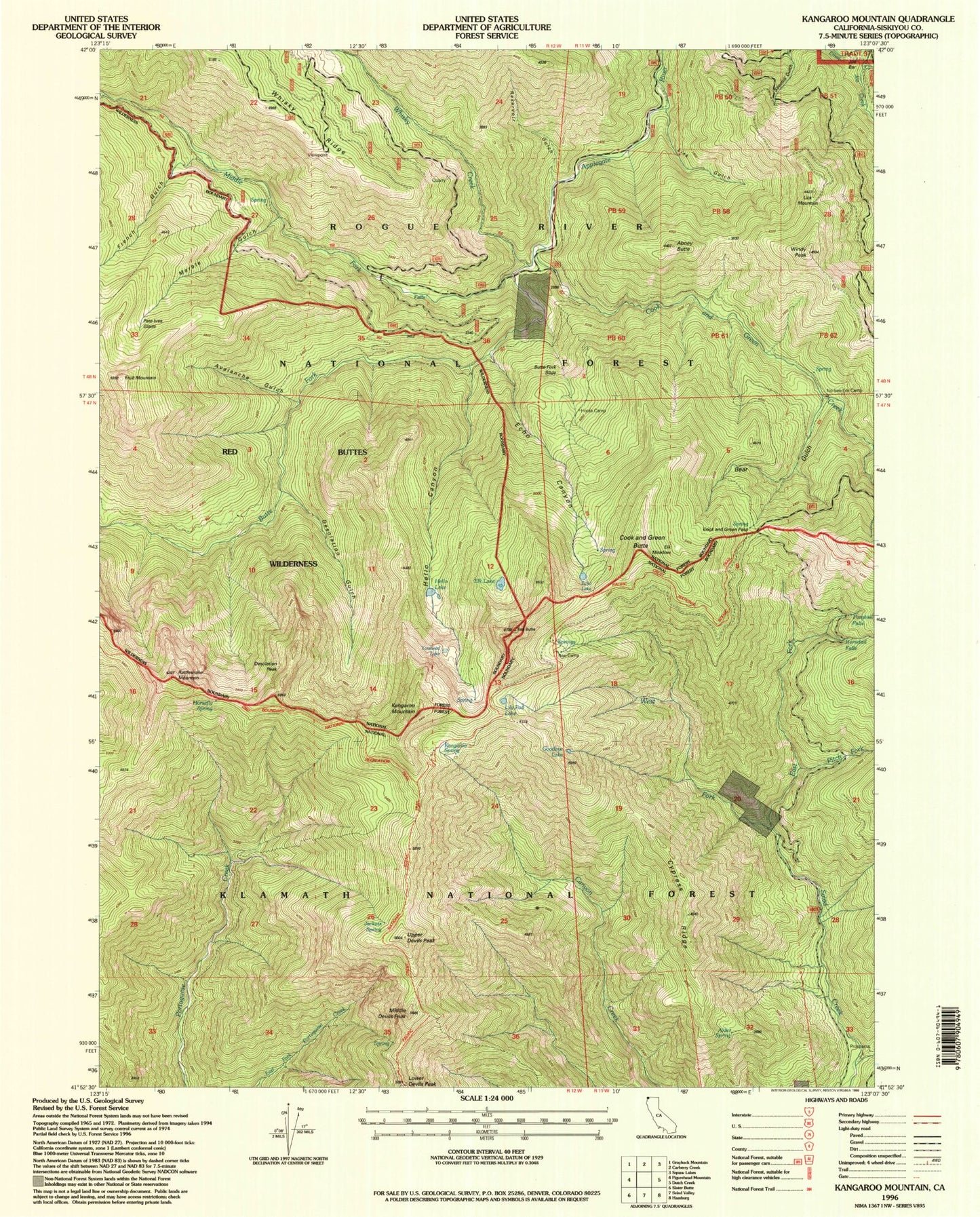
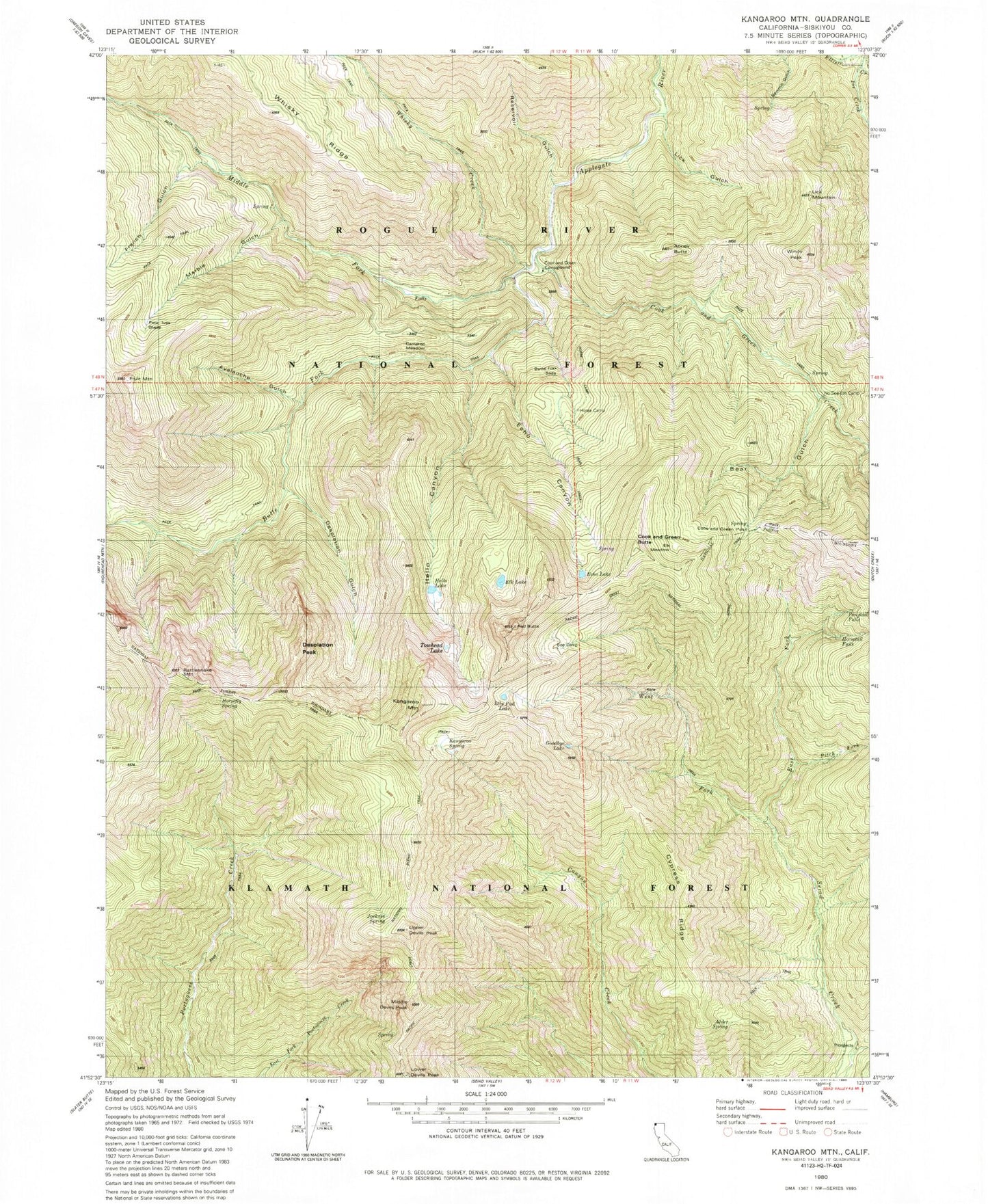
Historical USGS topographic quad map of Kangaroo Mountain in the state of California. Typical map scale is 1:24,000, but may vary for certain years, if available. Print size: 24" x 27"
This quadrangle is in the following counties: Siskiyou.
The map contains contour lines, roads, rivers, towns, and lakes. Printed on high-quality waterproof paper with UV fade-resistant inks, and shipped rolled.
Contains the following named places: Horsetail Falls, Alder Spring, Bear Gulch, Butte Fork Applegate River, Cameron Meadow, Cook and Green Campground, Cook and Green Creek, Cook and Green Pass, Desolation Gulch, East Fork Seiad Creek, Echo Lake, Elk Meadow, French Gulch, Fruit Mountain, Hello Canyon, Hello Lake, Jackass Spring, Joe Creek, Kangaroo Mountain, Lick Gulch, Lily Pad Lake, Marble Gulch, Middle Devils Peak, Middle Fork Applegate River, Panther Gulch, Rattlesnake Mountain, Red Butte, Upper Devils Peak, West Fork Seiad Creek, Whisky Creek, Windy Peak, Cook and Green Butte, Desolation Peak, Elk Lake, Towhead Lake, Avalanche Gulch, Bee Camp, Butte Fork Slide, Cypress Ridge, Echo Canyon, Goodbye Lake, Horse Camp, Horse Camp Trail, Horsefly Spring, Kangaroo Spring, No-See-Em Camp, Pete Ives Glade, Pitch Fork, Ponytail Falls, Reservoir Gulch, Abney Butte, Lick Mountain, Lower Devils Peak