
MyTopo
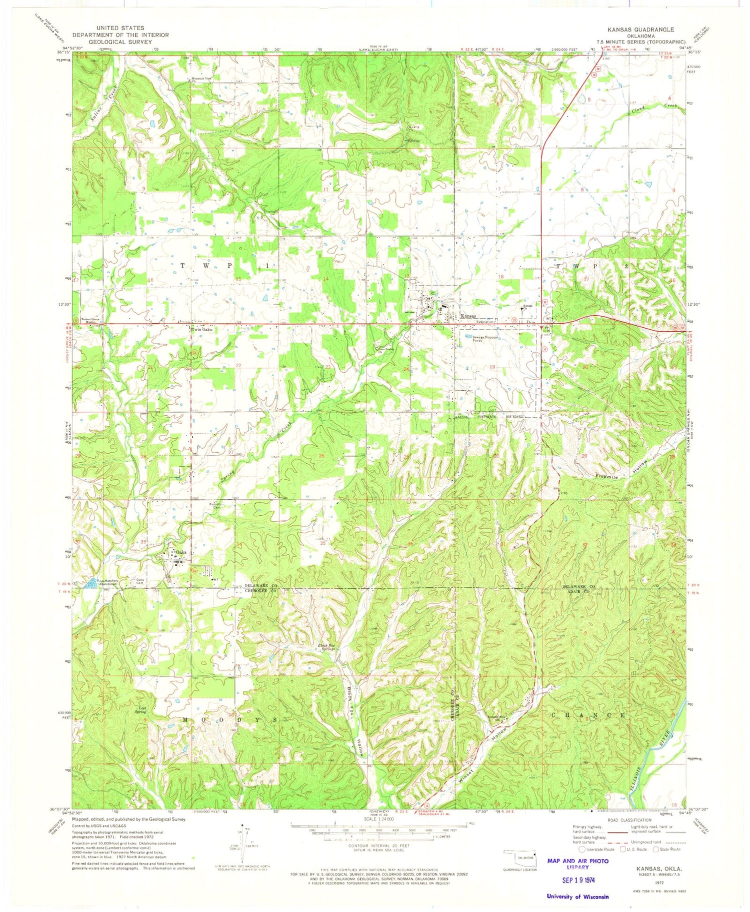
Classic USGS Kansas Oklahoma 7.5'x7.5' Topo Map
Couldn't load pickup availability
Historical USGS topographic quad map of Kansas in the state of Oklahoma. Map scale may vary for some years, but is generally around 1:24,000. Print size is approximately 24" x 27"
This quadrangle is in the following counties: Adair, Cherokee, Delaware.
The map contains contour lines, roads, rivers, towns, and lakes. Printed on high-quality waterproof paper with UV fade-resistant inks, and shipped rolled.
Contains the following named places: Black Fox Springs, Clear Creek Dam, Cookson Hills Christian School, Cookson Hills Christian School Airport, Deer Dam, Deer Lake, First Baptist Church, Flint Ridge Volunteer Fire Department, Galilean Church, Kansas, Kansas Cemetery, Kansas Church, Kansas Elementary School, Kansas High School, Kansas Middle School, Kansas Police Department, Kansas Post Office, Kansas Volunteer Fire Department, Long Prairie Baptist Church, Long Prairie Cemetery, Lost Spring, Mountain View Church, Northeast Technology Center Kansas Campus, Oaks, Oaks - Mission Elementary School, Oaks - Mission High School, Oaks Cemetery, Oaks Community, Oaks Post Office, Oaks Volunteer Fire Department, Russell Cemetery, Town of Kansas, Town of Oaks, Twin Oaks, Twin Oaks Census Designated Place, Walnut Grove Mission, ZIP Codes: 74347, 74359, 74368


