
MyTopo
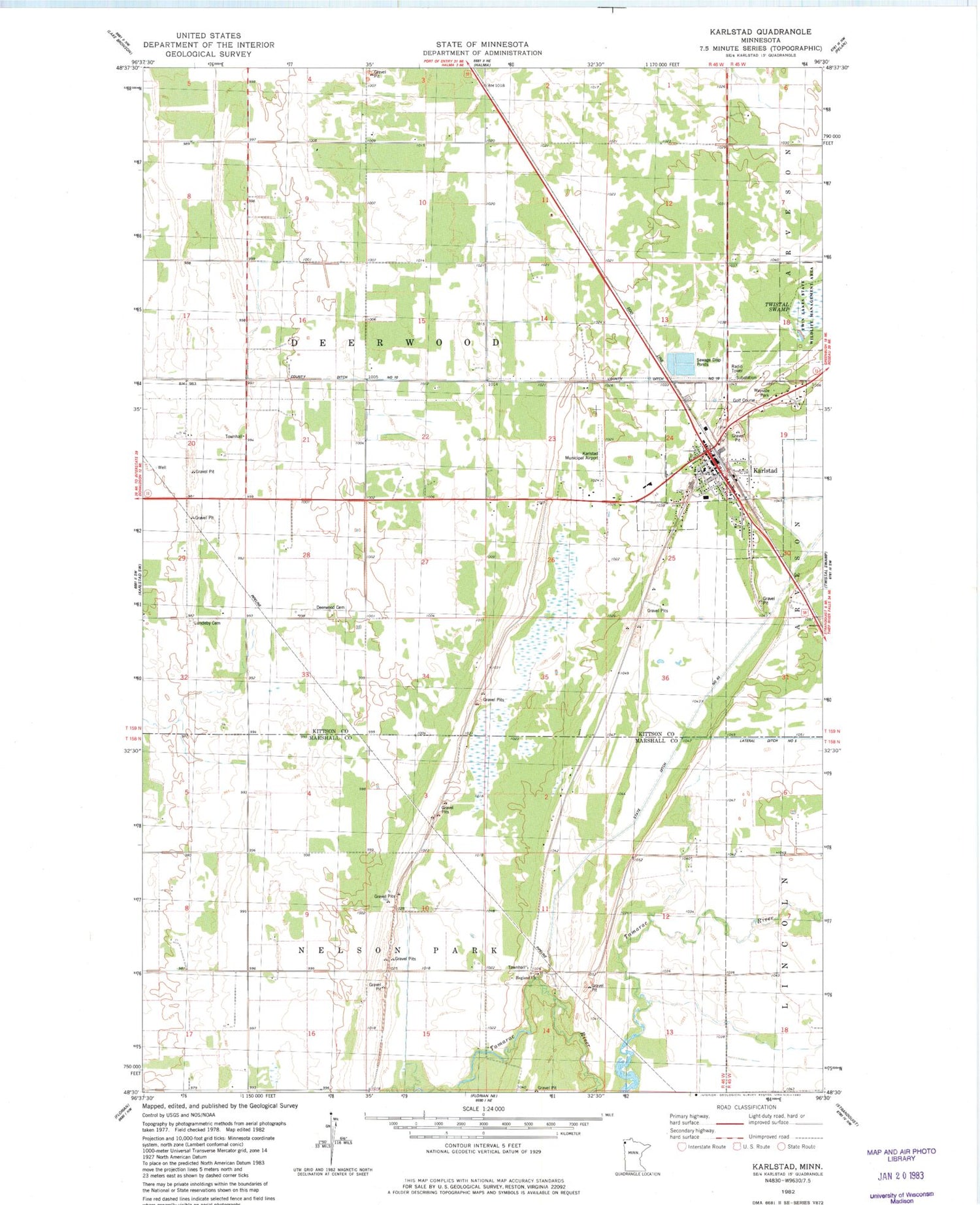
Classic USGS Karlstad Minnesota 7.5'x7.5' Topo Map
Couldn't load pickup availability
Historical USGS topographic quad map of Karlstad in the state of Minnesota. Map scale may vary for some years, but is generally around 1:24,000. Print size is approximately 24" x 27"
This quadrangle is in the following counties: Kittson, Marshall.
The map contains contour lines, roads, rivers, towns, and lakes. Printed on high-quality waterproof paper with UV fade-resistant inks, and shipped rolled.
Contains the following named places: Altru Clinic, Baptist Church, Beaton Post Office, City of Karlstad, County Ditch Number Ten, Deerwood, Deerwood Cemetery, Deerwood Church, Fir Post Office, First Lutheran Church, Green Lea Mobile Home Park, Hegland Church, Hegland Free Lutheran Church Cemetery, Heritage Christian School, Karlstad, Karlstad Cemetery, Karlstad Country Golf Club, Karlstad Gospel Tabernacle Church, Karlstad Municipal Airport, Karlstad Municipal Moose Park Campground, Karlstad Post Office, Karlstad Volunteer Fire Department, Kittson Memorial Nursing Center, Lundeby Cemetery, Pearson Cemetery, Resurrection Lutheran Church, Saint Edward's Catholic Church, Seventh Day Adventist Church, State Ditch Number Ninty, Sundby Mobile Home Court, Township of Deerwood, Township of Nelson Park, Tri - County Emergency Medical Services District, Tri-County High School


