
MyTopo
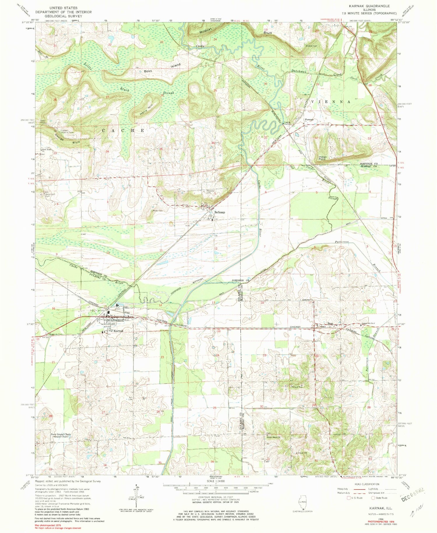
Classic USGS Karnak Illinois 7.5'x7.5' Topo Map
Couldn't load pickup availability
Historical USGS topographic quad map of Karnak in the state of Illinois. Map scale may vary for some years, but is generally around 1:24,000. Print size is approximately 24" x 27"
This quadrangle is in the following counties: Johnson, Massac, Pulaski.
The map contains contour lines, roads, rivers, towns, and lakes. Printed on high-quality waterproof paper with UV fade-resistant inks, and shipped rolled.
Contains the following named places: Anderson Church, Anderson School, Ash Ridge Post Office, Bear Branch, Belknap, Belknap Election Precinct, Belknap Masonic Cemetery, Belknap Post Office, Belknap Volunteer Fire Department, Boaz, Boss Island, Cache River State Natural Area, Cave Creek, Cave Creek Glade Nature Preserve, Courtney Spur, Cypress Lookout Tower, Dutchman Creek, Forman, George Bluff, Greenbrier School, Hairy Hill, Heron Pond Preserve, Hill Cemetery, Indian Point, Karnak, Karnak Election Precinct, Karnak Post Office, Karnak Volunteer Fire Department, Lincoln Green Post Office, Little Black Slough, Little Black Slough Nature Preserve, Logan Election Precinct, Logan School Number 6, Lower Salem Church, Miller Cemetery, Old Cache River, Patterson Branch, Post Creek School, Scanlin Spur, Swan Lake School, Township of Cache, Union School, Village of Belknap, Village of Karnak, West Eden Cemetery, West Eden Church, West Eden School, Wildcat Bluff, Wildcat Cemetery, ZIP Code: 62956


