
MyTopo
Classic USGS Karthaus Pennsylvania 7.5'x7.5' Topo Map
Couldn't load pickup availability
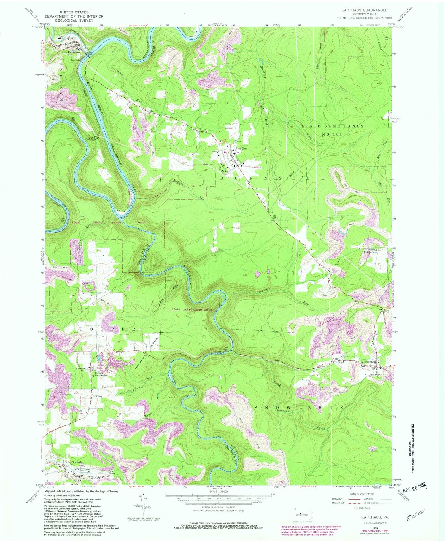
Historical USGS topographic quad map of Karthaus in the state of Pennsylvania. Map scale may vary for some years, but is generally around 1:24,000. Print size is approximately 24" x 27"
This quadrangle is in the following counties: Centre, Clearfield.
The map contains contour lines, roads, rivers, towns, and lakes. Printed on high-quality waterproof paper with UV fade-resistant inks, and shipped rolled.
Contains the following named places: Akely Hollow, Ames Run, Belford Number 3 Mine Station, Big Sterling Spring, Black Moshannon Creek, Boake Run, Confer Quarry, Cooper Settlement, Crawford Run, Curleys Run, Drifting, Drifting Post Office, German School, German Settlement, German Settlement School, Grassflat, Grassflat Census Designated Place, Grassflat Lanse Lutheran Cemetery, Grassflat Volunteer Fire Company Station 19, Karthaus, Karthaus Ambulance Service Station 20, Karthaus Post Office, Karthaus Tunnel, Karthaus Volunteer Fire Company Station 20, Laurel Run, Laurel Run School, Lower Star School, Miles Run, Moshannon, Moshannon Census Designated Place, Moshannon Creek, Moshannon Post Office, Moshannon Summit, Mosquito Creek, Mount Carmel Number 2 Mine Station, Mountain Top Airport, Old Star School, Pine Glen, Pine Glen Cemetery, Pine Glen Census Designated Place, Pine Glen Volunteer Fire Company 17, Redlick Run, Rock Run, Rupley Run, Saint Severins Cemetery, Sevenmile Run, State Game Lands Number 100, Township of Cooper, Weber Run, ZIP Codes: 16834, 16839, 16845, 16859


