MyTopo
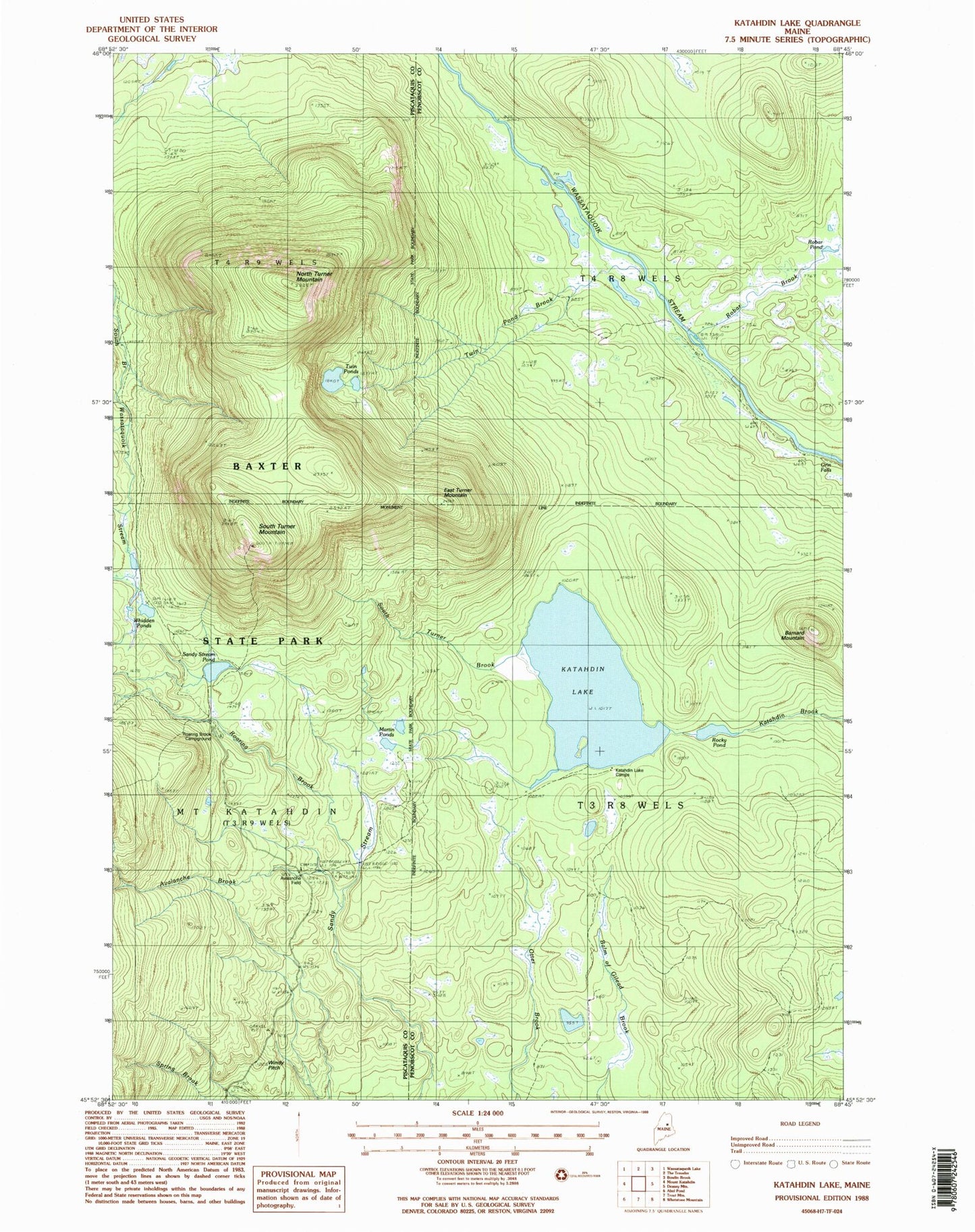
Classic USGS Katahdin Lake Maine 7.5'x7.5' Topo Map
Couldn't load pickup availability
Historical USGS topographic quad map of Katahdin Lake in the state of Maine. Typical map scale is 1:24,000, but may vary for certain years, if available. Print size: 24" x 27"
This quadrangle is in the following counties: Penobscot, Piscataquis.
The map contains contour lines, roads, rivers, towns, and lakes. Printed on high-quality waterproof paper with UV fade-resistant inks, and shipped rolled.
Contains the following named places: Avalanche Brook, Barnard Mountain, East Turner Mountain, Katahdin Lake, Katahdin Lake Camps, Martin Ponds, North Turner Mountain, Roaring Brook, Roaring Brook Campground, Robar Brook, Rober Pond, Rocky Pond, Sand Bank Trail, Sandy Stream Pond, South Turner Brook, South Turner Mountain, Twin Pond Brook, Twin Ponds, Whidden Ponds, Windey Pitch, T3 R8 WELS, T4 R8 WELS