MyTopo
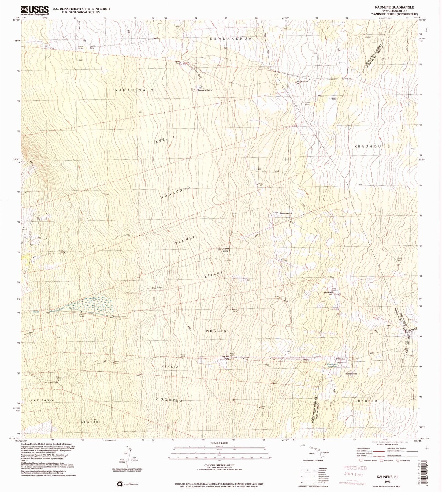
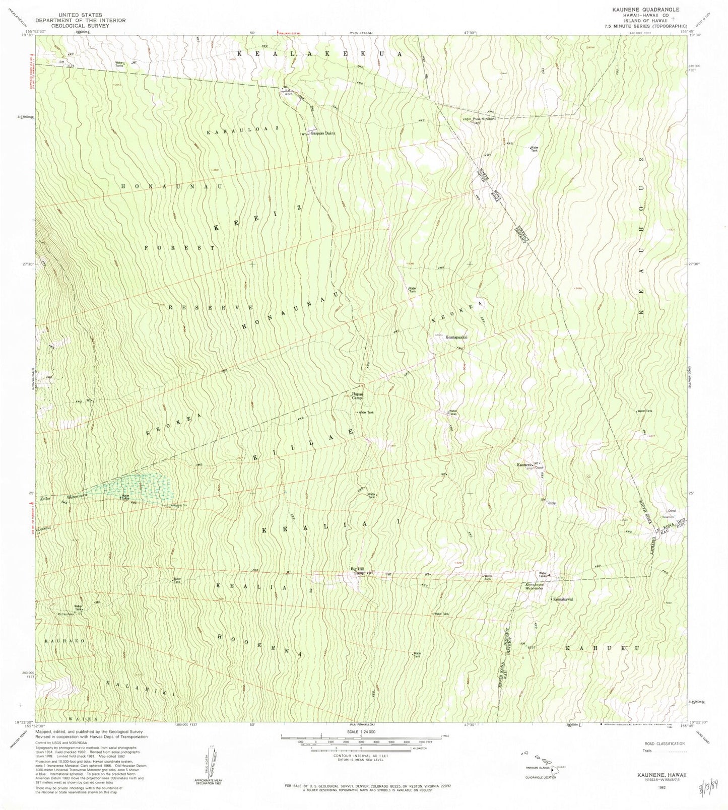
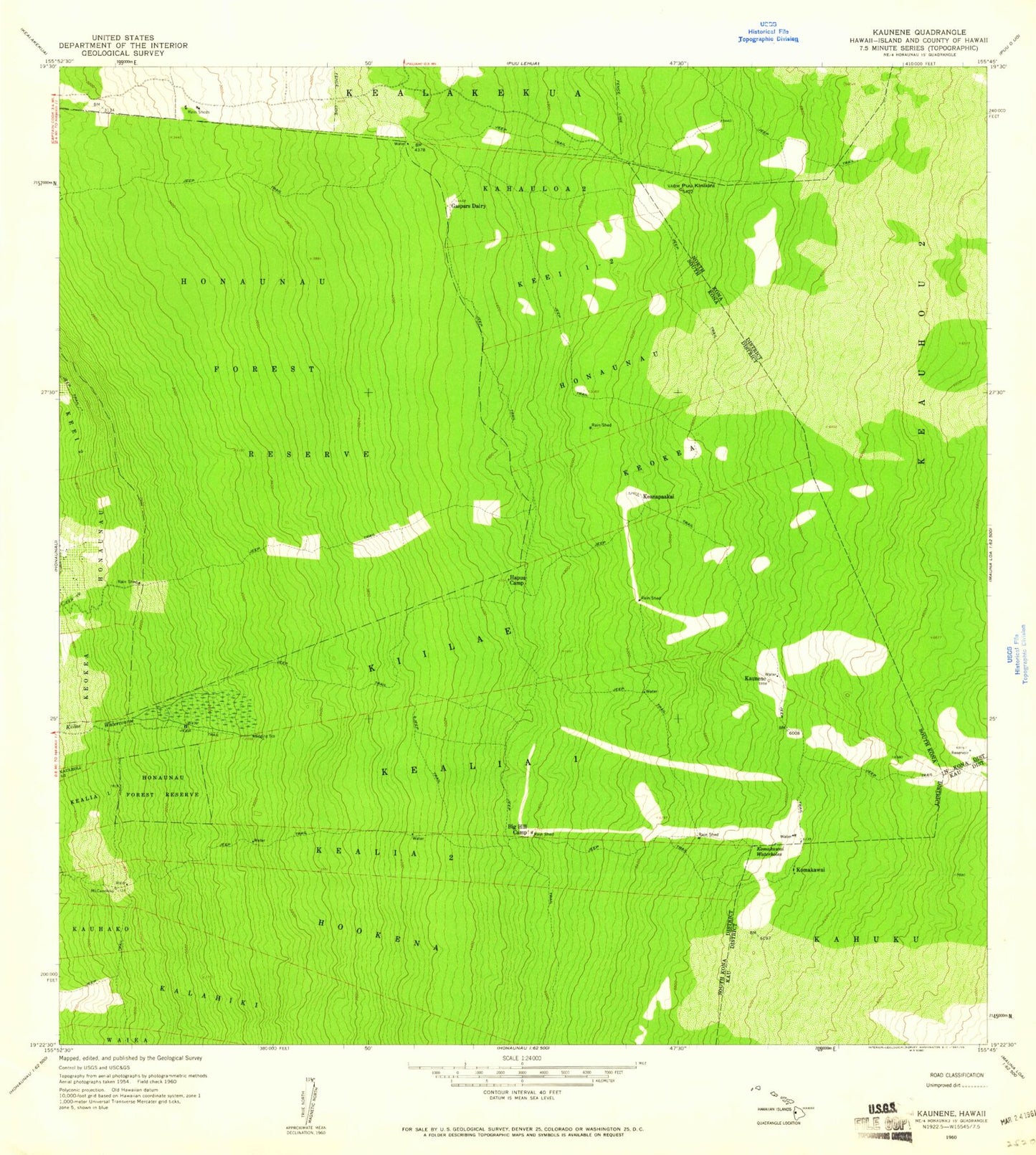
Classic USGS Kaunene Hawaii 7.5'x7.5' Topo Map
Couldn't load pickup availability
Historical USGS topographic quad map of Kaunene in the state of Hawaii. Map scale may vary for some years, but is generally around 1:24,000. Print size is approximately 24" x 27"
This quadrangle is in the following counties: Hawaii.
The map contains contour lines, roads, rivers, towns, and lakes. Printed on high-quality waterproof paper with UV fade-resistant inks, and shipped rolled.
Contains the following named places: Big Hill Camp, Gaspars Dairy, Hapu'u Camp, Honaunau, Honaunau Forest Reserve, Honaunau-Napoopoo Census Designated Place, Ho'okena, Kalahiki, Kaunene, Kealia, Kealia 1, Kealia 2, Keanapa'akai, Ke'ei 1-2, Keokea, Ki'ilae, Komakawai, Komakawai Waterholes, Pu'ukinikini, South Kona District, ZIP Code: 96726