MyTopo
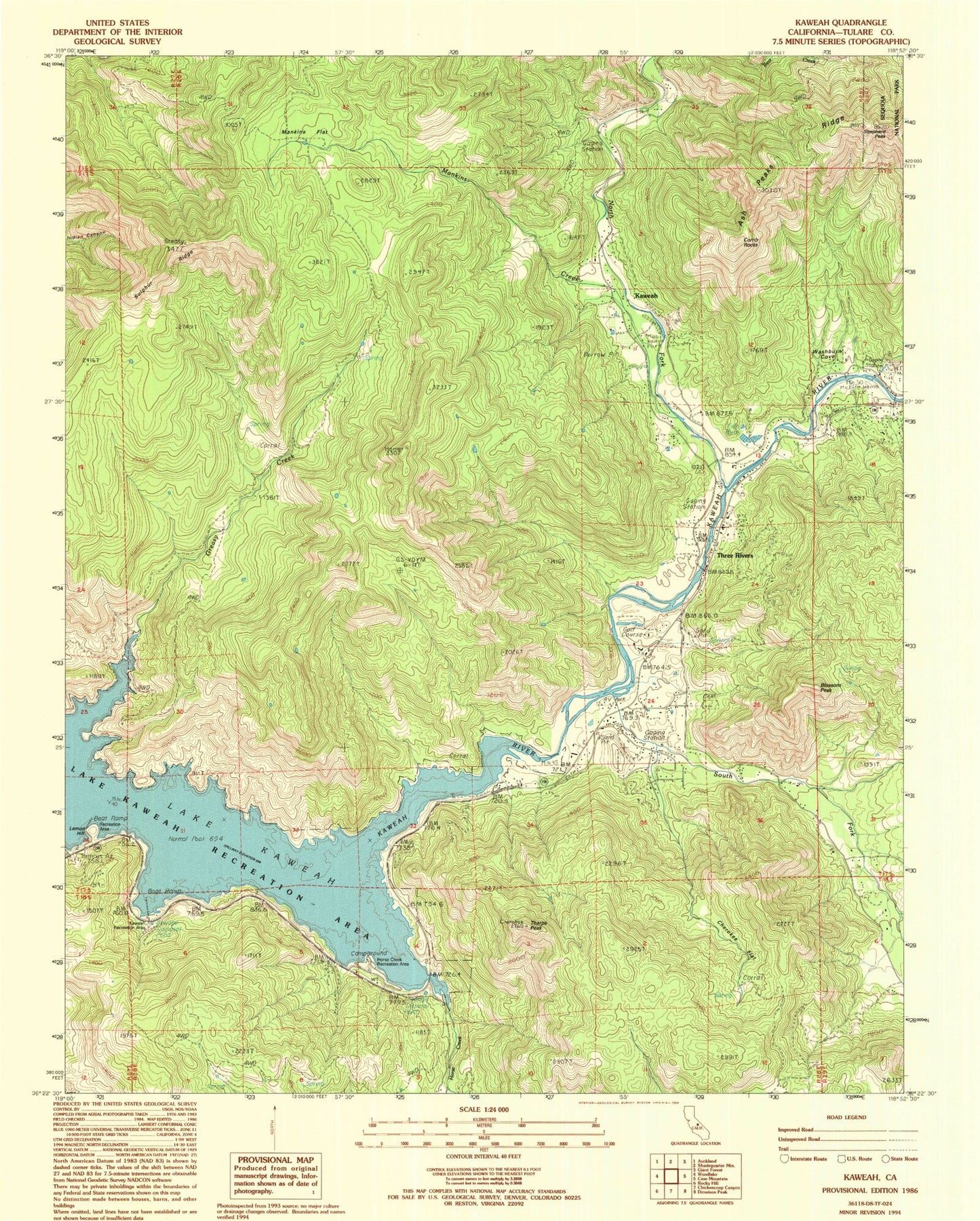
Classic USGS Kaweah California 7.5'x7.5' Topo Map
Couldn't load pickup availability
Historical USGS topographic quad map of Kaweah in the state of California. Map scale may vary for some years, but is generally around 1:24,000. Print size is approximately 24" x 27"
This quadrangle is in the following counties: Tulare.
The map contains contour lines, roads, rivers, towns, and lakes. Printed on high-quality waterproof paper with UV fade-resistant inks, and shipped rolled.
Contains the following named places: Barton Mountain, Blossom Peak, Cherokee Flat, Comb Rocks, Department of Forestry and Fire Protection Three Rivers Unit, Greasy Creek, Horse Creek, Horse Creek Recreation Area, Kaweah, Kaweah Recreation Area, Lake Kaweah, Lake Kaweah Boat Patrol, Lake Kaweah Recreation Area, Lemon Hill, Mankins Creek, Mankins Flat, North Fork Kaweah River, Shepherd Peak, South Fork Kaweah River, Sulphur Ridge, Tharps Peak, Three Rivers, Three Rivers Ambulance, Three Rivers Census Designated Place, Three Rivers Elementary School, Three Rivers Golf Course, Three Rivers Post Office, Three Rivers Public Cemetery, Tulare County Fire Department Battalion 1 Three Rivers Station 14, Union School, Washburn Cove, ZIP Code: 93244