MyTopo
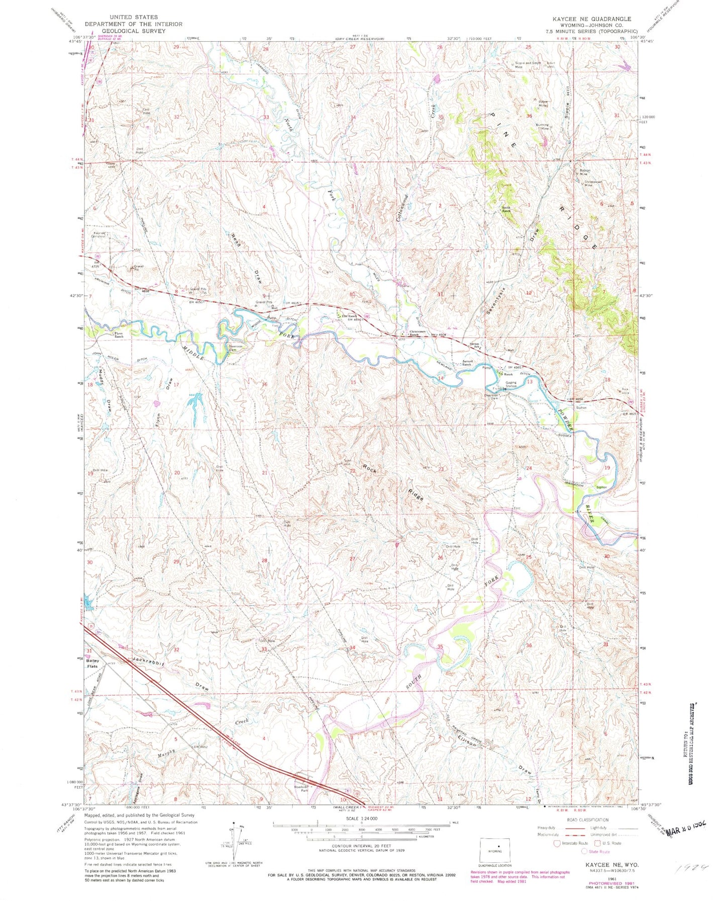
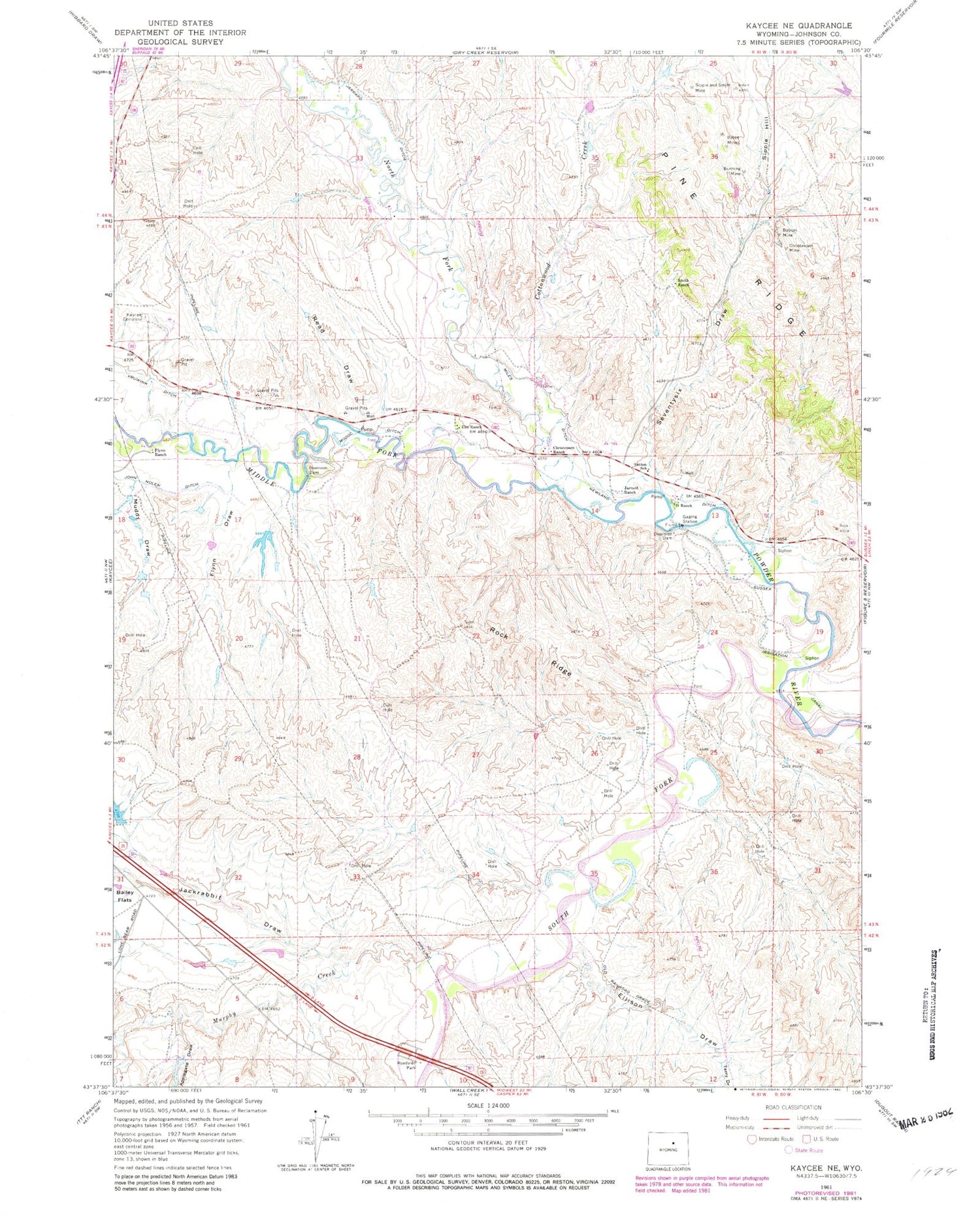
Classic USGS Kaycee NE Wyoming 7.5'x7.5' Topo Map
Couldn't load pickup availability
Historical USGS topographic quad map of Kaycee NE in the state of Wyoming. Map scale may vary for some years, but is generally around 1:24,000. Print size is approximately 24" x 27"
This quadrangle is in the following counties: Johnson.
The map contains contour lines, roads, rivers, towns, and lakes. Printed on high-quality waterproof paper with UV fade-resistant inks, and shipped rolled.
Contains the following named places: Applegate Dam, Applegate Draw, Applegate Reservoir, Babion Mine, Bunning Mine, Bybee Mines, Christensen Mine, Christensen Ranch, Christenson Mine, Cottonwood Creek, D Ranch, Ellison Draw, Elm Ranch, Flynn Draw, Flynn Ranch, Jackrabbit Draw, Jarrard Ditch, Jarrard Extension Mine, Jarrard Ranch, Jarrard Rock Pile Mine, John Nolen Ditch, Kaycee Cemetery, Middle Fork Powder River, Miles Ditch, Modoc Ditch, Muddy Draw, Murphy Creek, N Jack Rabbit Dam, N Jack Rabbit Reservoir, Newland Ditch, North Fork Powder River, Read Draw, Rock Ridge, Schiffer Mine, Seventysix Draw, Sipple and Smith Mine, Sipple Hill, Smith Ranch, South Fork Powder River, Sutton School, Terry Draw, Ullery Mine, ZIP Code: 82639