
MyTopo
Classic USGS Kayjay Kentucky 7.5'x7.5' Topo Map
Couldn't load pickup availability
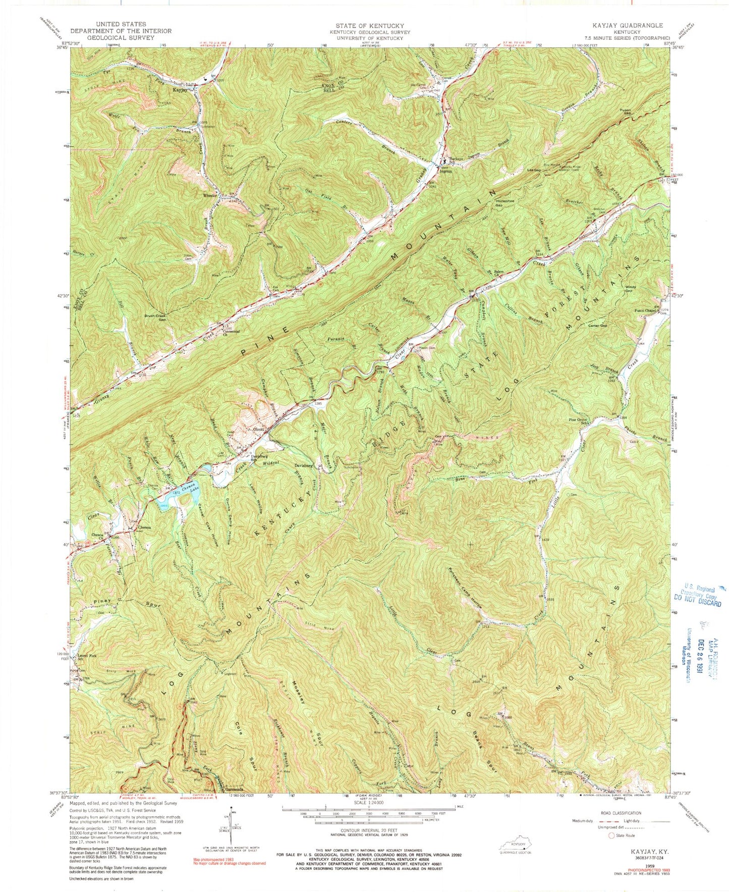
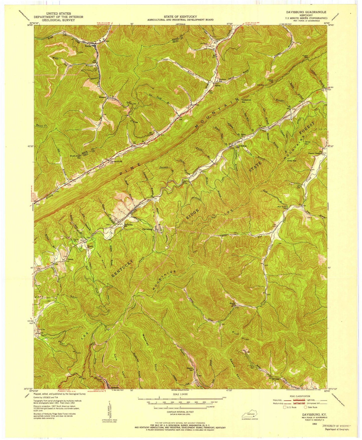
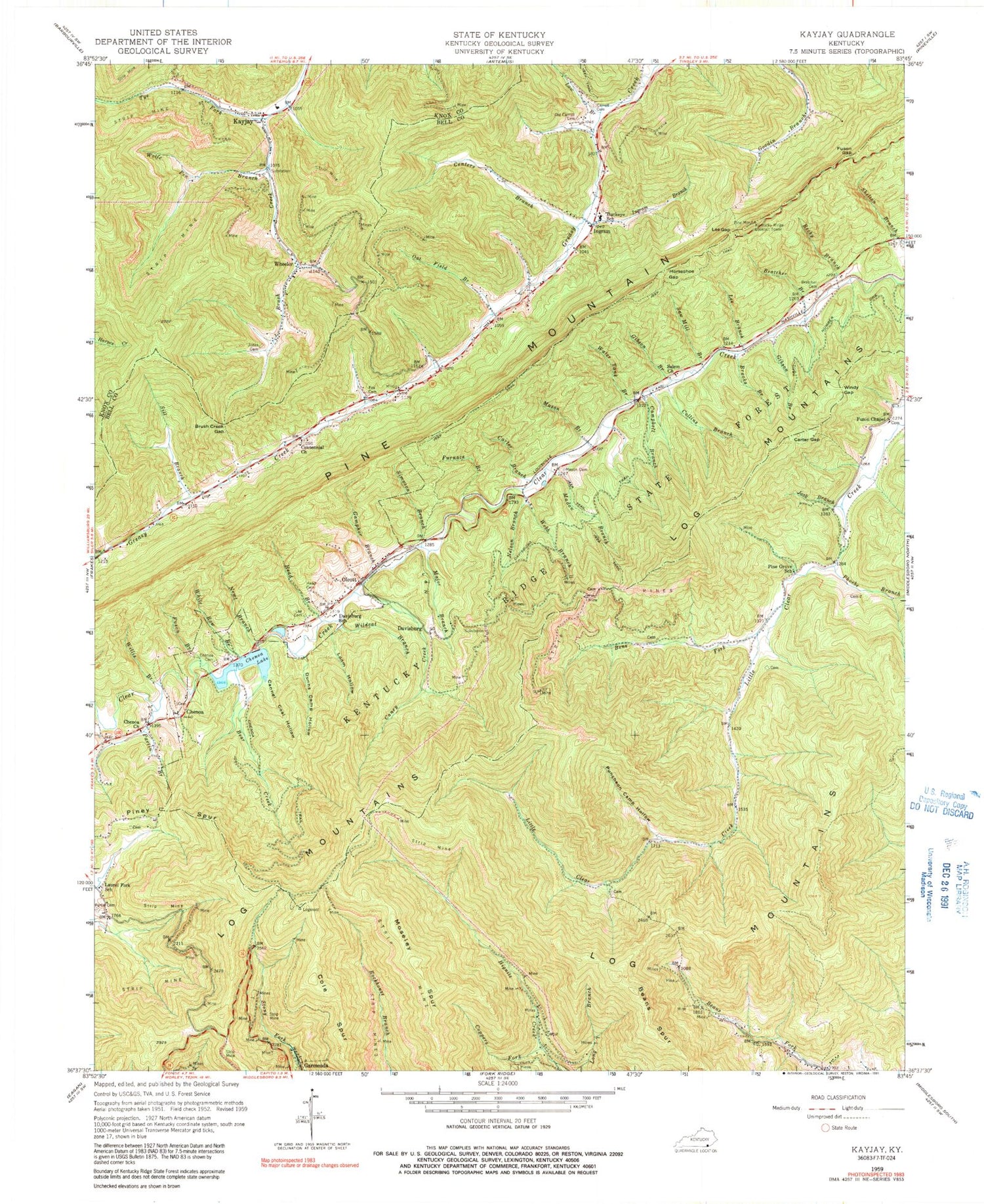
Historical USGS topographic quad map of Kayjay in the state of Kentucky. Map scale may vary for some years, but is generally around 1:24,000. Print size is approximately 24" x 27"
This quadrangle is in the following counties: Bell, Knox.
The map contains contour lines, roads, rivers, towns, and lakes. Printed on high-quality waterproof paper with UV fade-resistant inks, and shipped rolled.
Contains the following named places: A Carrp Mine, Alcedo Railroad Station, Artemus Volunteer Fire Department Station 2, Beans Spur, Bear Branch, Bear Creek, Becky Branch, Bell County Forestry Camp, Bens Fork, Benway Railroad Station, Birdwood Railroad Station, Bratcher Branch, Bratcher Cemetery, Brooks Branch, Brush Creek Gap, Brush Mountain, Buckeye School, Cairnes Railroad Station, Campbell Branch, Canada Peak, Caney Creek, Cannel Coal Hollow, Carroll Cemetery, Carter Branch, Carter Gap, Centennial Church, Centers Branch, Chenoa, Chenoa Cemetery, Chenoa Church, Chenoa Lake, Cole Spur, Collins Branch, Coppers Fork, Davisburg, Davisburg School, Dunns Camp Hollow, Evenston Railroad Station, Fox Cemetery, Furnace Branch, Fuson Branch, Fuson Chapel, Fuson Gap, Gamphor Branch, Garmeada, Gibson Branch, Harrison Railroad Station, Hawley Railroad Station, Head Branch, Head Cemetery, Hignite Railroad Station, Horseshoe Gap, Ingram, Ingram Branch, Jack Branch, Jones Cemetery, Kayjay, Kayjay Post Office, Kentucky Ridge Division, Kentucky Ridge Lookout Tower, Kentucky Ridge State Forest, Laurel Fork School, Law Branch, Lee Branch, Lee Cemetery, Lee Gap, Log Mountain Lookout Tower, Loom Hollow, Madon Branch, Major Branch, Markley Railroad Station, Mason Branch, Mason Cemetery, Moseley Spur, Murtea Railroad Station, Nelson Branch, Newt Branch, Oat Field Branch, Olcott, Olcott Railroad Station, Old Carroll Cemetery, Partin Branch, Partin Cemetery, Phoebe Branch, Pine Grove School, Puncheon Camp Hollow, Rockhouse 1 Mine, Sagamore Railroad Station, Salem Church, Saw Mill Branch, Sill Branch, Simpson Branch, Stony Fork Railroad Station, Tye Fork, Tye Fork Coal Company, Union Mission Church, Water Tank Branch, Waterdale Railroad Station, Webb Branch, Wheeler, Wheeler Post Office, Wheeler Railroad Station, White Row Branch, Wildcat Branch, Willis Branch, Windy Gap, Wolfe Pen Branch, Yearwood Railroad Station, ZIP Code: 40977