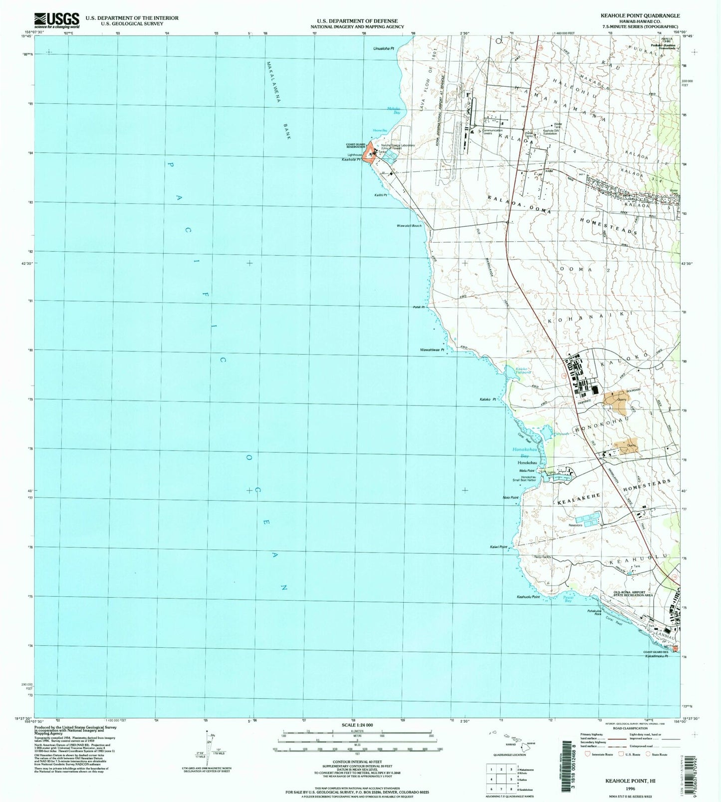
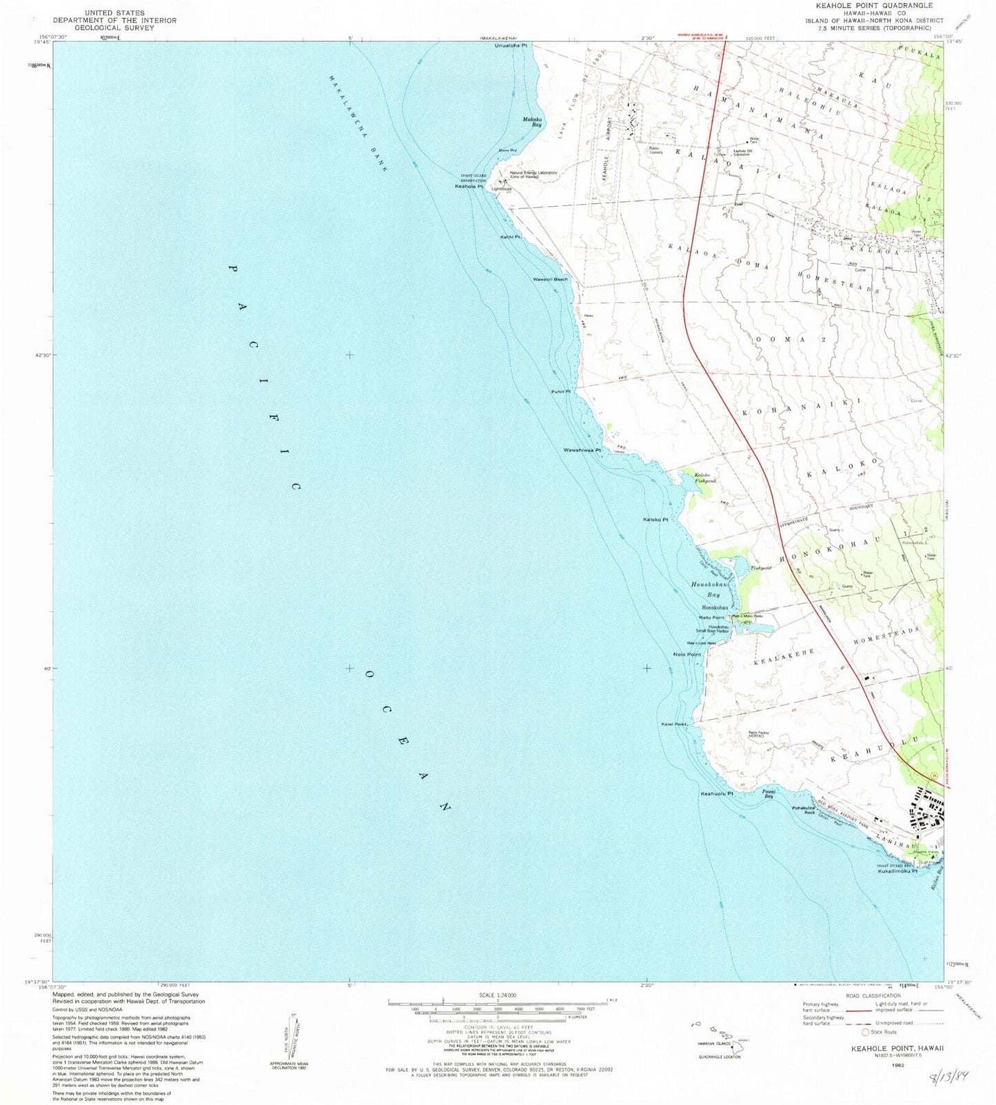
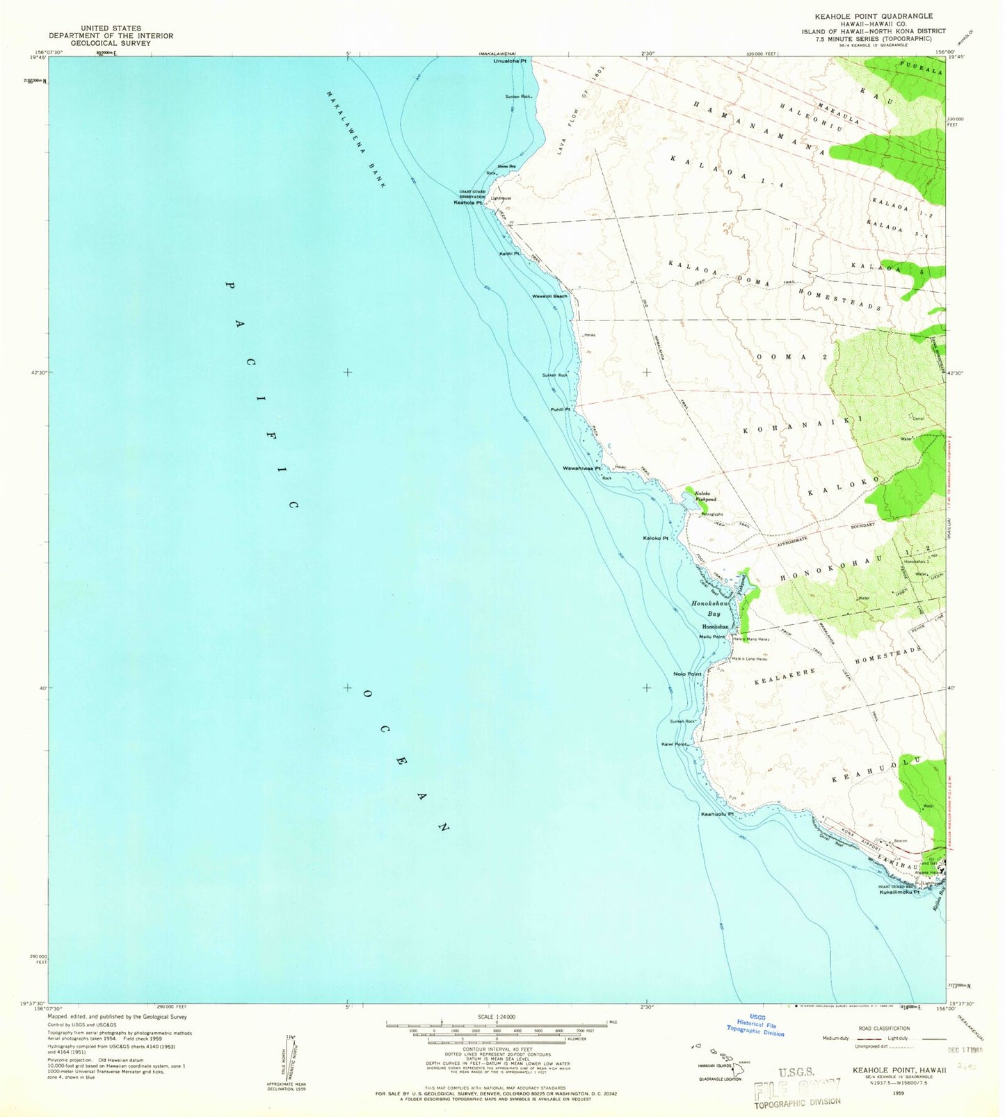
MyTopo
Classic USGS Keahole Point Hawaii 7.5'x7.5' Topo Map
Couldn't load pickup availability
Historical USGS topographic quad map of Keahole Point in the state of Hawaii. Map scale may vary for some years, but is generally around 1:24,000. Print size is approximately 24" x 27"
This quadrangle is in the following counties: Hawaii.
The map contains contour lines, roads, rivers, towns, and lakes. Printed on high-quality waterproof paper with UV fade-resistant inks, and shipped rolled.
Contains the following named places: Ahu'ena Heiau, 'Ai'opio Fishpond, 'Alula Beach, Beans Beach, Ellison Onizuka Kona International Airport at Keahole, Hale o Mano Heiau, Haleohiu, Haleolono Heiau, Hamanamana, Hawaii County Police Department Kona Station, Honokohau, Honokohau 1-2, Honokohau Bay, Honokohau Beach, Honokohau Hawaiian Home Land, Honokohau Small Boat Harbor, Hoona Bay, Kaehole Southwest Substation, Kaiminani Census Designated Place, Kaiwi Point, Kalaoa Hawaiian Homeland, Kalaoa One-Four, Kalaoa Three-Four, Kalaoa Volunteer Fire Station 07B, Kalaoa-'O'oma Homesteads, Kalihi Point, Kaloko Fishpond, Kaloko Point, Kaloko-Honokohau National Historical Park, Keahole Point, Keahuolu Point, Kealakehe Homesteads, KIPA-AM (Kalaoa), Kohanaiki, Kona Airport, Kukailimoku Point, Lanihau, Maka'eo, Makako Bay, Maka'ula, Maliu Point, Mamalahoa Trail, Natural Energy Laboratory, Noio Point, Old Kona Airport State Recreation Area, Old Mamalahoa Trail, 'O'oma 2, Pawai Bay, Pohakuloa Rock, Puhili Point, Unualoha Point, Wawahiwa'a Point, Wawaloli Beach