MyTopo
Classic USGS Keams Canyon Arizona 7.5'x7.5' Topo Map
Couldn't load pickup availability
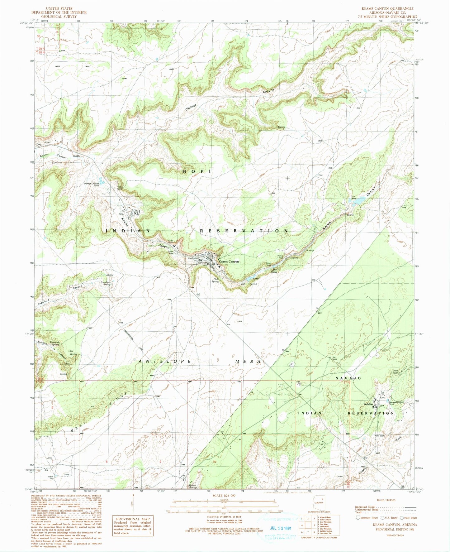
Historical USGS topographic quad map of Keams Canyon in the state of Arizona. Map scale may vary for some years, but is generally around 1:24,000. Print size is approximately 24" x 27"
This quadrangle is in the following counties: Navajo.
The map contains contour lines, roads, rivers, towns, and lakes. Printed on high-quality waterproof paper with UV fade-resistant inks, and shipped rolled.
Contains the following named places: Antelope Mesa, Bluebird Spring, Chakpahu, Chili Spring, Department of Health Indian Hospital, Dove Spring, Jeddito, Jeddito Census Designated Place, Jeddito School, Keams Canyon, Keams Canyon Boarding School, Keams Canyon Campground, Keams Canyon Census Designated Place, Keams Canyon Community Park, Keams Canyon Day School, Keams Canyon Fire Department, Keams Canyon Post Office, Kokopnyama, Lake Maho, Nesuftanga, Pink Arrow, Skunk Springs, Snowbird Spring, Twin Dams, ZIP Code: 86034