MyTopo
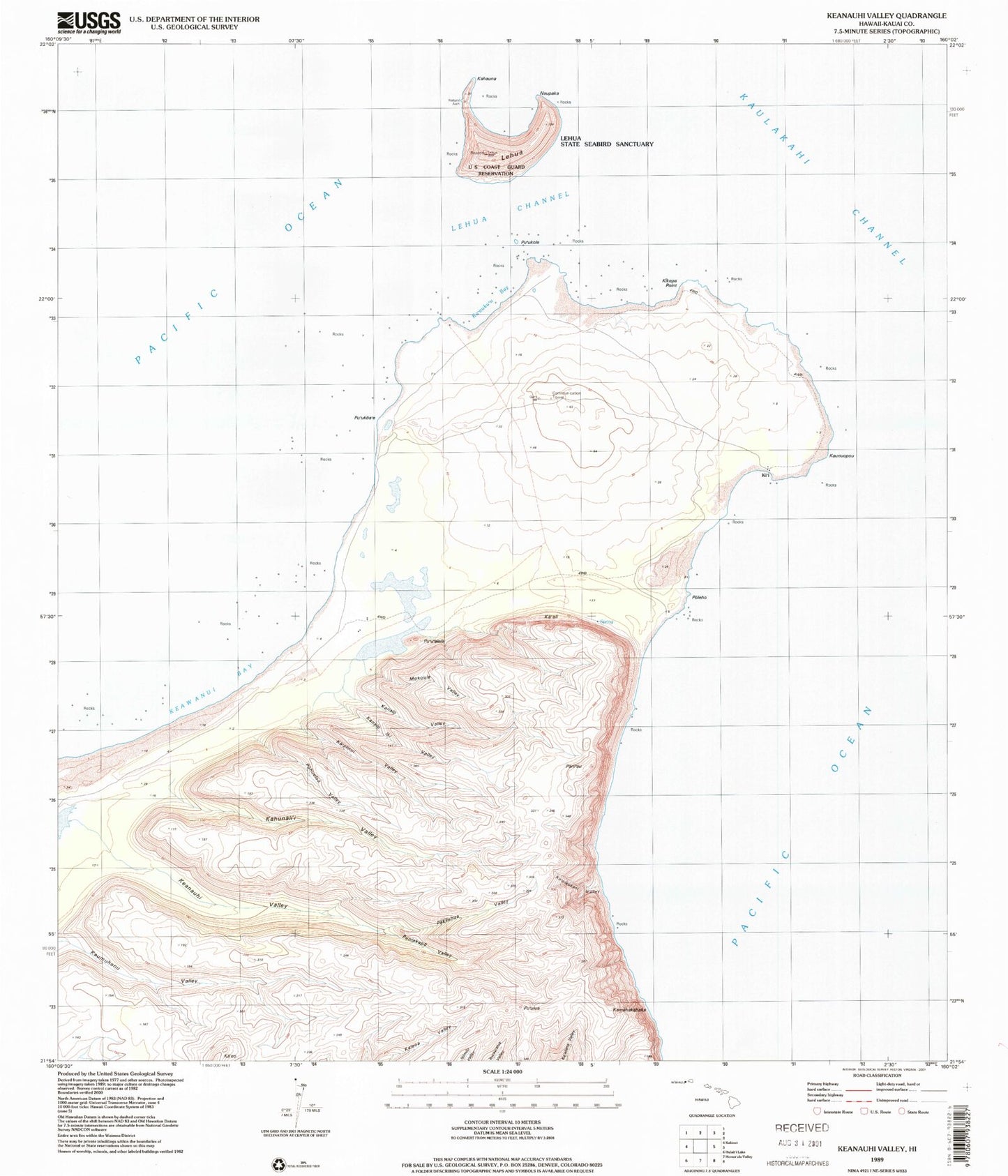
Classic USGS Keanauhi Valley Hawaii 7.5'x7.5' Topo Map
Couldn't load pickup availability
Historical USGS topographic quad map of Keanauhi Valley in the state of Hawaii. Map scale may vary for some years, but is generally around 1:24,000. Print size is approximately 24" x 27"
This quadrangle is in the following counties: Kauai.
The map contains contour lines, roads, rivers, towns, and lakes. Printed on high-quality waterproof paper with UV fade-resistant inks, and shipped rolled.
Contains the following named places: Ka'aku'u Bay, Ka'aku'u Beach, Ka'ali, Ka'alinui Valley, Ka'eo, Kahauna, Kahunali'i Valley, Kamahakahaka, Kamakalepo Point, Kanalo Valley, Kanaloiki Valley, Kaunuakala, Kaunuokahe Point, Kaunuopou, Keamano Bay, Keamano Beach, Keanauhi Valley, Keaulepe, Keawanui Bay, Keawanui Beach, Ki'i, Kikepa Point, Ko'olaukani Valley, Lehua, Lehua Channel, Lehua Landing, Lehua State Seabird Sanctuary, Mokouia Valley, Naupaka, Ni'ihau, Pakilehua Valley, Palikoa'e, Pani'au, Pohueloa Valley, Poleho, Poleho Point, Puniakapo Valley, Pu'u'alala, Pu'ukole, Pu'ulua, Waiakanaio Stream