

MyTopo
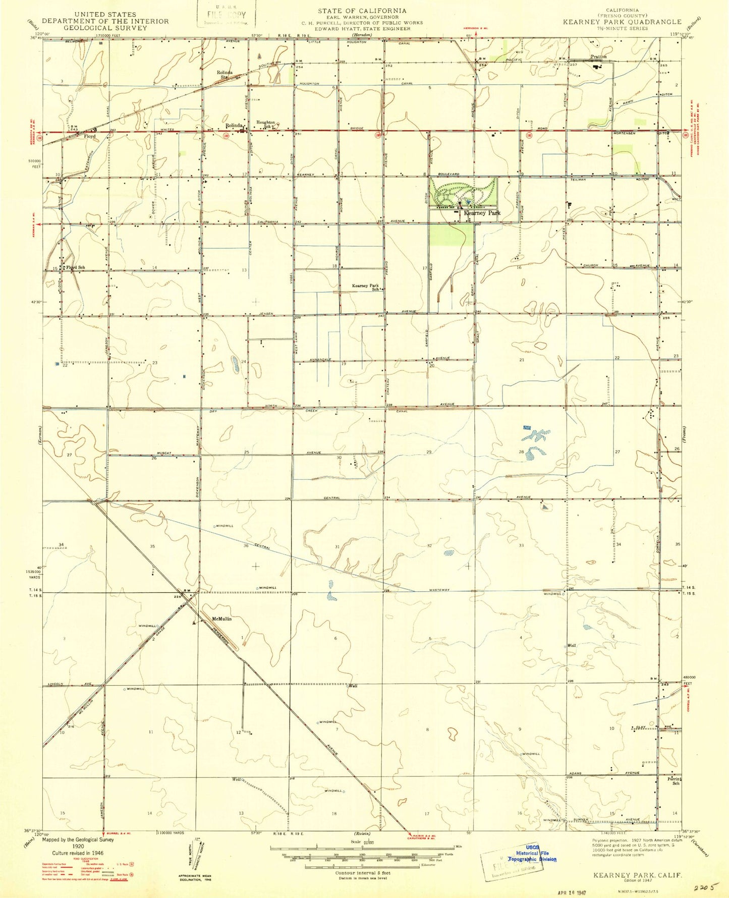
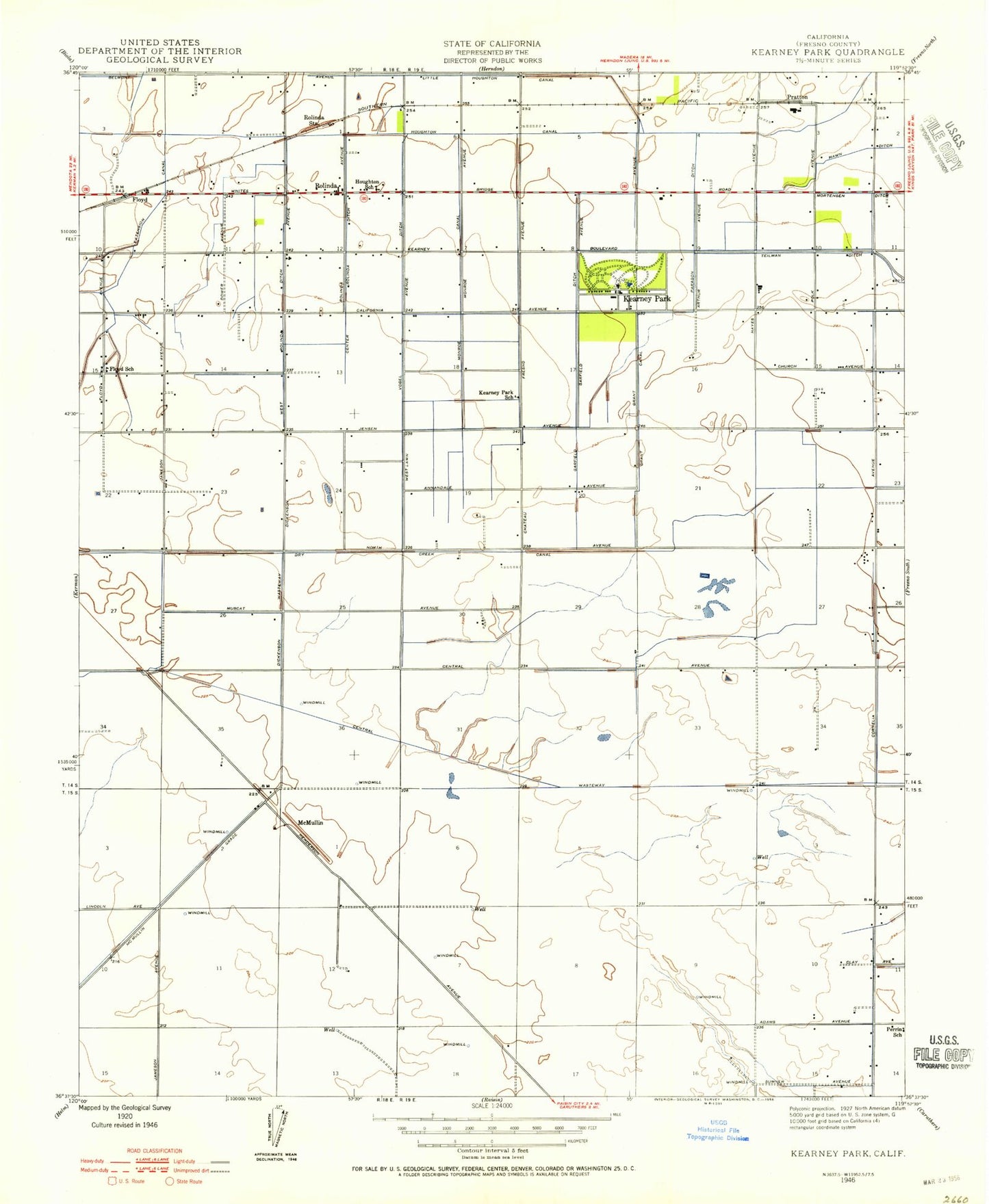
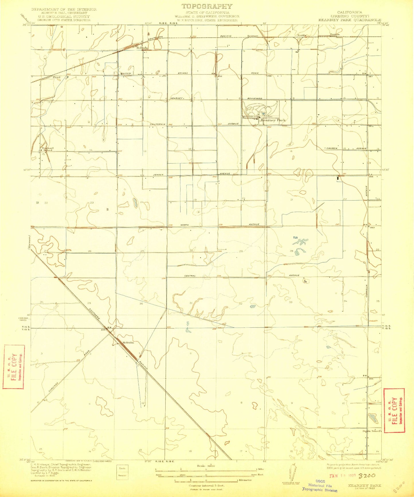
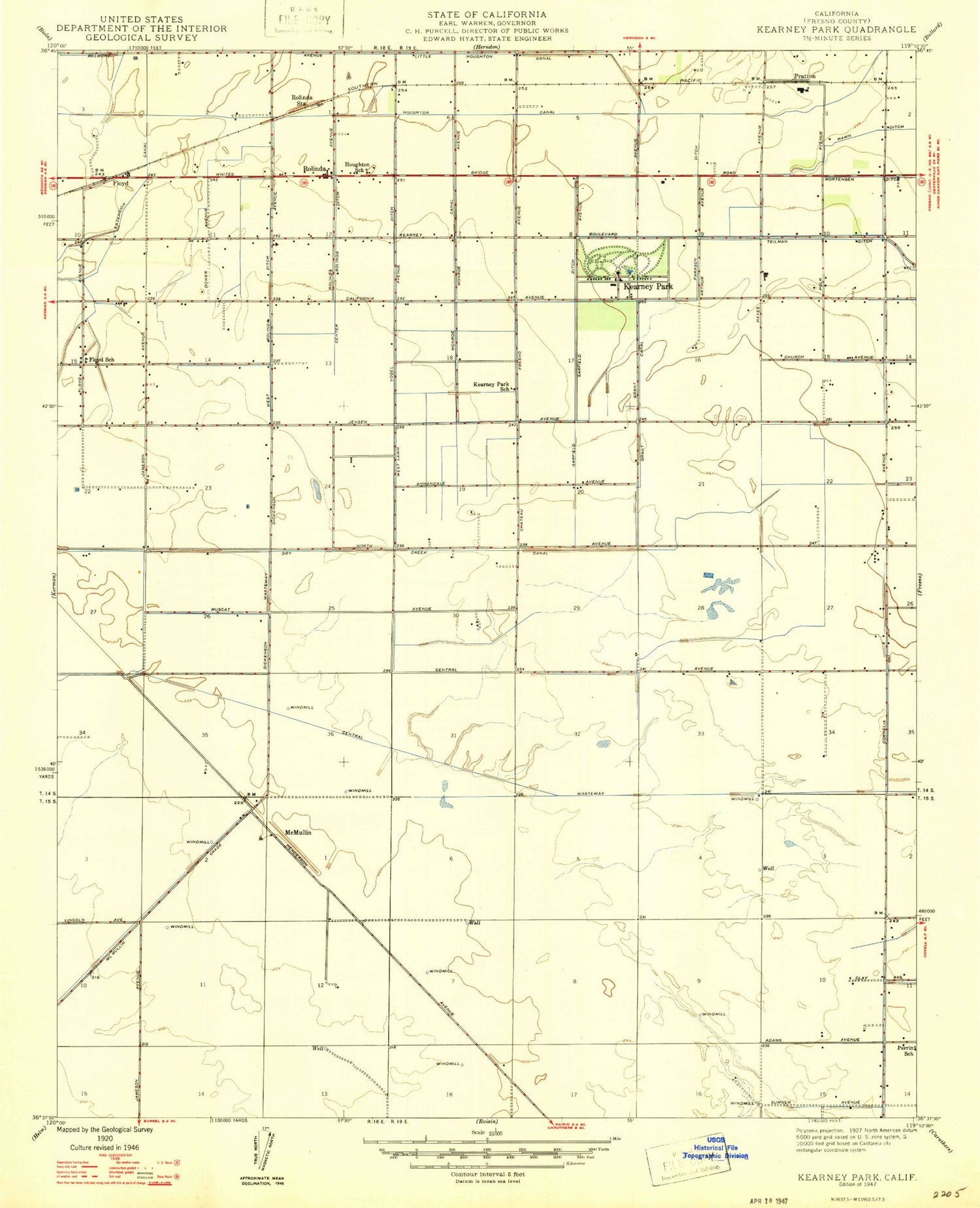
Classic USGS Kearney Park California 7.5'x7.5' Topo Map
Couldn't load pickup availability
Historical USGS topographic quad map of Kearney Park in the state of California. Map scale may vary for some years, but is generally around 1:24,000. Print size is approximately 24" x 27"
This quadrangle is in the following counties: Fresno.
The map contains contour lines, roads, rivers, towns, and lakes. Printed on high-quality waterproof paper with UV fade-resistant inks, and shipped rolled.
Contains the following named places: Adams Waste, Center Rolinda Ditch, Central Wasteway, City of Fresno Sewage Treatment Plant, Dickenson Waste, Dry Creek Canal, Floyd, Floyd School, Fresno City and County Historical Society Archives, Fresno Memorial Gardens, Fruit Vale, Garfield Ditch, Hawn Ditch, Honor Farm, Houghton - Kearney Elementary School, Houghton Canal, Houghton School, Kearney Park, Kearney Park School, Kearney Substation, Little Houghton Canal, Machado Dairy, McMullin, Milky Way Dairy, Nevills, North Central Fire Protection District Station 22, Paragon Ditch, Perrin School, Pratton, Rolinda, Rolinda Station, Teilman Ditch, Vogel Ditch, West Rolinda Ditch, ZIP Code: 93706