MyTopo
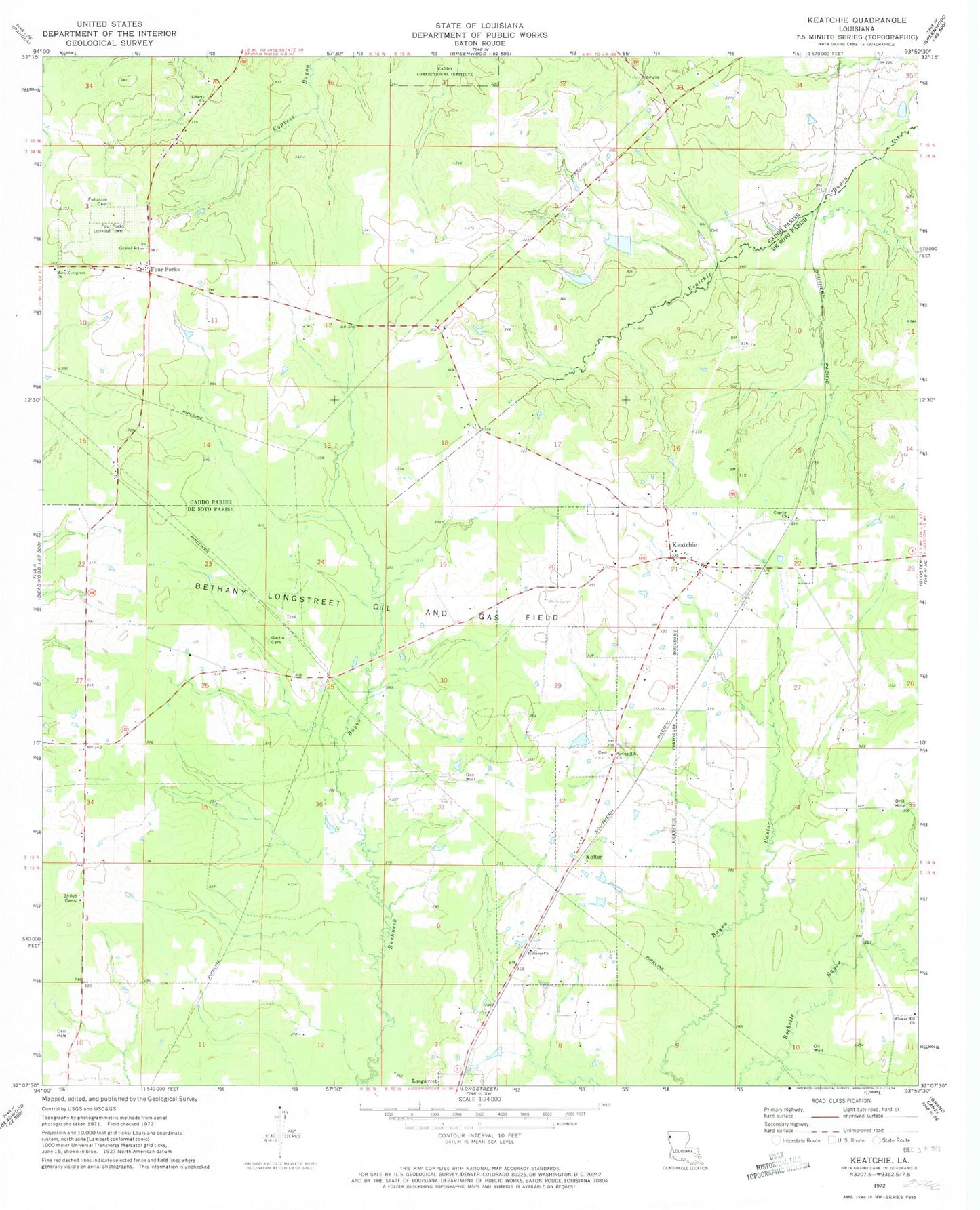
Classic USGS Keatchie Louisiana 7.5'x7.5' Topo Map
Couldn't load pickup availability
Historical USGS topographic quad map of Keatchie in the state of Louisiana. Map scale may vary for some years, but is generally around 1:24,000. Print size is approximately 24" x 27"
This quadrangle is in the following counties: Caddo, De Soto.
The map contains contour lines, roads, rivers, towns, and lakes. Printed on high-quality waterproof paper with UV fade-resistant inks, and shipped rolled.
Contains the following named places: Bethany Longstreet Oil and Gas Field, Burris School, Caddo Correctional Institute, Charity Church, Flower Hill Baptist Church, Flower Hill Cemetery, Four Forks, Four Forks Lookout Tower, Fullalove Cemetery, Gatlin Cemetery, Good Hope Church, Holiness Church, Joseph Grove School, Keatchie, Kolter, Liberty Church, Little Rock School, Maeora Airport, Mary Evergreen Church, Milton Crowe Lake Number One Dam, Milton Crowe Lake Number Two Dam, Parish Governing Authority District 1A, Shiloh Camp, Spring Hill Church, Town of Keachi, Ward One, Whitley, ZIP Code: 71046