MyTopo
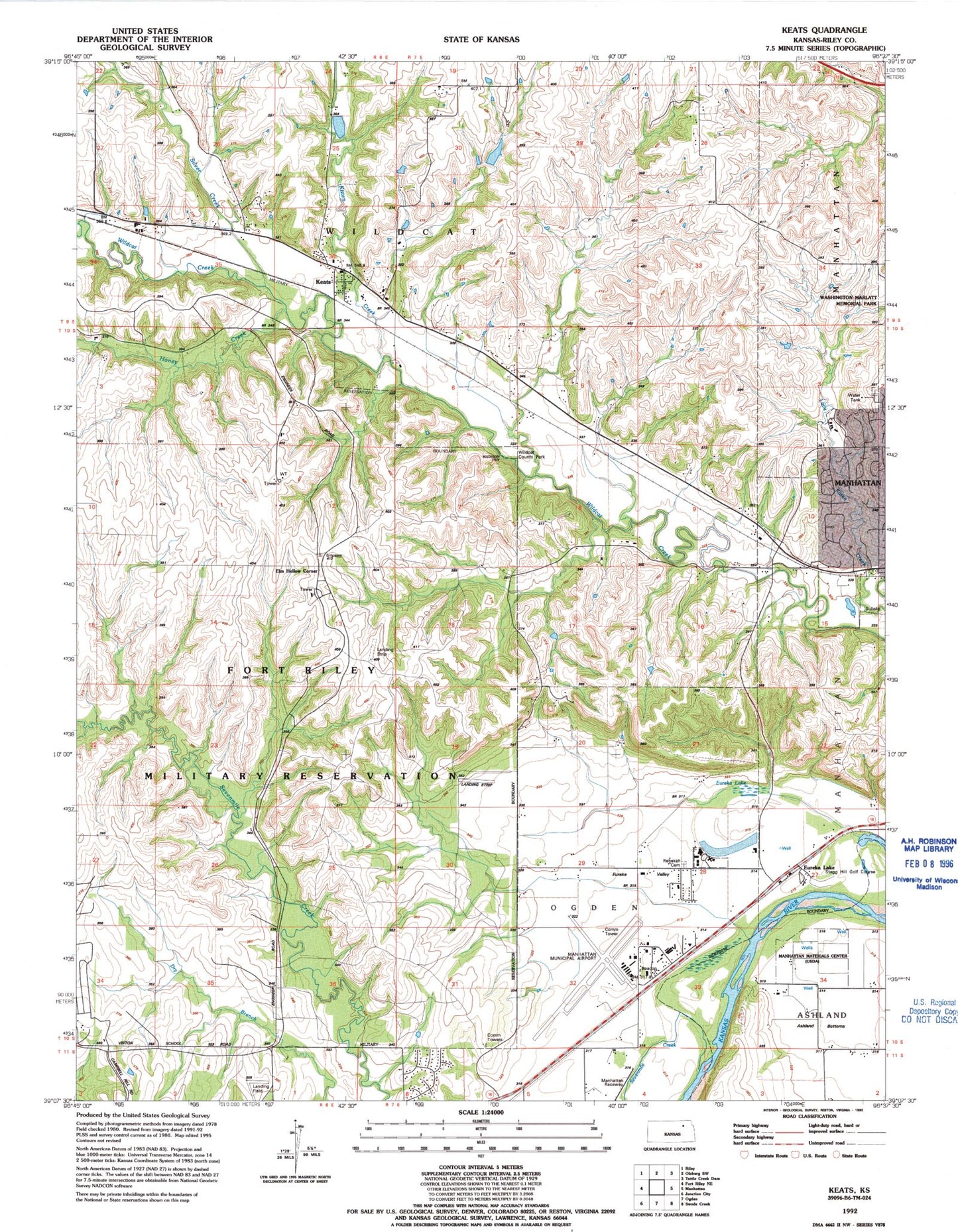
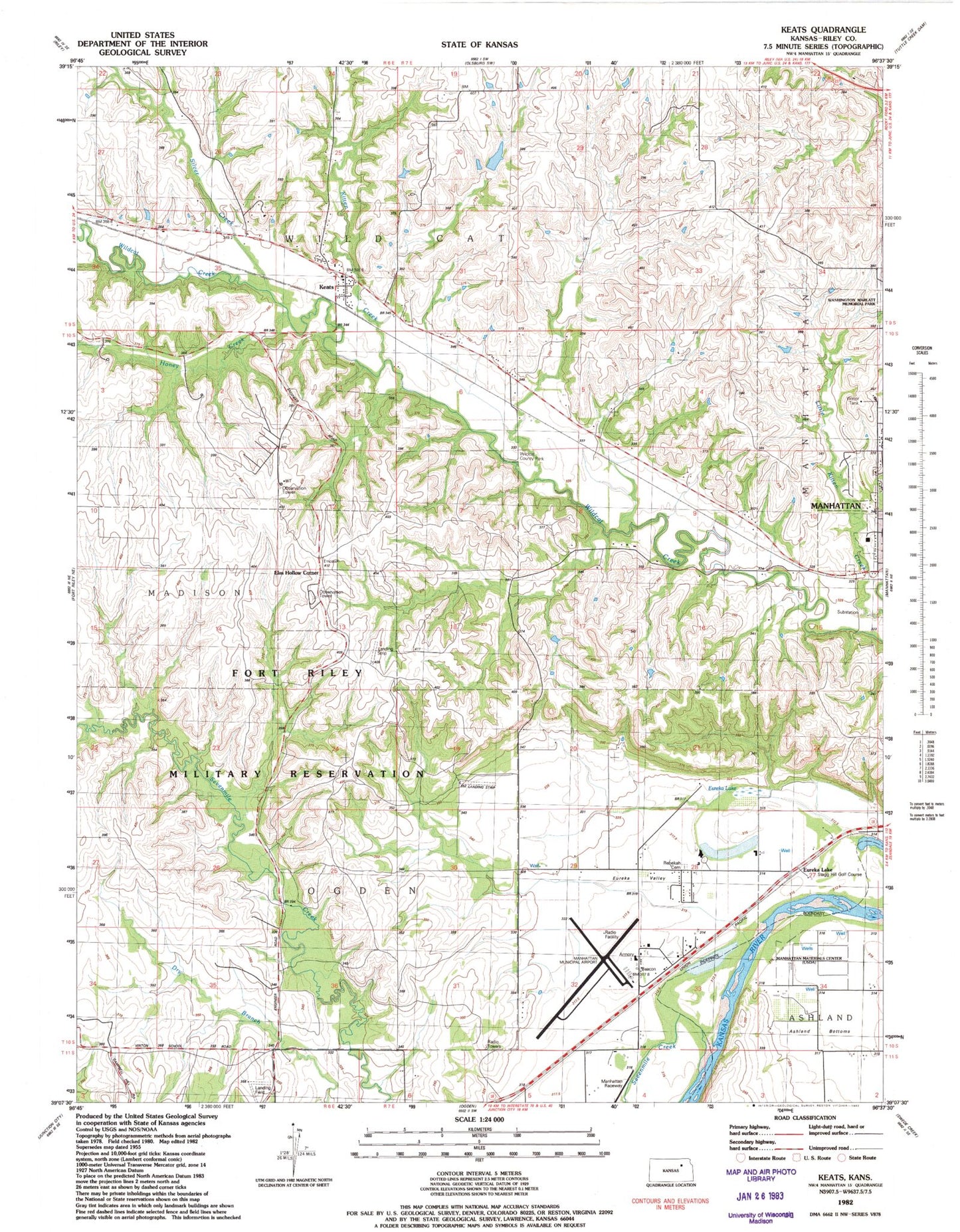
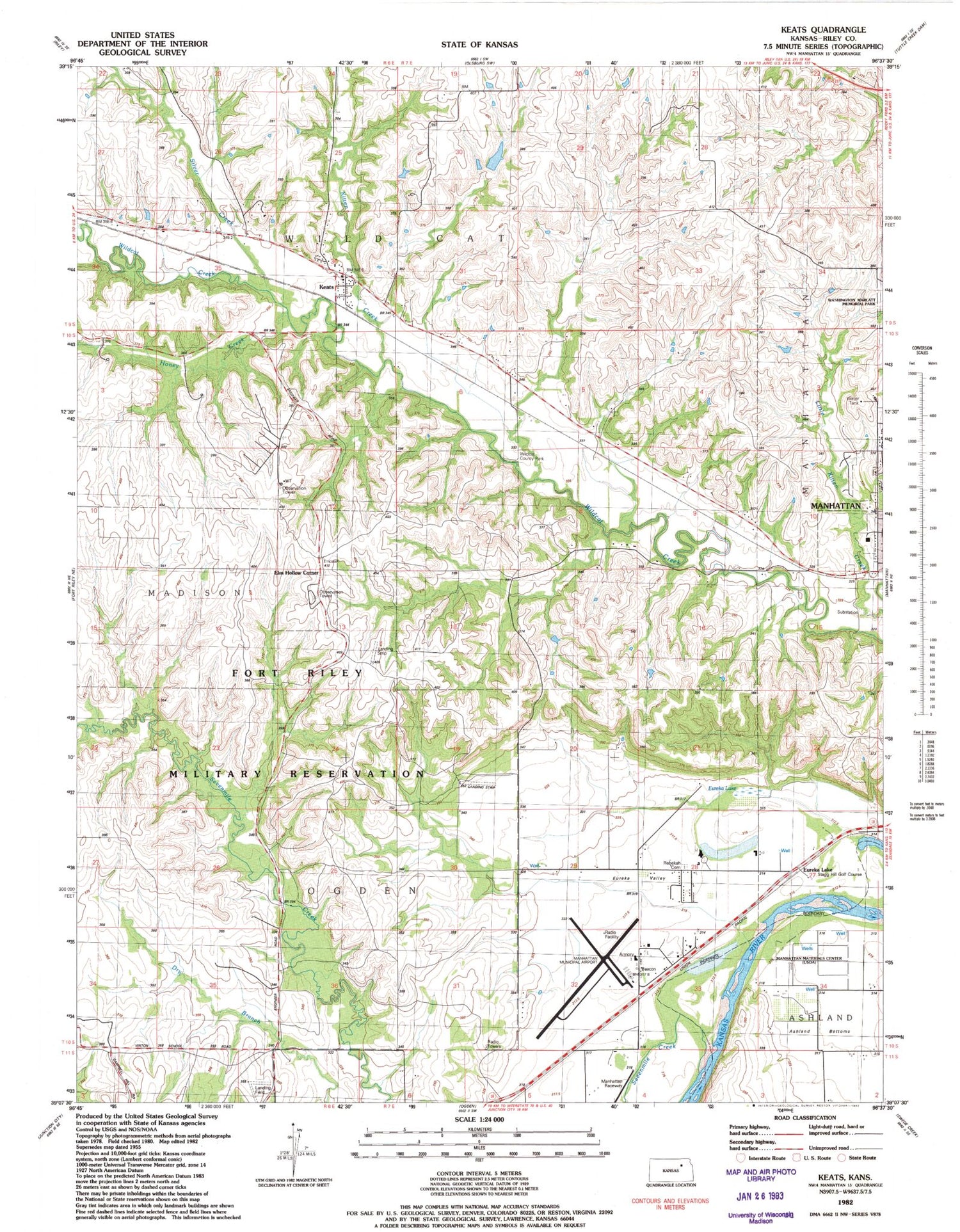
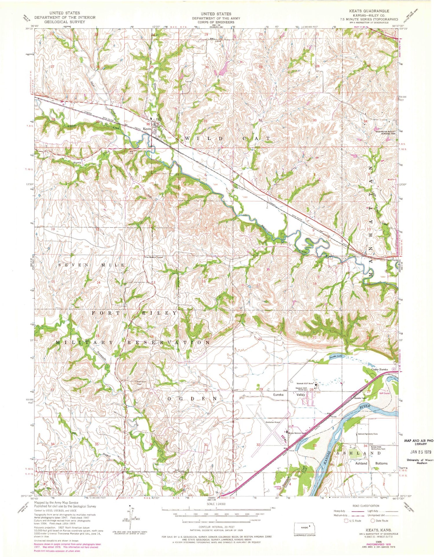
Classic USGS Keats Kansas 7.5'x7.5' Topo Map
Couldn't load pickup availability
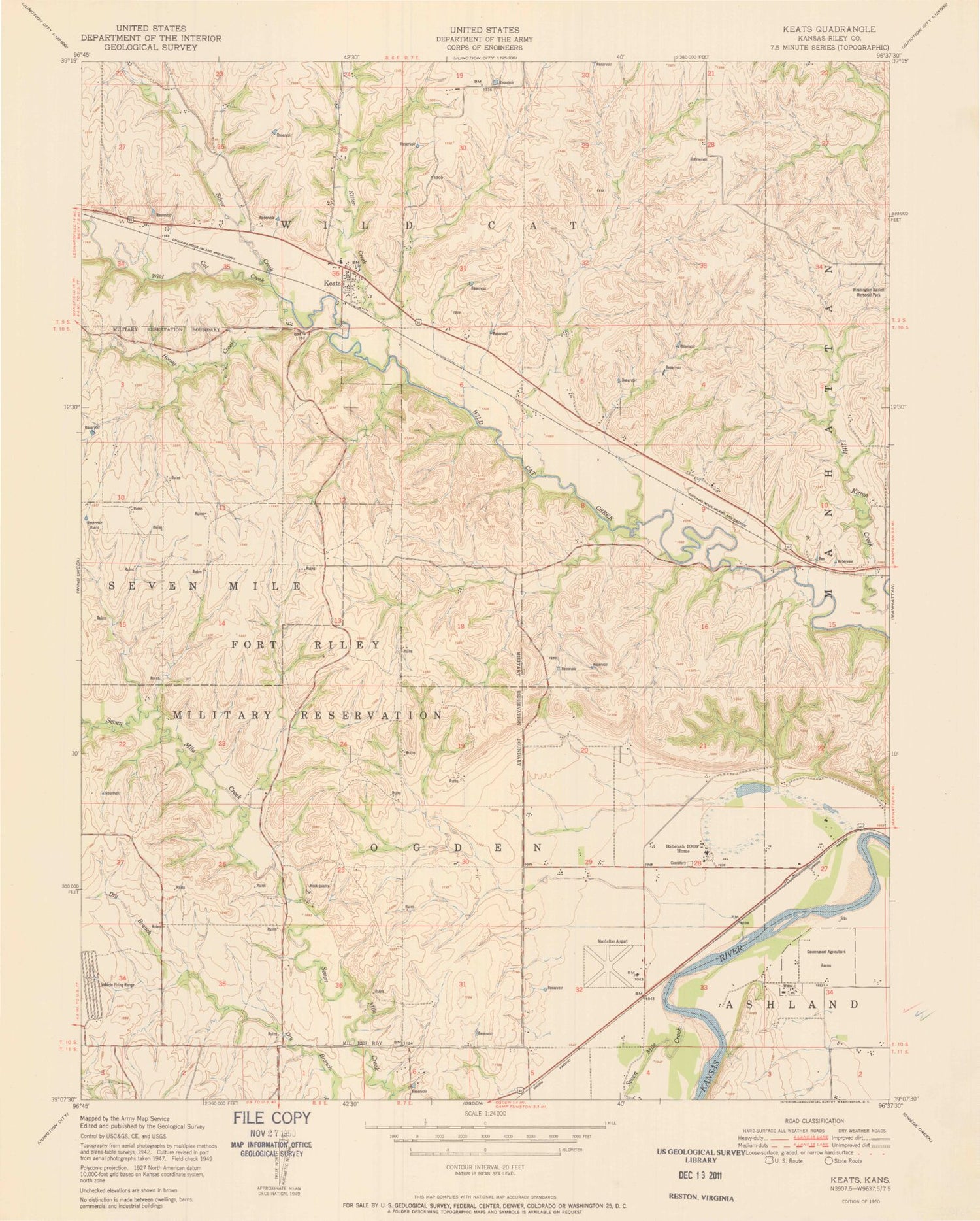
Historical USGS topographic quad map of Keats in the state of Kansas. Map scale may vary for some years, but is generally around 1:24,000. Print size is approximately 24" x 27"
This quadrangle is in the following counties: Riley.
The map contains contour lines, roads, rivers, towns, and lakes. Printed on high-quality waterproof paper with UV fade-resistant inks, and shipped rolled.
Contains the following named places: Amanda Arnold Elementary School, Calvary Chapel Manhattan, Camp Eureka, Colbert Hills Golf Course, Elm Hollow Corner, Eureka Lake, Eureka Valley, Faith Baptist Church, Faith Bible Academy, Frank Anneberg Park, Honey Creek, Kansas State Horticulture Farm, Kansas State University Agronomy Ashland Bottoms Farm, Kansas Veterans Cemetery at Manhattan, Keats, Keats Census Designated Place, Keats United Methodist Church, Kitten Creek, Manhattan Fire Department Station 4, Manhattan Plant Materials Center, Manhattan Regional Airport, N & N Airport, Natalies Creek, Prairie National Park, Rebekah Independent Order of Odd Fellows Home Cemetery, Rebekah IOOF Home, Riley County Fire District 1 Station 4, Riley County Police Department Airport Substation, Sevenmile Creek, Silver Creek, Township of Wildcat, Wildcat Creek Golf Course