MyTopo
Classic USGS Keene Kentucky 7.5'x7.5' Topo Map
Couldn't load pickup availability
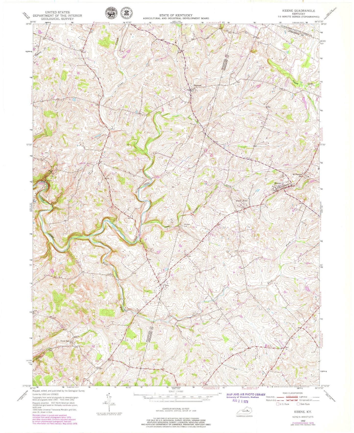
Historical USGS topographic quad map of Keene in the state of Kentucky. Map scale may vary for some years, but is generally around 1:24,000. Print size is approximately 24" x 27"
This quadrangle is in the following counties: Fayette, Jessamine, Woodford.
The map contains contour lines, roads, rivers, towns, and lakes. Printed on high-quality waterproof paper with UV fade-resistant inks, and shipped rolled.
Contains the following named places: Canewood Farm, Cave Hill Church, Cave Spring, Cave Spring Creek, Cave Springs Church, Cedar Grove Farm, City of Keene, Clear Creek Presbyterian Church, Clifton Farm, Clover Bottom Church, Dixon Town, East Fork Clear Creek, Ebenezer Cemetery, Ebenezer Presbyterian Church, Elmwood Farm, Fort Garrett Post Office, Fort Garrett Railroad Station, Frost Cemetery, Hillside Farm, Hughes Mill, Jessamine County Fire Department Station 3, Keene, Keene Cemetery, Keene Post Office, Locust Hall Farm, Locust Hill Farm, McGee Cemetery, Meridian Hill, Mount Pleasant School, Oak Hill Farm, Pinckard, Pinckard Post Office, Pinckard Railroad Station, Pleasant Hill, Pleasant Valley Farm, Pleasant View Farm, Price Cemetery, Rose Glade Farm, Russell Cemetery, Sallee Cemetery, School Number Fourteen, Singletons Mill, Sinking Creek, South Woodford Division, Troy, Vales of Cedar, Woods Cemetery, ZIP Code: 40339