MyTopo
Classic USGS Keevil Arkansas 7.5'x7.5' Topo Map
Couldn't load pickup availability
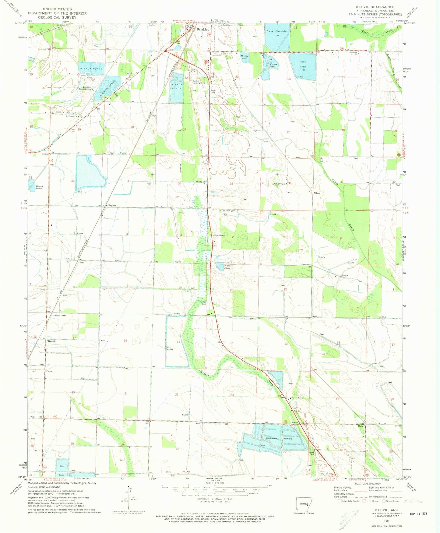
Historical USGS topographic quad map of Keevil in the state of Arkansas. Map scale may vary for some years, but is generally around 1:24,000. Print size is approximately 24" x 27"
This quadrangle is in the following counties: Monroe.
The map contains contour lines, roads, rivers, towns, and lakes. Printed on high-quality waterproof paper with UV fade-resistant inks, and shipped rolled.
Contains the following named places: Alfrey, Bayless, Brinkley Country Club, Dunn's Fish Farm, East Monroe County Rural Fire Department Station 1, Emmons, Finell Cemetery, Fitzhugh Cemetery, Jeffries Church, Jordan Cemetery, KBRI-AM (Brinkley), Keevil, KQMC-FM (Brinkley), Lake Greenlee, Lake Greenlee Reservoir, Lake Greenlee Reservoir Dam, Maple Slough, Mount Canaan Church, New Hope Church, New Hope School, Oak Grove Church, Rich, Saint John Cemetery, Saint Johns Missionary Baptist Church, Stoops, Township of Brinkley, Township of Cypress Ridge, Township of Dixon, Township of Keevil, Upper Cemetery, ZIP Code: 72021