MyTopo
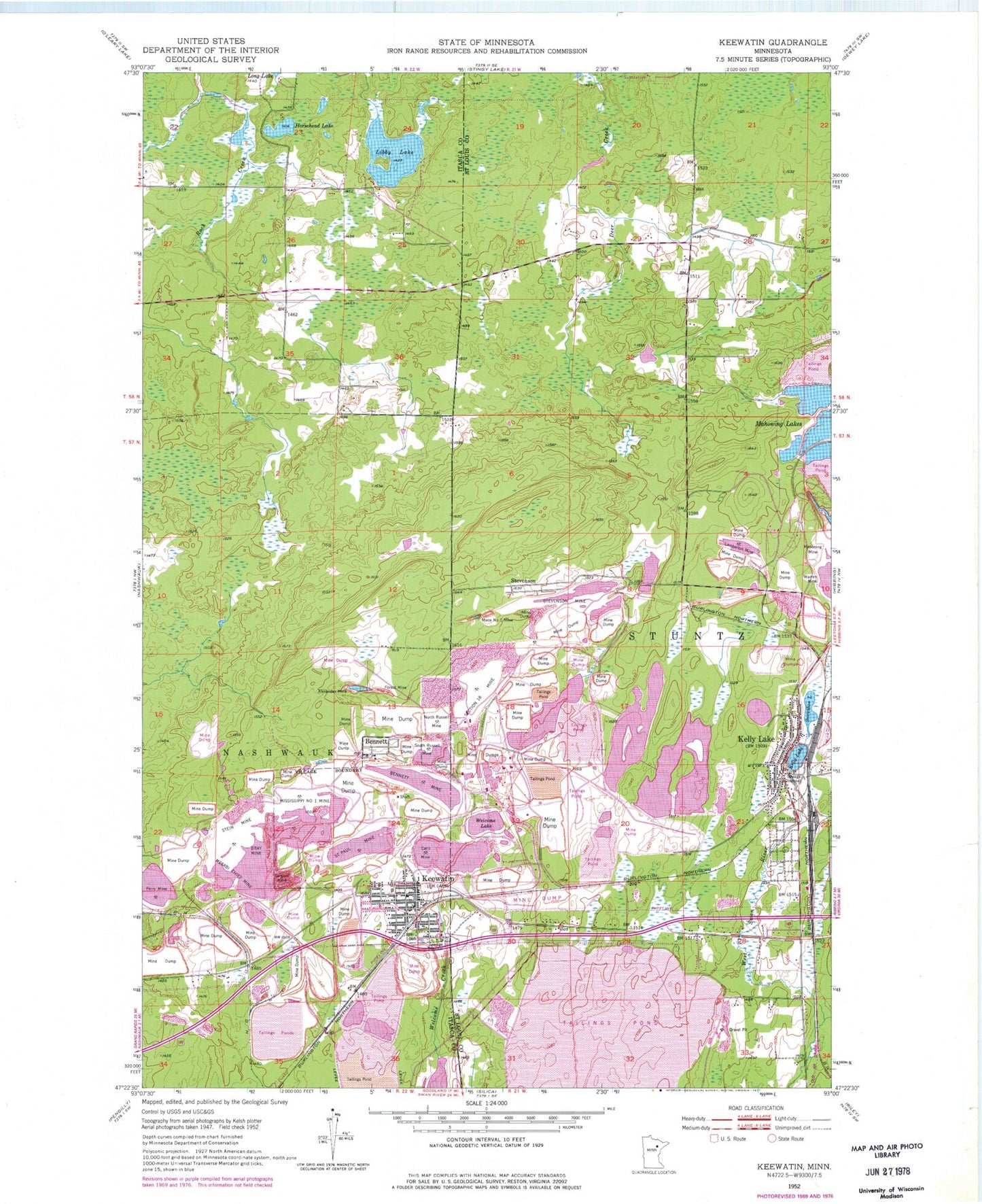
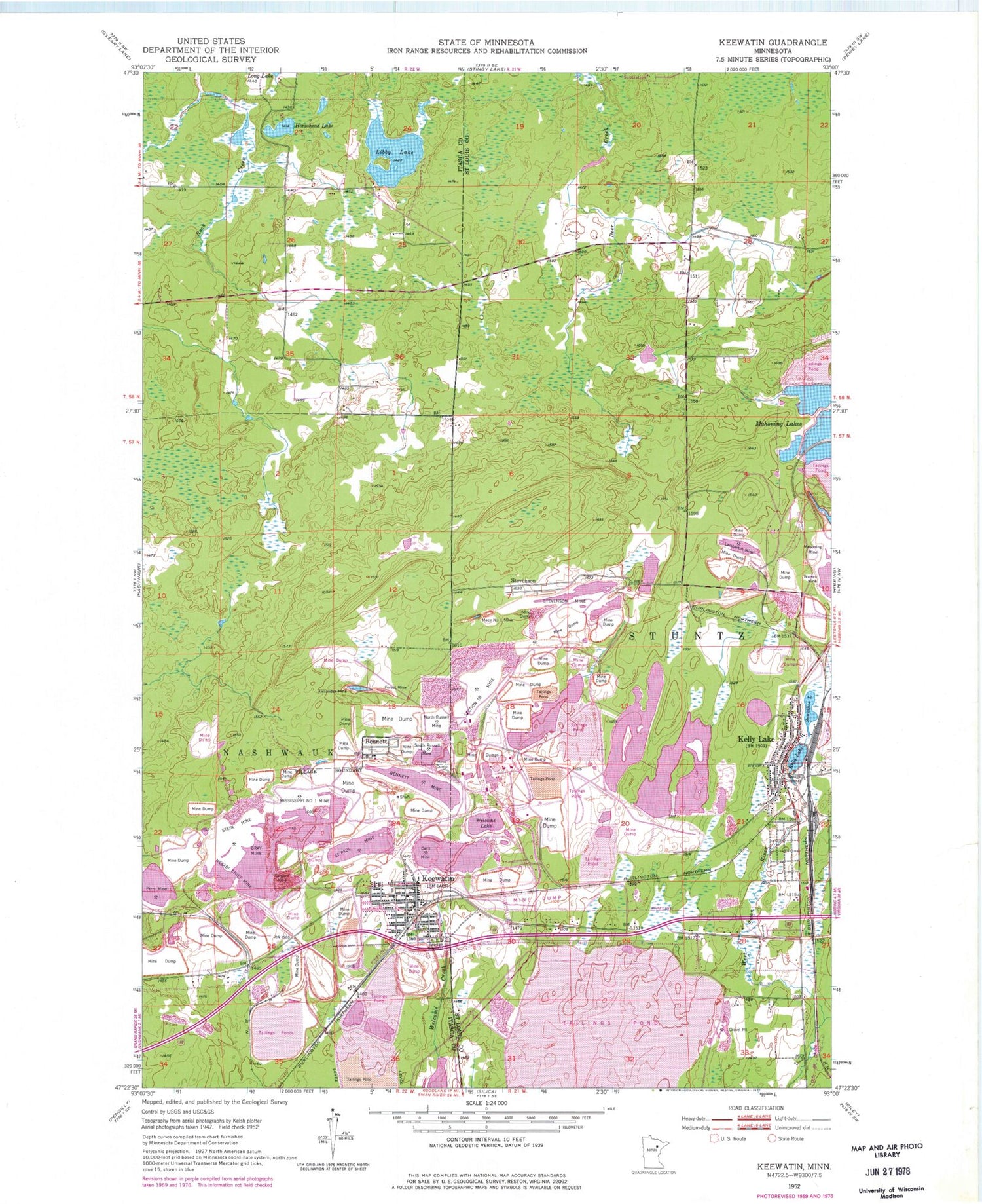
Classic USGS Keewatin Minnesota 7.5'x7.5' Topo Map
Couldn't load pickup availability
Historical USGS topographic quad map of Keewatin in the state of Minnesota. Map scale may vary for some years, but is generally around 1:24,000. Print size is approximately 24" x 27"
This quadrangle is in the following counties: Itasca, St. Louis.
The map contains contour lines, roads, rivers, towns, and lakes. Printed on high-quality waterproof paper with UV fade-resistant inks, and shipped rolled.
Contains the following named places: Alexander Mine, Bennett, Bennett Mine, Bray Mine, Carlz Mine, City of Keewatin, Congregation of the Good Shepherd, Forest Mine, Hibbing Fire Department Station 3, Horsehead Lake, Keewatin, Keewatin Cemetery, Keewatin Elementary School, Keewatin Fire Department, Keewatin Police Department, Keewatin Post Office, Keewatin Public Library, Kelly Lake, Kelly Lake Post Office, Kelly Lake Station, Lamberton Mine, Libby Lake, Mace Number One Mine, Mahoning Lakes, Mesabi Chief Mine, Mesabi Range, Mississippi Number One Mine, North Russell Mine, Olson's Mobile Home Park, Perry Mine, Saint Mary's Catholic Church, Saint Paul Mine, Sargent Mine, Section Eighteen Mine, Snowshoe Lake, South Russell Mine, Stein Mine, Stevenson, Stevenson Mine, Stevenson Post Office, Township of Stuntz, United Methodist Church, Welcome Lake, WKKQ-AM (Nashwauk), ZIP Code: 55753