MyTopo
Classic USGS Keiser Arkansas 7.5'x7.5' Topo Map
Couldn't load pickup availability
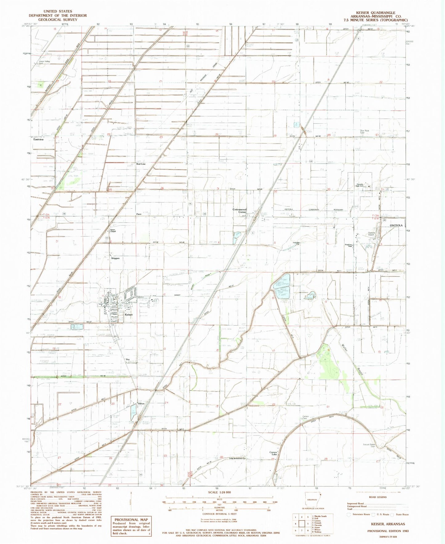
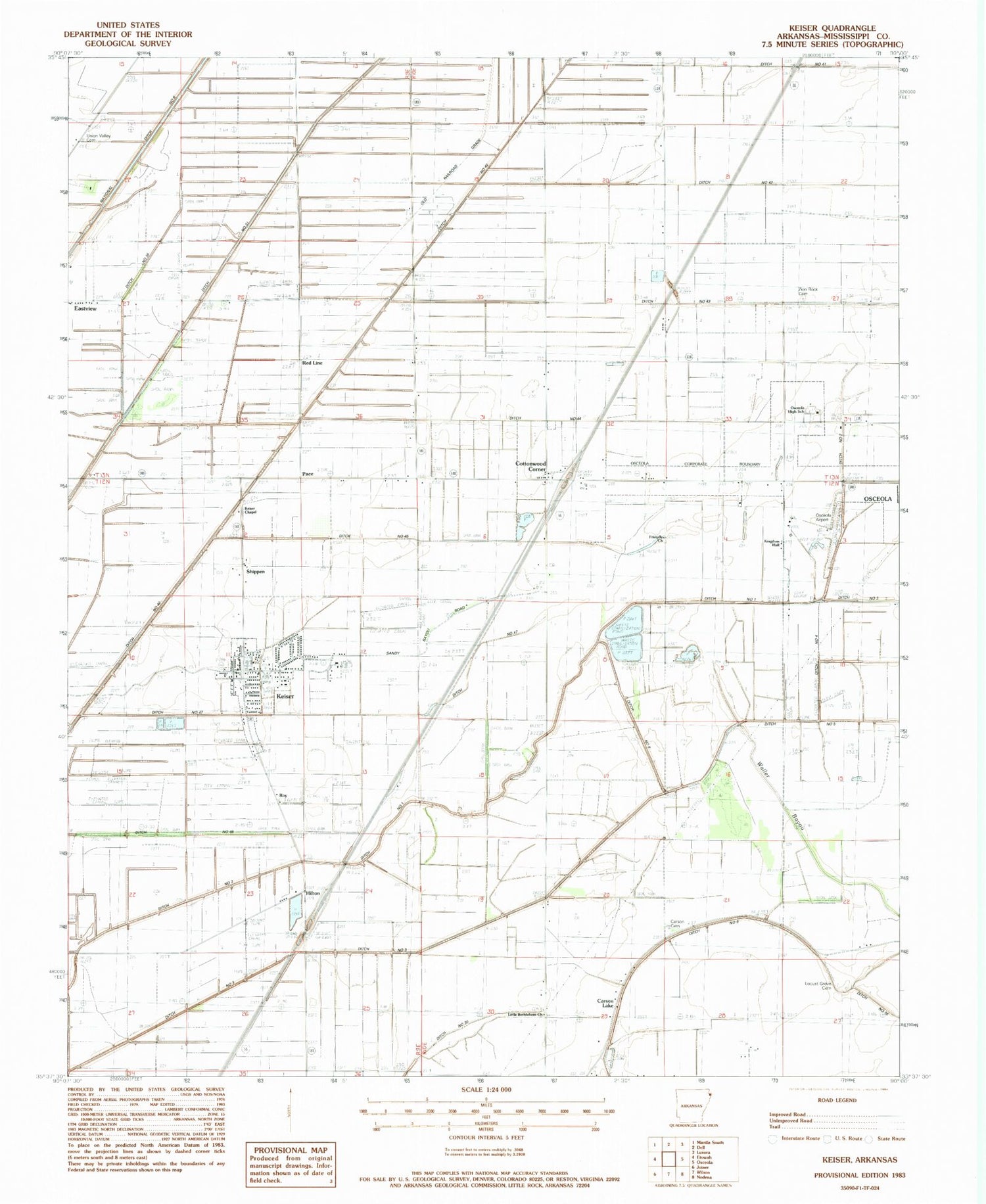
Historical USGS topographic quad map of Keiser in the state of Arkansas. Map scale may vary for some years, but is generally around 1:24,000. Print size is approximately 24" x 27"
This quadrangle is in the following counties: Mississippi.
The map contains contour lines, roads, rivers, towns, and lakes. Printed on high-quality waterproof paper with UV fade-resistant inks, and shipped rolled.
Contains the following named places: Carson Cemetery, Carson Church, Carson Lake, Carson Lake School, Carson School, City of Keiser, Cottonwood Corner, Ditch Number 1, Ditch Number 3, Ditch Number 4, Ditch Number 40-a, Ditch Number 41, Ditch Number 42, Ditch Number 43, Ditch Number 45, Ditch Number 46, Ditch Number 47, Ditch Number 47-A, Ditch Number 47-B, Ditch Number 48, Ditch Number 5, Ditch Number 55, Ditch Number 6, First Baptist Church of Keiser, Friendly Church, Friendship School, Hilton, Keiser, Keiser Chapel, Keiser Elementary School, Keiser Fire Department, Keiser Police Department, Keiser Post Office, Kingdom Hall, Little Bethlehem Cemetery, Little Bethlehem Church, Locust Grove Cemetery, Locust Grove Church, Manchester Cemetery, National Ditch Number 6, New Bethel Church, Osceola High School, Osceola Municipal Airport, Pace, Red Line, Riverlawn Country Club, Roy, Sandy Bayou, Shippen, Township of Monroe, Union Valley Cemetery, Union Valley Church, Union Valley School, Walnut Grove Church, Zion Rock Cemetery, Zion Rock Church, ZIP Codes: 72351, 72370