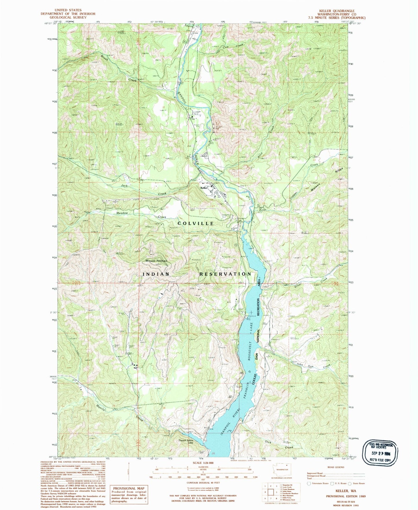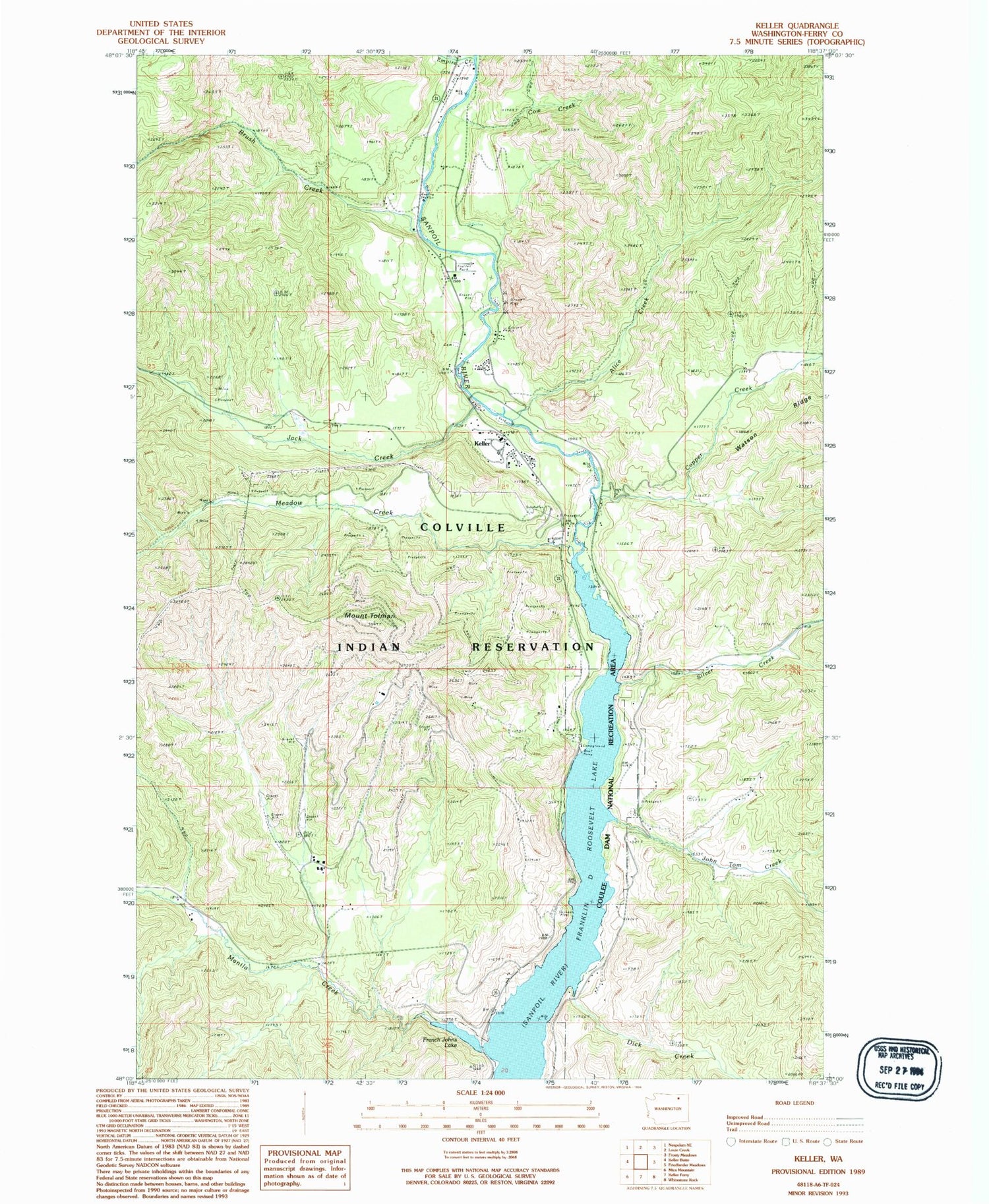
MyTopo
Classic USGS Keller Washington 7.5'x7.5' Topo Map
Couldn't load pickup availability
Historical USGS topographic quad map of Keller in the state of Washington. Map scale may vary for some years, but is generally around 1:24,000. Print size is approximately 24" x 27"
This quadrangle is in the following counties: Ferry.
The map contains contour lines, roads, rivers, towns, and lakes. Printed on high-quality waterproof paper with UV fade-resistant inks, and shipped rolled.
Contains the following named places: Alice Creek, Brush Creek, Colville Tribal Emergency Medical Services, Consolidated Mines, Copper Creek, Cow Creek, Dick Creek, Empire Creek, French Johns Lake, Jack Creek, John Tom Creek, Keller, Keller Census Designated Place, Keller Elementary School, Keller Post Office, Manila Creek, Meadow Creek, Meadow Creek Mine, Mount Tolman, Silver Creek, ZIP Code: 99140